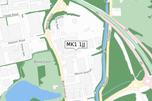
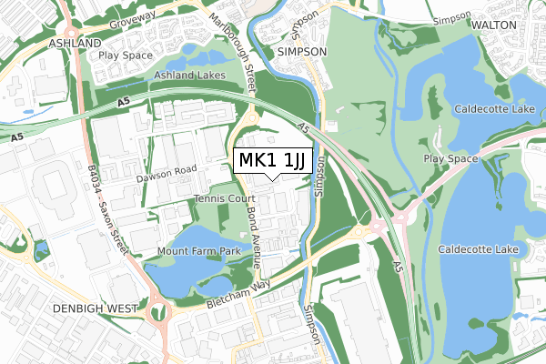
MK1 1JJ is located in the Bletchley East electoral ward, within the unitary authority of Milton Keynes and the English Parliamentary constituency of Milton Keynes South. The Sub Integrated Care Board (ICB) Location is NHS Bedfordshire, Luton and Milton Keynes ICB - M1J4Y and the police force is Thames Valley. This postcode has been in use since October 2017.


GetTheData
Source: OS Open Zoomstack (Ordnance Survey)
Licence: Open Government Licence (requires attribution)
Attribution: Contains OS data © Crown copyright and database right 2025
Source: Open Postcode Geo
Licence: Open Government Licence (requires attribution)
Attribution: Contains OS data © Crown copyright and database right 2025; Contains Royal Mail data © Royal Mail copyright and database right 2025; Source: Office for National Statistics licensed under the Open Government Licence v.3.0
| Easting | 488022 |
| Northing | 235347 |
| Latitude | 52.009595 |
| Longitude | -0.718953 |
GetTheData
Source: Open Postcode Geo
Licence: Open Government Licence
| Country | England |
| Postcode District | MK1 |
➜ See where MK1 is on a map ➜ Where is Bletchley? | |
GetTheData
Source: Land Registry Price Paid Data
Licence: Open Government Licence
| Ward | Bletchley East |
| Constituency | Milton Keynes South |
GetTheData
Source: ONS Postcode Database
Licence: Open Government Licence
| Bond Avenue | Mount Farm | 145m |
| Bond Avenue | Mount Farm | 171m |
| Simpson Road | Simpson | 212m |
| Simpson Road | Simpson | 229m |
| Fenny Lock Roundabout West (Bletcham Way) | Fenny Lock | 405m |
| Fenny Stratford Station | 1.1km |
| Bow Brickhill Station | 1.7km |
| Bletchley Station | 2km |
GetTheData
Source: NaPTAN
Licence: Open Government Licence
GetTheData
Source: ONS Postcode Database
Licence: Open Government Licence


➜ Get more ratings from the Food Standards Agency
GetTheData
Source: Food Standards Agency
Licence: FSA terms & conditions
| Last Collection | |||
|---|---|---|---|
| Location | Mon-Fri | Sat | Distance |
| Mail Centre, Dawson Road | 19:30 | 466m | |
| Dawson Road | 18:30 | 12:00 | 472m |
| Bletchley Delivery Office | 18:30 | 12:30 | 527m |
GetTheData
Source: Dracos
Licence: Creative Commons Attribution-ShareAlike
The below table lists the International Territorial Level (ITL) codes (formerly Nomenclature of Territorial Units for Statistics (NUTS) codes) and Local Administrative Units (LAU) codes for MK1 1JJ:
| ITL 1 Code | Name |
|---|---|
| TLJ | South East (England) |
| ITL 2 Code | Name |
| TLJ1 | Berkshire, Buckinghamshire and Oxfordshire |
| ITL 3 Code | Name |
| TLJ12 | Milton Keynes |
| LAU 1 Code | Name |
| E06000042 | Milton Keynes |
GetTheData
Source: ONS Postcode Directory
Licence: Open Government Licence
The below table lists the Census Output Area (OA), Lower Layer Super Output Area (LSOA), and Middle Layer Super Output Area (MSOA) for MK1 1JJ:
| Code | Name | |
|---|---|---|
| OA | E00175386 | |
| LSOA | E01033497 | Milton Keynes 023E |
| MSOA | E02003481 | Milton Keynes 023 |
GetTheData
Source: ONS Postcode Directory
Licence: Open Government Licence
| MK1 1SW | Bond Avenue | 53m |
| MK1 1JA | Ward Road | 306m |
| MK1 1LG | Clarke Road | 473m |
| MK6 3DT | The Mount | 539m |
| MK1 1JQ | Dane Road | 541m |
| MK6 3AL | 575m | |
| MK6 3FD | Walden Croft | 581m |
| MK6 3AJ | Mount Pleasant | 610m |
| MK1 1QT | Dawson Road | 633m |
| MK6 3AX | Lissel Road | 684m |
GetTheData
Source: Open Postcode Geo; Land Registry Price Paid Data
Licence: Open Government Licence