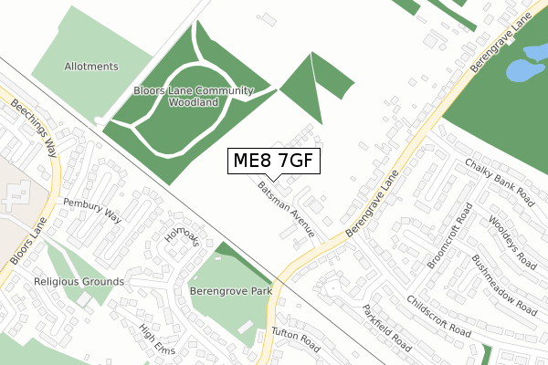
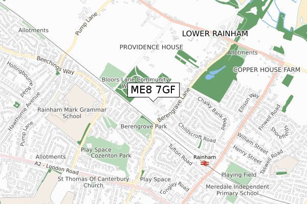
ME8 7GF is located in the Rainham North electoral ward, within the unitary authority of Medway and the English Parliamentary constituency of Gillingham and Rainham. The Sub Integrated Care Board (ICB) Location is NHS Kent and Medway ICB - 91Q and the police force is Kent. This postcode has been in use since February 2020.


GetTheData
Source: OS Open Zoomstack (Ordnance Survey)
Licence: Open Government Licence (requires attribution)
Attribution: Contains OS data © Crown copyright and database right 2025
Source: Open Postcode Geo
Licence: Open Government Licence (requires attribution)
Attribution: Contains OS data © Crown copyright and database right 2025; Contains Royal Mail data © Royal Mail copyright and database right 2025; Source: Office for National Statistics licensed under the Open Government Licence v.3.0
| Easting | 581448 |
| Northing | 166801 |
| Latitude | 51.371274 |
| Longitude | 0.605470 |
GetTheData
Source: Open Postcode Geo
Licence: Open Government Licence
| Country | England |
| Postcode District | ME8 |
➜ See where ME8 is on a map ➜ Where is Gillingham? | |
GetTheData
Source: Land Registry Price Paid Data
Licence: Open Government Licence
| Ward | Rainham North |
| Constituency | Gillingham And Rainham |
GetTheData
Source: ONS Postcode Database
Licence: Open Government Licence
16, BATSMAN AVENUE, RAINHAM, GILLINGHAM, ME8 7GF 2021 28 MAY £380,000 |
22, BATSMAN AVENUE, RAINHAM, GILLINGHAM, ME8 7GF 2021 31 MAR £385,000 |
6, BATSMAN AVENUE, RAINHAM, GILLINGHAM, ME8 7GF 2020 10 DEC £469,000 |
8, BATSMAN AVENUE, RAINHAM, GILLINGHAM, ME8 7GF 2020 26 JUN £510,000 |
4, BATSMAN AVENUE, RAINHAM, GILLINGHAM, ME8 7GF 2020 28 FEB £440,000 |
GetTheData
Source: HM Land Registry Price Paid Data
Licence: Contains HM Land Registry data © Crown copyright and database right 2025. This data is licensed under the Open Government Licence v3.0.
| Parkfield Road (Childscroft Road) | Lower Rainham | 245m |
| Parkfield Road (Childscroft Road) | Lower Rainham | 248m |
| Berengrave Lane | Lower Rainham | 248m |
| Berengrave Lane | Lower Rainham | 265m |
| Broomcroft Road (Childscroft Road) | Lower Rainham | 363m |
| Rainham (Kent) Station | 0.7km |
| Gillingham (Kent) Station | 4.2km |
| Newington Station | 4.8km |
GetTheData
Source: NaPTAN
Licence: Open Government Licence
GetTheData
Source: ONS Postcode Database
Licence: Open Government Licence


➜ Get more ratings from the Food Standards Agency
GetTheData
Source: Food Standards Agency
Licence: FSA terms & conditions
| Last Collection | |||
|---|---|---|---|
| Location | Mon-Fri | Sat | Distance |
| Tufton Road | 17:30 | 12:15 | 288m |
| Berengrave Lane | 17:30 | 12:00 | 316m |
| Bloors Lane | 17:30 | 12:00 | 386m |
GetTheData
Source: Dracos
Licence: Creative Commons Attribution-ShareAlike
The below table lists the International Territorial Level (ITL) codes (formerly Nomenclature of Territorial Units for Statistics (NUTS) codes) and Local Administrative Units (LAU) codes for ME8 7GF:
| ITL 1 Code | Name |
|---|---|
| TLJ | South East (England) |
| ITL 2 Code | Name |
| TLJ4 | Kent |
| ITL 3 Code | Name |
| TLJ41 | Medway |
| LAU 1 Code | Name |
| E06000035 | Medway |
GetTheData
Source: ONS Postcode Directory
Licence: Open Government Licence
The below table lists the Census Output Area (OA), Lower Layer Super Output Area (LSOA), and Middle Layer Super Output Area (MSOA) for ME8 7GF:
| Code | Name | |
|---|---|---|
| OA | E00081358 | |
| LSOA | E01016093 | Medway 023A |
| MSOA | E02003336 | Medway 023 |
GetTheData
Source: ONS Postcode Directory
Licence: Open Government Licence
| ME8 7NJ | Berengrave Lane | 190m |
| ME8 7DN | Holmoaks | 207m |
| ME8 7NL | Berengrave Lane | 207m |
| ME8 7ST | Childscroft Road | 255m |
| ME8 7DL | Pembury Way | 261m |
| ME8 7SX | Hartpiece Close | 263m |
| ME8 7SU | Parkfield Road | 266m |
| ME8 7NB | Berengrave Lane | 267m |
| ME8 7DR | Chestfield Close | 272m |
| ME8 7DQ | Holmoaks | 287m |
GetTheData
Source: Open Postcode Geo; Land Registry Price Paid Data
Licence: Open Government Licence