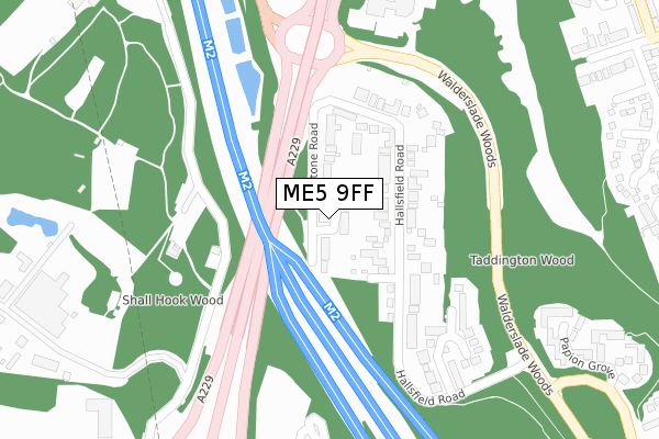
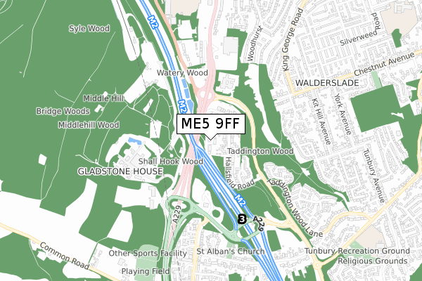
ME5 9FF is located in the Walderslade electoral ward, within the local authority district of Tonbridge and Malling and the English Parliamentary constituency of Chatham and Aylesford. The Sub Integrated Care Board (ICB) Location is NHS Kent and Medway ICB - 91Q and the police force is Kent. This postcode has been in use since September 2017.


GetTheData
Source: OS Open Zoomstack (Ordnance Survey)
Licence: Open Government Licence (requires attribution)
Attribution: Contains OS data © Crown copyright and database right 2025
Source: Open Postcode Geo
Licence: Open Government Licence (requires attribution)
Attribution: Contains OS data © Crown copyright and database right 2025; Contains Royal Mail data © Royal Mail copyright and database right 2025; Source: Office for National Statistics licensed under the Open Government Licence v.3.0
| Easting | 574718 |
| Northing | 163077 |
| Latitude | 51.339930 |
| Longitude | 0.507056 |
GetTheData
Source: Open Postcode Geo
Licence: Open Government Licence
| Country | England |
| Postcode District | ME5 |
➜ See where ME5 is on a map ➜ Where is Chatham? | |
GetTheData
Source: Land Registry Price Paid Data
Licence: Open Government Licence
| Ward | Walderslade |
| Constituency | Chatham And Aylesford |
GetTheData
Source: ONS Postcode Database
Licence: Open Government Licence
| Bridgewood Roundabout (A2045) | Blue Bell Hill Village | 130m |
| Bridgewood Roundabout (A2045) | Blue Bell Hill Village | 208m |
| Bridgewood Manor (Walderslade Woods) | Walderslade | 290m |
| Car Park (Lord Lees Grove) | Blue Bell Hill Village | 299m |
| Asda (Maidstone Road) | Chatham | 565m |
| Snodland Station | 4.2km |
| Halling Station | 4.5km |
| Chatham Station | 4.6km |
GetTheData
Source: NaPTAN
Licence: Open Government Licence
| Percentage of properties with Next Generation Access | 100.0% |
| Percentage of properties with Superfast Broadband | 100.0% |
| Percentage of properties with Ultrafast Broadband | 100.0% |
| Percentage of properties with Full Fibre Broadband | 0.0% |
Superfast Broadband is between 30Mbps and 300Mbps
Ultrafast Broadband is > 300Mbps
| Median download speed | 350.0Mbps |
| Average download speed | 265.4Mbps |
| Maximum download speed | 350.00Mbps |
| Median upload speed | 19.5Mbps |
| Average upload speed | 19.5Mbps |
| Maximum upload speed | 19.53Mbps |
| Percentage of properties unable to receive 2Mbps | 0.0% |
| Percentage of properties unable to receive 5Mbps | 0.0% |
| Percentage of properties unable to receive 10Mbps | 0.0% |
| Percentage of properties unable to receive 30Mbps | 0.0% |
GetTheData
Source: Ofcom
Licence: Ofcom Terms of Use (requires attribution)
GetTheData
Source: ONS Postcode Database
Licence: Open Government Licence


➜ Get more ratings from the Food Standards Agency
GetTheData
Source: Food Standards Agency
Licence: FSA terms & conditions
| Last Collection | |||
|---|---|---|---|
| Location | Mon-Fri | Sat | Distance |
| Blue Bell Hill | 16:00 | 10:30 | 768m |
| Princes Avenue | 17:15 | 10:45 | 792m |
| Robin Hood Lane | 16:00 | 11:00 | 1,018m |
GetTheData
Source: Dracos
Licence: Creative Commons Attribution-ShareAlike
The below table lists the International Territorial Level (ITL) codes (formerly Nomenclature of Territorial Units for Statistics (NUTS) codes) and Local Administrative Units (LAU) codes for ME5 9FF:
| ITL 1 Code | Name |
|---|---|
| TLJ | South East (England) |
| ITL 2 Code | Name |
| TLJ4 | Kent |
| ITL 3 Code | Name |
| TLJ46 | West Kent |
| LAU 1 Code | Name |
| E07000115 | Tonbridge and Malling |
GetTheData
Source: ONS Postcode Directory
Licence: Open Government Licence
The below table lists the Census Output Area (OA), Lower Layer Super Output Area (LSOA), and Middle Layer Super Output Area (MSOA) for ME5 9FF:
| Code | Name | |
|---|---|---|
| OA | E00125489 | |
| LSOA | E01024721 | Tonbridge and Malling 001C |
| MSOA | E02005149 | Tonbridge and Malling 001 |
GetTheData
Source: ONS Postcode Directory
Licence: Open Government Licence
| ME5 9RX | Maidstone Road | 47m |
| ME5 9RS | Hallsfield Road | 125m |
| ME5 9RT | Hallsfield Road | 166m |
| ME5 9RR | Sadlers Close | 268m |
| ME5 9BZ | Marston Walk | 445m |
| ME5 9BS | Papion Grove | 446m |
| ME5 9BH | Chestnut Avenue | 488m |
| ME5 9BJ | Chestnut Avenue | 497m |
| ME5 9QL | Maidstone Road | 517m |
| ME5 9BY | Marston Close | 540m |
GetTheData
Source: Open Postcode Geo; Land Registry Price Paid Data
Licence: Open Government Licence