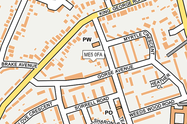
ME5 0FA is located in the Wayfield & Weeds Wood electoral ward, within the unitary authority of Medway and the English Parliamentary constituency of Chatham and Aylesford. The Sub Integrated Care Board (ICB) Location is NHS Kent and Medway ICB - 91Q and the police force is Kent. This postcode has been in use since May 2017.


GetTheData
Source: OS OpenMap – Local (Ordnance Survey)
Source: OS VectorMap District (Ordnance Survey)
Licence: Open Government Licence (requires attribution)
| Easting | 575560 |
| Northing | 164047 |
| Latitude | 51.348384 |
| Longitude | 0.519610 |
GetTheData
Source: Open Postcode Geo
Licence: Open Government Licence
| Country | England |
| Postcode District | ME5 |
➜ See where ME5 is on a map ➜ Where is Chatham? | |
GetTheData
Source: Land Registry Price Paid Data
Licence: Open Government Licence
| Ward | Wayfield & Weeds Wood |
| Constituency | Chatham And Aylesford |
GetTheData
Source: ONS Postcode Database
Licence: Open Government Licence
| Silverweed Road | Weeds Wood | 93m |
| Silverweed Road | Weeds Wood | 103m |
| Sorrell Road | Weeds Wood | 126m |
| Sorrell Road | Weeds Wood | 140m |
| Weeds Wood Road | Weeds Wood | 217m |
| Chatham Station | 3.6km |
| Rochester Station | 4.2km |
| Gillingham (Kent) Station | 4.7km |
GetTheData
Source: NaPTAN
Licence: Open Government Licence
| Percentage of properties with Next Generation Access | 100.0% |
| Percentage of properties with Superfast Broadband | 100.0% |
| Percentage of properties with Ultrafast Broadband | 100.0% |
| Percentage of properties with Full Fibre Broadband | 0.0% |
Superfast Broadband is between 30Mbps and 300Mbps
Ultrafast Broadband is > 300Mbps
| Percentage of properties unable to receive 2Mbps | 0.0% |
| Percentage of properties unable to receive 5Mbps | 0.0% |
| Percentage of properties unable to receive 10Mbps | 0.0% |
| Percentage of properties unable to receive 30Mbps | 0.0% |
GetTheData
Source: Ofcom
Licence: Ofcom Terms of Use (requires attribution)
GetTheData
Source: ONS Postcode Database
Licence: Open Government Licence


➜ Get more ratings from the Food Standards Agency
GetTheData
Source: Food Standards Agency
Licence: FSA terms & conditions
| Last Collection | |||
|---|---|---|---|
| Location | Mon-Fri | Sat | Distance |
| Weeds Wood Post Office | 17:30 | 11:30 | 182m |
| King George Road | 17:30 | 11:30 | 194m |
| Saracen Fields | 18:00 | 09:00 | 266m |
GetTheData
Source: Dracos
Licence: Creative Commons Attribution-ShareAlike
The below table lists the International Territorial Level (ITL) codes (formerly Nomenclature of Territorial Units for Statistics (NUTS) codes) and Local Administrative Units (LAU) codes for ME5 0FA:
| ITL 1 Code | Name |
|---|---|
| TLJ | South East (England) |
| ITL 2 Code | Name |
| TLJ4 | Kent |
| ITL 3 Code | Name |
| TLJ41 | Medway |
| LAU 1 Code | Name |
| E06000035 | Medway |
GetTheData
Source: ONS Postcode Directory
Licence: Open Government Licence
The below table lists the Census Output Area (OA), Lower Layer Super Output Area (LSOA), and Middle Layer Super Output Area (MSOA) for ME5 0FA:
| Code | Name | |
|---|---|---|
| OA | E00081729 | |
| LSOA | E01016173 | Medway 033D |
| MSOA | E02003346 | Medway 033 |
GetTheData
Source: ONS Postcode Directory
Licence: Open Government Licence
| ME5 0UG | Gorse Avenue | 66m |
| ME5 0UD | Silverweed Road | 70m |
| ME5 0TT | King George Road | 94m |
| ME5 0QU | Silverweed Road | 97m |
| ME5 0SN | Rosemary Close | 107m |
| ME5 0UE | Argent Terrace | 111m |
| ME5 0UH | Gorse Avenue | 131m |
| ME5 0XA | Saffron Way | 131m |
| ME5 0UJ | Gorse Avenue | 139m |
| ME5 0SL | Harebell Close | 140m |
GetTheData
Source: Open Postcode Geo; Land Registry Price Paid Data
Licence: Open Government Licence