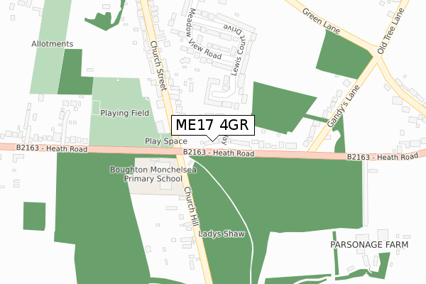
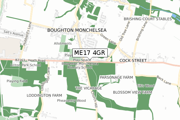
ME17 4GR is located in the Boughton Monchelsea and Chart Sutton electoral ward, within the local authority district of Maidstone and the English Parliamentary constituency of Faversham and Mid Kent. The Sub Integrated Care Board (ICB) Location is NHS Kent and Medway ICB - 91Q and the police force is Kent. This postcode has been in use since January 2020.


GetTheData
Source: OS Open Zoomstack (Ordnance Survey)
Licence: Open Government Licence (requires attribution)
Attribution: Contains OS data © Crown copyright and database right 2025
Source: Open Postcode Geo
Licence: Open Government Licence (requires attribution)
Attribution: Contains OS data © Crown copyright and database right 2025; Contains Royal Mail data © Royal Mail copyright and database right 2025; Source: Office for National Statistics licensed under the Open Government Licence v.3.0
| Easting | 576988 |
| Northing | 150844 |
| Latitude | 51.229339 |
| Longitude | 0.533556 |
GetTheData
Source: Open Postcode Geo
Licence: Open Government Licence
| Country | England |
| Postcode District | ME17 |
➜ See where ME17 is on a map ➜ Where is Boughton Monchelsea? | |
GetTheData
Source: Land Registry Price Paid Data
Licence: Open Government Licence
| Ward | Boughton Monchelsea And Chart Sutton |
| Constituency | Faversham And Mid Kent |
GetTheData
Source: ONS Postcode Database
Licence: Open Government Licence
1, TOMPSETT CLOSE, BOUGHTON MONCHELSEA, MAIDSTONE, ME17 4GR 2021 28 JAN £550,000 |
2, TOMPSETT CLOSE, BOUGHTON MONCHELSEA, MAIDSTONE, ME17 4GR 2020 3 SEP £545,000 |
3, TOMPSETT CLOSE, BOUGHTON MONCHELSEA, MAIDSTONE, ME17 4GR 2020 31 JUL £548,000 |
➜ Boughton Monchelsea house prices
GetTheData
Source: HM Land Registry Price Paid Data
Licence: Contains HM Land Registry data © Crown copyright and database right 2025. This data is licensed under the Open Government Licence v3.0.
| Village Hall (Church Street) | Boughton Monchelsea | 130m |
| Village Hall (Church Street) | Boughton Monchelsea | 158m |
| The Albion (Green Lane) | Boughton Monchelsea | 432m |
| Old Tree Lane (Green Lane) | Boughton Monchelsea | 433m |
| The Albion (Green Lane) | Boughton Monchelsea | 443m |
| East Farleigh Station | 4.5km |
| Maidstone West Station | 4.7km |
GetTheData
Source: NaPTAN
Licence: Open Government Licence
GetTheData
Source: ONS Postcode Database
Licence: Open Government Licence


➜ Get more ratings from the Food Standards Agency
GetTheData
Source: Food Standards Agency
Licence: FSA terms & conditions
| Last Collection | |||
|---|---|---|---|
| Location | Mon-Fri | Sat | Distance |
| Boughton Quarries | 16:00 | 09:00 | 847m |
| Hubbards Lane | 16:30 | 09:00 | 960m |
| Linton Road | 17:00 | 11:00 | 1,410m |
GetTheData
Source: Dracos
Licence: Creative Commons Attribution-ShareAlike
The below table lists the International Territorial Level (ITL) codes (formerly Nomenclature of Territorial Units for Statistics (NUTS) codes) and Local Administrative Units (LAU) codes for ME17 4GR:
| ITL 1 Code | Name |
|---|---|
| TLJ | South East (England) |
| ITL 2 Code | Name |
| TLJ4 | Kent |
| ITL 3 Code | Name |
| TLJ45 | Mid Kent |
| LAU 1 Code | Name |
| E07000110 | Maidstone |
GetTheData
Source: ONS Postcode Directory
Licence: Open Government Licence
The below table lists the Census Output Area (OA), Lower Layer Super Output Area (LSOA), and Middle Layer Super Output Area (MSOA) for ME17 4GR:
| Code | Name | |
|---|---|---|
| OA | E00123520 | |
| LSOA | E01024331 | Maidstone 012A |
| MSOA | E02005079 | Maidstone 012 |
GetTheData
Source: ONS Postcode Directory
Licence: Open Government Licence
| ME17 4HU | Heath Road | 157m |
| ME17 4LG | Lewis Court Drive | 179m |
| ME17 4HN | Church Street | 200m |
| ME17 4LJ | Meadow View Road | 242m |
| ME17 4JF | Gandys Lane | 284m |
| ME17 4LQ | Lewis Court Drive | 294m |
| ME17 4LH | Meadow View Road | 330m |
| ME17 4LF | Green Lane | 373m |
| ME17 4HW | Church Street | 380m |
| ME17 4LE | Green Lane | 398m |
GetTheData
Source: Open Postcode Geo; Land Registry Price Paid Data
Licence: Open Government Licence