ME17 3FP maps, stats, and open data
ME17 3FP is located in the Sutton Valence and Langley electoral ward, within the local authority district of Maidstone and the English Parliamentary constituency of Faversham and Mid Kent. The Sub Integrated Care Board (ICB) Location is NHS Kent and Medway ICB - 91Q and the police force is Kent. This postcode has been in use since August 2017.
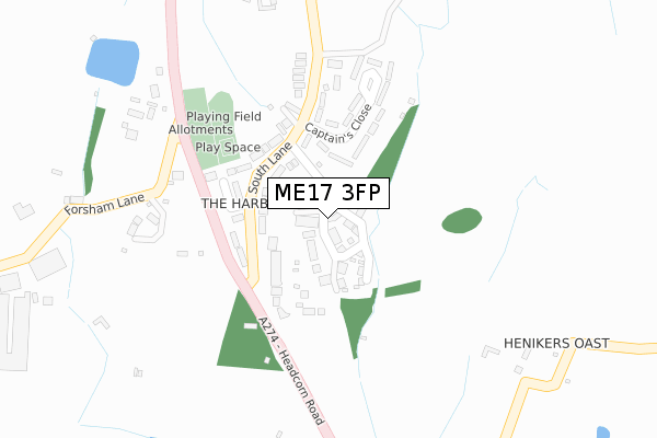
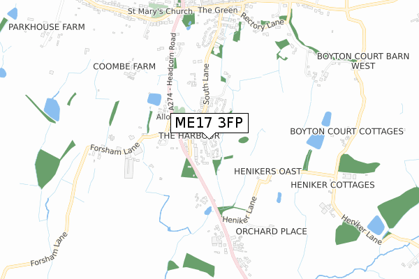
ME17 3FP maps


Licence: Open Government Licence (requires attribution)
Attribution: Contains OS data © Crown copyright and database right 2025
Source: Open Postcode Geo
Licence: Open Government Licence (requires attribution)
Attribution: Contains OS data © Crown copyright and database right 2025; Contains Royal Mail data © Royal Mail copyright and database right 2025; Source: Office for National Statistics licensed under the Open Government Licence v.3.0
ME17 3FP geodata
| Easting | 581246 |
| Northing | 148415 |
| Latitude | 51.206185 |
| Longitude | 0.593249 |
Where is ME17 3FP?
| Country | England |
| Postcode District | ME17 |
Politics
| Ward | Sutton Valence And Langley |
|---|---|
| Constituency | Faversham And Mid Kent |
House Prices
Sales of detached houses in ME17 3FP
2024 31 OCT £650,000 |
2024 12 JAN £500,000 |
2023 10 OCT £780,000 |
9, GREENSAND MEADOW, SUTTON VALENCE, MAIDSTONE, ME17 3FP 2019 9 AUG £725,000 |
10, GREENSAND MEADOW, SUTTON VALENCE, MAIDSTONE, ME17 3FP 2019 3 MAY £595,000 |
1, GREENSAND MEADOW, SUTTON VALENCE, MAIDSTONE, ME17 3FP 2019 8 FEB £650,000 |
2018 7 DEC £705,000 |
16, GREENSAND MEADOW, SUTTON VALENCE, MAIDSTONE, ME17 3FP 2018 29 NOV £470,000 |
2018 9 NOV £595,000 |
2, GREENSAND MEADOW, SUTTON VALENCE, MAIDSTONE, ME17 3FP 2018 24 APR £595,000 |
Licence: Contains HM Land Registry data © Crown copyright and database right 2025. This data is licensed under the Open Government Licence v3.0.
Transport
Nearest bus stops to ME17 3FP
| The Harbour (Headcorn Road) | Sutton Valence | 174m |
| The Harbour (Headcorn Road) | Sutton Valence | 214m |
| Lay-by (Headcorn Road) | Gladdish | 703m |
| Kings Head (North Street) | Sutton Valence | 817m |
| Lay-by (Headcorn Road) | Gladdish | 826m |
Nearest railway stations to ME17 3FP
| Staplehurst Station | 4.9km |
| Headcorn Station | 5.1km |
Broadband
Broadband access in ME17 3FP (2020 data)
| Percentage of properties with Next Generation Access | 100.0% |
| Percentage of properties with Superfast Broadband | 100.0% |
| Percentage of properties with Ultrafast Broadband | 0.0% |
| Percentage of properties with Full Fibre Broadband | 0.0% |
Superfast Broadband is between 30Mbps and 300Mbps
Ultrafast Broadband is > 300Mbps
Broadband speed in ME17 3FP (2019 data)
Download
| Median download speed | 39.1Mbps |
| Average download speed | 35.7Mbps |
| Maximum download speed | 67.54Mbps |
Upload
| Median upload speed | 7.4Mbps |
| Average upload speed | 6.1Mbps |
| Maximum upload speed | 10.23Mbps |
Broadband limitations in ME17 3FP (2020 data)
| Percentage of properties unable to receive 2Mbps | 0.0% |
| Percentage of properties unable to receive 5Mbps | 0.0% |
| Percentage of properties unable to receive 10Mbps | 0.0% |
| Percentage of properties unable to receive 30Mbps | 0.0% |
Deprivation
46% of English postcodes are less deprived than ME17 3FP:Food Standards Agency
Three nearest food hygiene ratings to ME17 3FP (metres)


➜ Get more ratings from the Food Standards Agency
Nearest post box to ME17 3FP
| Last Collection | |||
|---|---|---|---|
| Location | Mon-Fri | Sat | Distance |
| Sutton Valence Post Office | 17:00 | 12:00 | 845m |
| Chart Sutton | 16:15 | 09:00 | 1,221m |
| Warmlake | 16:45 | 09:00 | 1,825m |
ME17 3FP ITL and ME17 3FP LAU
The below table lists the International Territorial Level (ITL) codes (formerly Nomenclature of Territorial Units for Statistics (NUTS) codes) and Local Administrative Units (LAU) codes for ME17 3FP:
| ITL 1 Code | Name |
|---|---|
| TLJ | South East (England) |
| ITL 2 Code | Name |
| TLJ4 | Kent |
| ITL 3 Code | Name |
| TLJ45 | Mid Kent |
| LAU 1 Code | Name |
| E07000110 | Maidstone |
ME17 3FP census areas
The below table lists the Census Output Area (OA), Lower Layer Super Output Area (LSOA), and Middle Layer Super Output Area (MSOA) for ME17 3FP:
| Code | Name | |
|---|---|---|
| OA | E00170372 | |
| LSOA | E01024411 | Maidstone 017D |
| MSOA | E02005084 | Maidstone 017 |
Nearest postcodes to ME17 3FP
| ME17 3AZ | South Lane | 141m |
| ME17 3AY | South Lane | 144m |
| ME17 3AB | The Harbour | 149m |
| ME17 3BA | Captains Close | 173m |
| ME17 3AS | Sutton Valence Hill | 200m |
| ME17 3AU | Sutton Valence Hill | 325m |
| ME17 3BB | South Lane | 407m |
| ME17 3EW | Forsham Lane | 464m |
| ME17 3BD | South Lane | 560m |
| ME17 3EH | Headcorn Road | 570m |