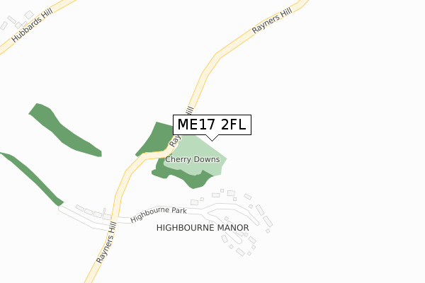
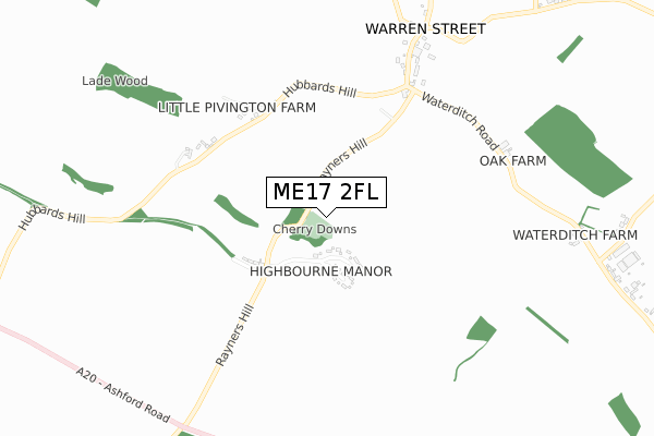
ME17 2FL is located in the Harrietsham and Lenham electoral ward, within the local authority district of Maidstone and the English Parliamentary constituency of Faversham and Mid Kent. The Sub Integrated Care Board (ICB) Location is NHS Kent and Medway ICB - 91Q and the police force is Kent. This postcode has been in use since April 2020.


GetTheData
Source: OS Open Zoomstack (Ordnance Survey)
Licence: Open Government Licence (requires attribution)
Attribution: Contains OS data © Crown copyright and database right 2025
Source: Open Postcode Geo
Licence: Open Government Licence (requires attribution)
Attribution: Contains OS data © Crown copyright and database right 2025; Contains Royal Mail data © Royal Mail copyright and database right 2025; Source: Office for National Statistics licensed under the Open Government Licence v.3.0
| Easting | 592372 |
| Northing | 152425 |
| Latitude | 51.238566 |
| Longitude | 0.754480 |
GetTheData
Source: Open Postcode Geo
Licence: Open Government Licence
| Country | England |
| Postcode District | ME17 |
➜ See where ME17 is on a map | |
GetTheData
Source: Land Registry Price Paid Data
Licence: Open Government Licence
| Ward | Harrietsham And Lenham |
| Constituency | Faversham And Mid Kent |
GetTheData
Source: ONS Postcode Database
Licence: Open Government Licence
| Rayners Hill (Ashford Road) | Lenham | 958m |
| Rayners Hill (Ashford Road) | Lenham | 986m |
| Lenham Station | 3.3km |
| Charing (Kent) Station | 4.2km |
GetTheData
Source: NaPTAN
Licence: Open Government Licence
GetTheData
Source: ONS Postcode Database
Licence: Open Government Licence

➜ Get more ratings from the Food Standards Agency
GetTheData
Source: Food Standards Agency
Licence: FSA terms & conditions
| Last Collection | |||
|---|---|---|---|
| Location | Mon-Fri | Sat | Distance |
| Warren Street | 16:00 | 09:45 | 810m |
| Glebe Gardens | 16:30 | 09:30 | 2,280m |
| Woodside Green | 16:00 | 09:30 | 2,284m |
GetTheData
Source: Dracos
Licence: Creative Commons Attribution-ShareAlike
The below table lists the International Territorial Level (ITL) codes (formerly Nomenclature of Territorial Units for Statistics (NUTS) codes) and Local Administrative Units (LAU) codes for ME17 2FL:
| ITL 1 Code | Name |
|---|---|
| TLJ | South East (England) |
| ITL 2 Code | Name |
| TLJ4 | Kent |
| ITL 3 Code | Name |
| TLJ45 | Mid Kent |
| LAU 1 Code | Name |
| E07000110 | Maidstone |
GetTheData
Source: ONS Postcode Directory
Licence: Open Government Licence
The below table lists the Census Output Area (OA), Lower Layer Super Output Area (LSOA), and Middle Layer Super Output Area (MSOA) for ME17 2FL:
| Code | Name | |
|---|---|---|
| OA | E00123675 | |
| LSOA | E01024362 | Maidstone 011B |
| MSOA | E02005078 | Maidstone 011 |
GetTheData
Source: ONS Postcode Directory
Licence: Open Government Licence
| ME17 2PE | Highbourne Park | 200m |
| ME17 2DX | Rayners Hill | 326m |
| ME17 2EJ | Hubbards Hill | 551m |
| ME17 2ED | Warren Street | 692m |
| ME17 2EE | Warren Street | 907m |
| ME17 2DY | Waterditch Lane | 961m |
| ME17 2EG | Warren Street | 1010m |
| ME17 2DS | Ashford Road | 1111m |
| ME13 0BZ | Bunce Court Road | 1182m |
| ME17 2DT | Ashford Road | 1196m |
GetTheData
Source: Open Postcode Geo; Land Registry Price Paid Data
Licence: Open Government Licence