Property/Postcode Data Search:
ME14 5GQ maps, stats, and open data
ME14 5GQ is located in the Boxley electoral ward, within the local authority district of Maidstone and the English Parliamentary constituency of Faversham and Mid Kent. The Sub Integrated Care Board (ICB) Location is NHS Kent and Medway ICB - 91Q and the police force is Kent. This postcode has been in use since March 2019.
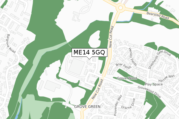
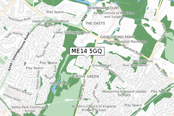
ME14 5GQ maps


Source: OS Open Zoomstack (Ordnance Survey)
Licence: Open Government Licence (requires attribution)
Attribution: Contains OS data © Crown copyright and database right 2025
Source: Open Postcode Geo
Licence: Open Government Licence (requires attribution)
Attribution: Contains OS data © Crown copyright and database right 2025; Contains Royal Mail data © Royal Mail copyright and database right 2025; Source: Office for National Statistics licensed under the Open Government Licence v.3.0
Licence: Open Government Licence (requires attribution)
Attribution: Contains OS data © Crown copyright and database right 2025
Source: Open Postcode Geo
Licence: Open Government Licence (requires attribution)
Attribution: Contains OS data © Crown copyright and database right 2025; Contains Royal Mail data © Royal Mail copyright and database right 2025; Source: Office for National Statistics licensed under the Open Government Licence v.3.0
ME14 5GQ geodata
| Easting | 577956 |
| Northing | 156530 |
| Latitude | 51.280115 |
| Longitude | 0.550230 |
Where is ME14 5GQ?
| Country | England |
| Postcode District | ME14 |
Politics
| Ward | Boxley |
|---|---|
| Constituency | Faversham And Mid Kent |
Transport
Nearest bus stops to ME14 5GQ
| Tv Studios (Grovewood Drive) | Grove Green | 172m |
| Tv Studios (Grovewood Drive) | Grove Green | 205m |
| Threshers Drive (Provender Way) | Grove Green | 317m |
| Threshers Drive (Provender Way) | Grove Green | 350m |
| Maidstone Crematorium (Bearsted Road) | Vinters Park | 354m |
Nearest railway stations to ME14 5GQ
| Bearsted Station | 2km |
| Maidstone East Station | 2km |
| Maidstone Barracks Station | 2.5km |
Deprivation
5.3% of English postcodes are less deprived than ME14 5GQ:Food Standards Agency
Three nearest food hygiene ratings to ME14 5GQ (metres)
School Of Science And Technology

School Of Science And Technology Ma
0m
The Maidstone Studios Limited

The Maidstone Studios
85m
Gymfinity

Newnham Court Shopping Village
494m
➜ Get more ratings from the Food Standards Agency
Nearest post box to ME14 5GQ
| Last Collection | |||
|---|---|---|---|
| Location | Mon-Fri | Sat | Distance |
| Provender Way | 16:45 | 09:00 | 491m |
| Grove Green Post Office | 17:00 | 12:30 | 553m |
| Bargrove Road | 17:30 | 12:30 | 643m |
ME14 5GQ ITL and ME14 5GQ LAU
The below table lists the International Territorial Level (ITL) codes (formerly Nomenclature of Territorial Units for Statistics (NUTS) codes) and Local Administrative Units (LAU) codes for ME14 5GQ:
| ITL 1 Code | Name |
|---|---|
| TLJ | South East (England) |
| ITL 2 Code | Name |
| TLJ4 | Kent |
| ITL 3 Code | Name |
| TLJ45 | Mid Kent |
| LAU 1 Code | Name |
| E07000110 | Maidstone |
ME14 5GQ census areas
The below table lists the Census Output Area (OA), Lower Layer Super Output Area (LSOA), and Middle Layer Super Output Area (MSOA) for ME14 5GQ:
| Code | Name | |
|---|---|---|
| OA | E00123527 | |
| LSOA | E01024336 | Maidstone 005B |
| MSOA | E02005072 | Maidstone 005 |
Nearest postcodes to ME14 5GQ
| ME14 5PW | Avondale Court | 126m |
| ME14 5UZ | Briar Fields | 183m |
| ME14 5UF | The Maltings | 212m |
| ME14 5UY | Henley Fields | 214m |
| ME14 5UB | Granary Close | 264m |
| ME14 5UR | Bilberry Close | 287m |
| ME14 5TX | Coppice View | 296m |
| ME14 5UT | Rampion Close | 308m |
| ME14 5UG | Orache Drive | 342m |
| ME14 5UA | Threshers Drive | 352m |