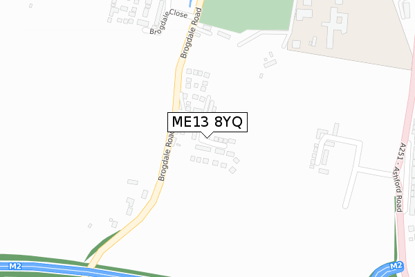
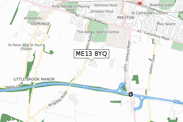
ME13 8YQ is located in the Watling electoral ward, within the local authority district of Swale and the English Parliamentary constituency of Faversham and Mid Kent. The Sub Integrated Care Board (ICB) Location is NHS Kent and Medway ICB - 91Q and the police force is Kent. This postcode has been in use since November 2019.


GetTheData
Source: OS Open Zoomstack (Ordnance Survey)
Licence: Open Government Licence (requires attribution)
Attribution: Contains OS data © Crown copyright and database right 2025
Source: Open Postcode Geo
Licence: Open Government Licence (requires attribution)
Attribution: Contains OS data © Crown copyright and database right 2025; Contains Royal Mail data © Royal Mail copyright and database right 2025; Source: Office for National Statistics licensed under the Open Government Licence v.3.0
| Easting | 601111 |
| Northing | 160064 |
| Latitude | 51.304159 |
| Longitude | 0.883799 |
GetTheData
Source: Open Postcode Geo
Licence: Open Government Licence
| Country | England |
| Postcode District | ME13 |
➜ See where ME13 is on a map ➜ Where is Faversham? | |
GetTheData
Source: Land Registry Price Paid Data
Licence: Open Government Licence
| Ward | Watling |
| Constituency | Faversham And Mid Kent |
GetTheData
Source: ONS Postcode Database
Licence: Open Government Licence
2023 23 MAY £402,000 |
37, TETTENHALL WAY, FAVERSHAM, ME13 8YQ 2021 29 JUN £549,995 |
47, TETTENHALL WAY, FAVERSHAM, ME13 8YQ 2021 23 JUN £519,995 |
45, TETTENHALL WAY, FAVERSHAM, ME13 8YQ 2021 14 JUN £539,995 |
31, TETTENHALL WAY, FAVERSHAM, ME13 8YQ 2021 23 MAR £382,995 |
53, TETTENHALL WAY, FAVERSHAM, ME13 8YQ 2021 29 JAN £344,995 |
35, TETTENHALL WAY, FAVERSHAM, ME13 8YQ 2020 17 DEC £554,995 |
33, TETTENHALL WAY, FAVERSHAM, ME13 8YQ 2020 17 DEC £470,000 |
5, TETTENHALL WAY, FAVERSHAM, ME13 8YQ 2020 30 OCT £540,000 |
23, TETTENHALL WAY, FAVERSHAM, ME13 8YQ 2020 29 OCT £374,995 |
GetTheData
Source: HM Land Registry Price Paid Data
Licence: Contains HM Land Registry data © Crown copyright and database right 2025. This data is licensed under the Open Government Licence v3.0.
| Waterworks (Ashford Road) | Faversham | 419m |
| Abbey School (Abbey School Grounds) | Faversham | 455m |
| Waterworks (Ashford Road) | Faversham | 591m |
| The Mall | Faversham | 627m |
| Brogdale Road (London Road) | Faversham | 631m |
| Faversham Station | 1km |
| Selling Station | 5km |
GetTheData
Source: NaPTAN
Licence: Open Government Licence
GetTheData
Source: ONS Postcode Database
Licence: Open Government Licence


➜ Get more ratings from the Food Standards Agency
GetTheData
Source: Food Standards Agency
Licence: FSA terms & conditions
| Last Collection | |||
|---|---|---|---|
| Location | Mon-Fri | Sat | Distance |
| Brogdale Road | 16:30 | 10:30 | 630m |
| The Mall | 17:30 | 12:00 | 669m |
| Upper St Annes Road | 17:30 | 12:00 | 792m |
GetTheData
Source: Dracos
Licence: Creative Commons Attribution-ShareAlike
The below table lists the International Territorial Level (ITL) codes (formerly Nomenclature of Territorial Units for Statistics (NUTS) codes) and Local Administrative Units (LAU) codes for ME13 8YQ:
| ITL 1 Code | Name |
|---|---|
| TLJ | South East (England) |
| ITL 2 Code | Name |
| TLJ4 | Kent |
| ITL 3 Code | Name |
| TLJ43 | Kent Thames Gateway |
| LAU 1 Code | Name |
| E07000113 | Swale |
GetTheData
Source: ONS Postcode Directory
Licence: Open Government Licence
The below table lists the Census Output Area (OA), Lower Layer Super Output Area (LSOA), and Middle Layer Super Output Area (MSOA) for ME13 8YQ:
| Code | Name | |
|---|---|---|
| OA | E00124983 | |
| LSOA | E01024626 | Swale 014E |
| MSOA | E02005128 | Swale 014 |
GetTheData
Source: ONS Postcode Directory
Licence: Open Government Licence
| ME13 8YA | Brogdale Road | 342m |
| ME13 8XW | Ashford Road | 364m |
| ME13 8ST | Brogdale Road | 384m |
| ME13 8XN | Ashford Road | 398m |
| ME13 8SX | Brogdale Road | 590m |
| ME13 8RX | London Road | 595m |
| ME13 8XJ | Ashford Road | 599m |
| ME13 8SU | Brogdale Road | 612m |
| ME13 8XL | Ashford Road | 621m |
| ME13 8YD | Salters Lane | 625m |
GetTheData
Source: Open Postcode Geo; Land Registry Price Paid Data
Licence: Open Government Licence