Property/Postcode Data Search:
ME13 8GY maps, stats, and open data
ME13 8GY is located in the Watling electoral ward, within the local authority district of Swale and the English Parliamentary constituency of Faversham and Mid Kent. The Sub Integrated Care Board (ICB) Location is NHS Kent and Medway ICB - 91Q and the police force is Kent. This postcode has been in use since August 2019.
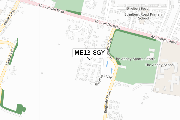
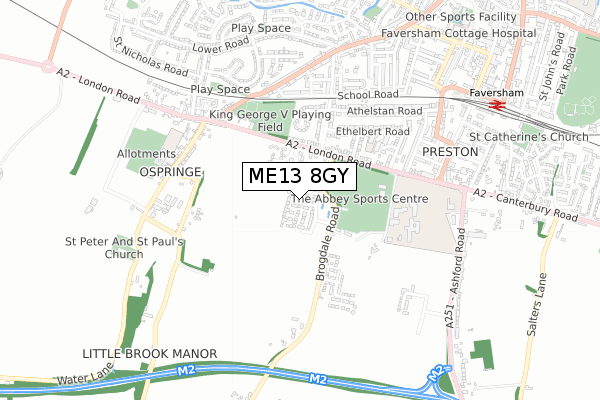
ME13 8GY maps


Source: OS Open Zoomstack (Ordnance Survey)
Licence: Open Government Licence (requires attribution)
Attribution: Contains OS data © Crown copyright and database right 2025
Source: Open Postcode Geo
Licence: Open Government Licence (requires attribution)
Attribution: Contains OS data © Crown copyright and database right 2025; Contains Royal Mail data © Royal Mail copyright and database right 2025; Source: Office for National Statistics licensed under the Open Government Licence v.3.0
Licence: Open Government Licence (requires attribution)
Attribution: Contains OS data © Crown copyright and database right 2025
Source: Open Postcode Geo
Licence: Open Government Licence (requires attribution)
Attribution: Contains OS data © Crown copyright and database right 2025; Contains Royal Mail data © Royal Mail copyright and database right 2025; Source: Office for National Statistics licensed under the Open Government Licence v.3.0
ME13 8GY geodata
| Easting | 600768 |
| Northing | 160525 |
| Latitude | 51.308420 |
| Longitude | 0.879145 |
Where is ME13 8GY?
| Country | England |
| Postcode District | ME13 |
Politics
| Ward | Watling |
|---|---|
| Constituency | Faversham And Mid Kent |
House Prices
Sales of detached houses in ME13 8GY
2023 28 FEB £725,000 |
11, BRIGDEN GARDENS, FAVERSHAM, ME13 8GY 2022 29 APR £535,000 |
21, BRIGDEN GARDENS, FAVERSHAM, ME13 8GY 2022 11 FEB £550,000 |
9, BRIGDEN GARDENS, FAVERSHAM, ME13 8GY 2021 29 SEP £635,000 |
22, BRIGDEN GARDENS, FAVERSHAM, ME13 8GY 2021 23 JUN £550,000 |
23, BRIGDEN GARDENS, FAVERSHAM, ME13 8GY 2021 28 JAN £530,000 |
6, BRIGDEN GARDENS, FAVERSHAM, ME13 8GY 2020 16 DEC £520,000 |
10, BRIGDEN GARDENS, FAVERSHAM, ME13 8GY 2020 7 DEC £512,000 |
7, BRIGDEN GARDENS, FAVERSHAM, ME13 8GY 2020 27 NOV £600,000 |
2020 16 JUN £565,000 |
Source: HM Land Registry Price Paid Data
Licence: Contains HM Land Registry data © Crown copyright and database right 2025. This data is licensed under the Open Government Licence v3.0.
Licence: Contains HM Land Registry data © Crown copyright and database right 2025. This data is licensed under the Open Government Licence v3.0.
Transport
Nearest bus stops to ME13 8GY
| Brogdale Road (London Road) | Faversham | 258m |
| Brogdale Road (London Road) | Faversham | 266m |
| Abbey School (Abbey School Grounds) | Faversham | 383m |
| Canute Road | Faversham | 439m |
| The Mall | Faversham | 600m |
Nearest railway stations to ME13 8GY
| Faversham Station | 0.9km |
| Selling Station | 5.5km |
Deprivation
9.1% of English postcodes are less deprived than ME13 8GY:Food Standards Agency
Three nearest food hygiene ratings to ME13 8GY (metres)
Carnalea

5-9 London Road
247m
Town Work Play

The Abbey School
483m
Independent Catering Management At Abbey School

The Abbey School
483m
➜ Get more ratings from the Food Standards Agency
Nearest post box to ME13 8GY
| Last Collection | |||
|---|---|---|---|
| Location | Mon-Fri | Sat | Distance |
| Upper St Annes Road | 17:30 | 12:00 | 310m |
| Ospringe Post Office | 17:15 | 12:00 | 539m |
| Athelstan Road | 17:30 | 12:00 | 561m |
ME13 8GY ITL and ME13 8GY LAU
The below table lists the International Territorial Level (ITL) codes (formerly Nomenclature of Territorial Units for Statistics (NUTS) codes) and Local Administrative Units (LAU) codes for ME13 8GY:
| ITL 1 Code | Name |
|---|---|
| TLJ | South East (England) |
| ITL 2 Code | Name |
| TLJ4 | Kent |
| ITL 3 Code | Name |
| TLJ43 | Kent Thames Gateway |
| LAU 1 Code | Name |
| E07000113 | Swale |
ME13 8GY census areas
The below table lists the Census Output Area (OA), Lower Layer Super Output Area (LSOA), and Middle Layer Super Output Area (MSOA) for ME13 8GY:
| Code | Name | |
|---|---|---|
| OA | E00124982 | |
| LSOA | E01024626 | Swale 014E |
| MSOA | E02005128 | Swale 014 |
Nearest postcodes to ME13 8GY
| ME13 8SU | Brogdale Road | 50m |
| ME13 0AF | Brogdale Place | 88m |
| ME13 8SX | Brogdale Road | 104m |
| ME13 8TB | Ospringe Place | 169m |
| ME13 8ST | Brogdale Road | 201m |
| ME13 8TA | London Road | 242m |
| ME13 8SN | London Road | 267m |
| ME13 8SL | London Road | 336m |
| ME13 8SJ | Egbert Road | 338m |
| ME13 8SY | Upper St Anns Road | 341m |