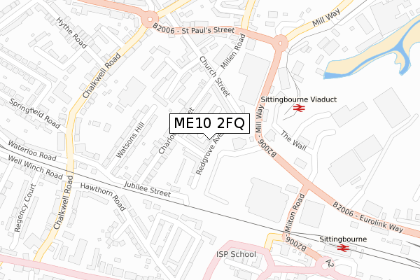
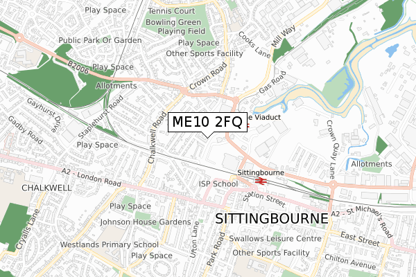
ME10 2FQ is located in the Chalkwell electoral ward, within the local authority district of Swale and the English Parliamentary constituency of Sittingbourne and Sheppey. The Sub Integrated Care Board (ICB) Location is NHS Kent and Medway ICB - 91Q and the police force is Kent. This postcode has been in use since June 2019.


GetTheData
Source: OS Open Zoomstack (Ordnance Survey)
Licence: Open Government Licence (requires attribution)
Attribution: Contains OS data © Crown copyright and database right 2025
Source: Open Postcode Geo
Licence: Open Government Licence (requires attribution)
Attribution: Contains OS data © Crown copyright and database right 2025; Contains Royal Mail data © Royal Mail copyright and database right 2025; Source: Office for National Statistics licensed under the Open Government Licence v.3.0
| Easting | 590264 |
| Northing | 164140 |
| Latitude | 51.344493 |
| Longitude | 0.730557 |
GetTheData
Source: Open Postcode Geo
Licence: Open Government Licence
| Country | England |
| Postcode District | ME10 |
➜ See where ME10 is on a map ➜ Where is Sittingbourne? | |
GetTheData
Source: Land Registry Price Paid Data
Licence: Open Government Licence
| Ward | Chalkwell |
| Constituency | Sittingbourne And Sheppey |
GetTheData
Source: ONS Postcode Database
Licence: Open Government Licence
| Morrisons (Mill Way) | Sittingbourne | 163m |
| Morrisons (Mill Way) | Sittingbourne | 174m |
| St Paul's Street | Chalkwell | 255m |
| Eurolink Way (The Wall) | Sittingbourne | 262m |
| St Paul's Street | Chalkwell | 267m |
| Sittingbourne Station | 0.4km |
| Kemsley Station | 2km |
| Newington Station | 4.4km |
GetTheData
Source: NaPTAN
Licence: Open Government Licence
| Percentage of properties with Next Generation Access | 100.0% |
| Percentage of properties with Superfast Broadband | 100.0% |
| Percentage of properties with Ultrafast Broadband | 73.3% |
| Percentage of properties with Full Fibre Broadband | 73.3% |
Superfast Broadband is between 30Mbps and 300Mbps
Ultrafast Broadband is > 300Mbps
| Percentage of properties unable to receive 2Mbps | 0.0% |
| Percentage of properties unable to receive 5Mbps | 0.0% |
| Percentage of properties unable to receive 10Mbps | 0.0% |
| Percentage of properties unable to receive 30Mbps | 0.0% |
GetTheData
Source: Ofcom
Licence: Ofcom Terms of Use (requires attribution)
GetTheData
Source: ONS Postcode Database
Licence: Open Government Licence


➜ Get more ratings from the Food Standards Agency
GetTheData
Source: Food Standards Agency
Licence: FSA terms & conditions
| Last Collection | |||
|---|---|---|---|
| Location | Mon-Fri | Sat | Distance |
| Church Street | 17:30 | 12:00 | 160m |
| London Road | 17:30 | 11:30 | 381m |
| Railway Station | 17:30 | 12:00 | 409m |
GetTheData
Source: Dracos
Licence: Creative Commons Attribution-ShareAlike
The below table lists the International Territorial Level (ITL) codes (formerly Nomenclature of Territorial Units for Statistics (NUTS) codes) and Local Administrative Units (LAU) codes for ME10 2FQ:
| ITL 1 Code | Name |
|---|---|
| TLJ | South East (England) |
| ITL 2 Code | Name |
| TLJ4 | Kent |
| ITL 3 Code | Name |
| TLJ43 | Kent Thames Gateway |
| LAU 1 Code | Name |
| E07000113 | Swale |
GetTheData
Source: ONS Postcode Directory
Licence: Open Government Licence
The below table lists the Census Output Area (OA), Lower Layer Super Output Area (LSOA), and Middle Layer Super Output Area (MSOA) for ME10 2FQ:
| Code | Name | |
|---|---|---|
| OA | E00124660 | |
| LSOA | E01024562 | Swale 012B |
| MSOA | E02005126 | Swale 012 |
GetTheData
Source: ONS Postcode Directory
Licence: Open Government Licence
| ME10 2JN | Charlotte Street | 95m |
| ME10 2JT | Periwinkle Close | 139m |
| ME10 2JX | Charlotte Street | 149m |
| ME10 2JR | Watsons Hill | 154m |
| ME10 1AX | Laburnum Place | 194m |
| ME10 2GX | Church Street | 204m |
| ME10 2JS | Watsons Hill | 212m |
| ME10 2JZ | Church Street | 217m |
| ME10 3EX | Milton Road | 227m |
| ME10 2JU | Periwinkle Close | 234m |
GetTheData
Source: Open Postcode Geo; Land Registry Price Paid Data
Licence: Open Government Licence