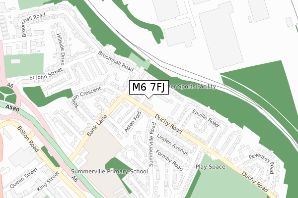
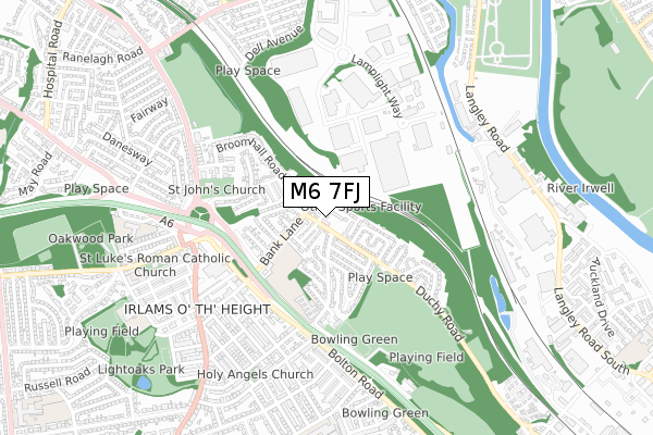
M6 7FJ is located in the Claremont electoral ward, within the metropolitan district of Salford and the English Parliamentary constituency of Salford and Eccles. The Sub Integrated Care Board (ICB) Location is NHS Greater Manchester ICB - 01G and the police force is Greater Manchester. This postcode has been in use since February 2020.


GetTheData
Source: OS Open Zoomstack (Ordnance Survey)
Licence: Open Government Licence (requires attribution)
Attribution: Contains OS data © Crown copyright and database right 2025
Source: Open Postcode Geo
Licence: Open Government Licence (requires attribution)
Attribution: Contains OS data © Crown copyright and database right 2025; Contains Royal Mail data © Royal Mail copyright and database right 2025; Source: Office for National Statistics licensed under the Open Government Licence v.3.0
| Easting | 380029 |
| Northing | 400699 |
| Latitude | 53.502618 |
| Longitude | -2.302552 |
GetTheData
Source: Open Postcode Geo
Licence: Open Government Licence
| Country | England |
| Postcode District | M6 |
➜ See where M6 is on a map ➜ Where is Salford? | |
GetTheData
Source: Land Registry Price Paid Data
Licence: Open Government Licence
| Ward | Claremont |
| Constituency | Salford And Eccles |
GetTheData
Source: ONS Postcode Database
Licence: Open Government Licence
2023 28 FEB £255,000 |
59, EGMONT STREET, SALFORD, M6 7FJ 2021 26 FEB £228,500 |
18, EGMONT STREET, SALFORD, M6 7FJ 2020 28 OCT £228,500 |
2020 27 OCT £185,500 |
22, EGMONT STREET, SALFORD, M6 7FJ 2020 27 OCT £228,500 |
14, EGMONT STREET, SALFORD, M6 7FJ 2020 29 SEP £185,500 |
19, EGMONT STREET, SALFORD, M6 7FJ 2020 21 AUG £226,500 |
GetTheData
Source: HM Land Registry Price Paid Data
Licence: Contains HM Land Registry data © Crown copyright and database right 2025. This data is licensed under the Open Government Licence v3.0.
| Duchy Rd/Summerville Rd (Duchy Rd) | Irlams O' Th' Height | 69m |
| Duchy Rd/Egmont St (Duchy Rd) | Irlams O' Th' Height | 77m |
| Duchy Rd/Stanhope Rd (Duchy Rd) | Irlams O' Th' Height | 258m |
| Duchy Rd/Central Ave (Duchy Rd) | Irlams O' Th' Height | 284m |
| Bank Ln/Deacons Dr (Bank Ln) | Irlams O' Th' Height | 323m |
| Clifton (Manchester) Station | 2.4km |
| Salford Crescent Station | 2.5km |
| Swinton (Manchester) Station | 2.7km |
GetTheData
Source: NaPTAN
Licence: Open Government Licence
GetTheData
Source: ONS Postcode Database
Licence: Open Government Licence


➜ Get more ratings from the Food Standards Agency
GetTheData
Source: Food Standards Agency
Licence: FSA terms & conditions
| Last Collection | |||
|---|---|---|---|
| Location | Mon-Fri | Sat | Distance |
| Cromwell Bridge P.o. | 17:30 | 12:00 | 528m |
| Agecroft Road | 17:30 | 12:00 | 892m |
| 34 Cresent/Hulme Place | 17:30 | 12:00 | 1,597m |
GetTheData
Source: Dracos
Licence: Creative Commons Attribution-ShareAlike
The below table lists the International Territorial Level (ITL) codes (formerly Nomenclature of Territorial Units for Statistics (NUTS) codes) and Local Administrative Units (LAU) codes for M6 7FJ:
| ITL 1 Code | Name |
|---|---|
| TLD | North West (England) |
| ITL 2 Code | Name |
| TLD3 | Greater Manchester |
| ITL 3 Code | Name |
| TLD34 | Greater Manchester South West |
| LAU 1 Code | Name |
| E08000006 | Salford |
GetTheData
Source: ONS Postcode Directory
Licence: Open Government Licence
The below table lists the Census Output Area (OA), Lower Layer Super Output Area (LSOA), and Middle Layer Super Output Area (MSOA) for M6 7FJ:
| Code | Name | |
|---|---|---|
| OA | E00028475 | |
| LSOA | E01005624 | Salford 017A |
| MSOA | E02001173 | Salford 017 |
GetTheData
Source: ONS Postcode Directory
Licence: Open Government Licence
| M6 7LB | Duchy Road | 52m |
| M6 7LD | Duchy Road | 79m |
| M6 7LH | Bank Lane | 83m |
| M27 8XU | Bank Lane | 83m |
| M6 7HD | Summerville Road | 148m |
| M6 7LP | Bank Lane | 151m |
| M6 7JH | Asten Fold | 151m |
| M6 7HS | Summerville Road | 153m |
| M6 7JZ | Duchy Road | 153m |
| M6 7JY | West Drive | 166m |
GetTheData
Source: Open Postcode Geo; Land Registry Price Paid Data
Licence: Open Government Licence