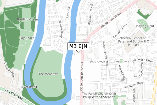
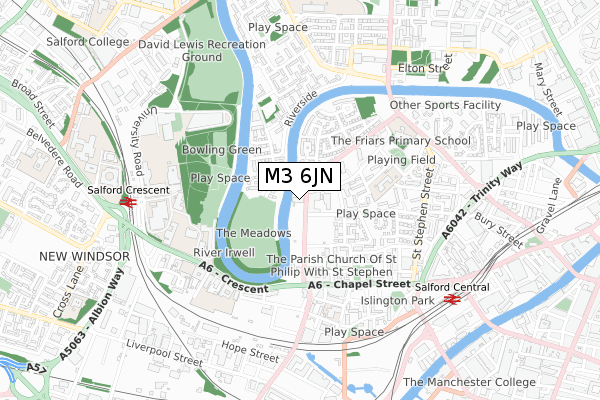
M3 6JN lies on Adelphi Street in Salford. M3 6JN is located in the Blackfriars & Trinity electoral ward, within the metropolitan district of Salford and the English Parliamentary constituency of Salford and Eccles. The Sub Integrated Care Board (ICB) Location is NHS Greater Manchester ICB - 01G and the police force is Greater Manchester. This postcode has been in use since November 2018.


GetTheData
Source: OS Open Zoomstack (Ordnance Survey)
Licence: Open Government Licence (requires attribution)
Attribution: Contains OS data © Crown copyright and database right 2025
Source: Open Postcode Geo
Licence: Open Government Licence (requires attribution)
Attribution: Contains OS data © Crown copyright and database right 2025; Contains Royal Mail data © Royal Mail copyright and database right 2025; Source: Office for National Statistics licensed under the Open Government Licence v.3.0
| Easting | 382509 |
| Northing | 398892 |
| Latitude | 53.486464 |
| Longitude | -2.265061 |
GetTheData
Source: Open Postcode Geo
Licence: Open Government Licence
| Street | Adelphi Street |
| Town/City | Salford |
| Country | England |
| Postcode District | M3 |
➜ See where M3 is on a map ➜ Where is Salford? | |
GetTheData
Source: Land Registry Price Paid Data
Licence: Open Government Licence
| Ward | Blackfriars & Trinity |
| Constituency | Salford And Eccles |
GetTheData
Source: ONS Postcode Database
Licence: Open Government Licence
| Adelphi St/Peru St (Adelphi St) | Salford University | 259m |
| Adelphi St/Chapel St (Adelphi Street) | Salford University | 289m |
| Silk St/Mathias Court (Silk St) | Broughton Bridge | 320m |
| The Crescent/Oldfield Rd (The Crescent) | Salford University | 348m |
| Silk St/Bramhall Court (Silk St) | Broughton Bridge | 373m |
| Exchange Square (Manchester Metrolink) (Corporation St) | Manchester City Centre | 1,502m |
| Deansgate-castlefield (Manchester Metrolink) (Whitworth Street West) | Manchester City Centre | 1,590m |
| St Peters Square (Manchester Metrolink) (Peter Street) | Manchester City Centre | 1,721m |
| Anchorage (Manchester Metrolink) (Anchorage Quay) | Salford Quays | 1,924m |
| Salford Crescent Station | 0.7km |
| Salford Central Station | 0.8km |
| Manchester Victoria Station | 1.5km |
GetTheData
Source: NaPTAN
Licence: Open Government Licence
| Percentage of properties with Next Generation Access | 100.0% |
| Percentage of properties with Superfast Broadband | 100.0% |
| Percentage of properties with Ultrafast Broadband | 100.0% |
| Percentage of properties with Full Fibre Broadband | 100.0% |
Superfast Broadband is between 30Mbps and 300Mbps
Ultrafast Broadband is > 300Mbps
| Percentage of properties unable to receive 2Mbps | 0.0% |
| Percentage of properties unable to receive 5Mbps | 0.0% |
| Percentage of properties unable to receive 10Mbps | 0.0% |
| Percentage of properties unable to receive 30Mbps | 0.0% |
GetTheData
Source: Ofcom
Licence: Ofcom Terms of Use (requires attribution)
GetTheData
Source: ONS Postcode Database
Licence: Open Government Licence


➜ Get more ratings from the Food Standards Agency
GetTheData
Source: Food Standards Agency
Licence: FSA terms & conditions
| Last Collection | |||
|---|---|---|---|
| Location | Mon-Fri | Sat | Distance |
| Silk St, Opp Bradwell | 19:00 | 12:00 | 281m |
| Dispensary, Opp Royal Hosp/ | 19:00 | 12:00 | 345m |
| Adelphi P.o. | 17:30 | 12:00 | 415m |
GetTheData
Source: Dracos
Licence: Creative Commons Attribution-ShareAlike
The below table lists the International Territorial Level (ITL) codes (formerly Nomenclature of Territorial Units for Statistics (NUTS) codes) and Local Administrative Units (LAU) codes for M3 6JN:
| ITL 1 Code | Name |
|---|---|
| TLD | North West (England) |
| ITL 2 Code | Name |
| TLD3 | Greater Manchester |
| ITL 3 Code | Name |
| TLD34 | Greater Manchester South West |
| LAU 1 Code | Name |
| E08000006 | Salford |
GetTheData
Source: ONS Postcode Directory
Licence: Open Government Licence
The below table lists the Census Output Area (OA), Lower Layer Super Output Area (LSOA), and Middle Layer Super Output Area (MSOA) for M3 6JN:
| Code | Name | |
|---|---|---|
| OA | E00028377 | |
| LSOA | E01032907 | Salford 022H |
| MSOA | E02001178 | Salford 022 |
GetTheData
Source: ONS Postcode Directory
Licence: Open Government Licence
| M3 6DN | Adelphi Street | 37m |
| M3 6DZ | Adelphi Street | 73m |
| M3 6DW | North George Street | 193m |
| M3 6JG | Linen Court | 198m |
| M3 6FW | Hull Square | 234m |
| M3 6FJ | Encombe Place | 243m |
| M3 6AH | Calico Close | 249m |
| M7 1RB | Cowslip Close | 254m |
| M3 6BS | Bank Place | 261m |
| M3 6FG | Burton Walk | 282m |
GetTheData
Source: Open Postcode Geo; Land Registry Price Paid Data
Licence: Open Government Licence