M3 4BA maps, stats, and open data
- Home
- Postcode
- M
- M3
- M3 4
M3 4BA is located in the Hulme electoral ward, within the metropolitan district of Manchester and the English Parliamentary constituency of Manchester Central. The Sub Integrated Care Board (ICB) Location is NHS Greater Manchester ICB - 14L and the police force is Greater Manchester. This postcode has been in use since September 2017.
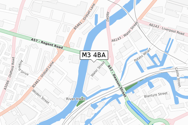
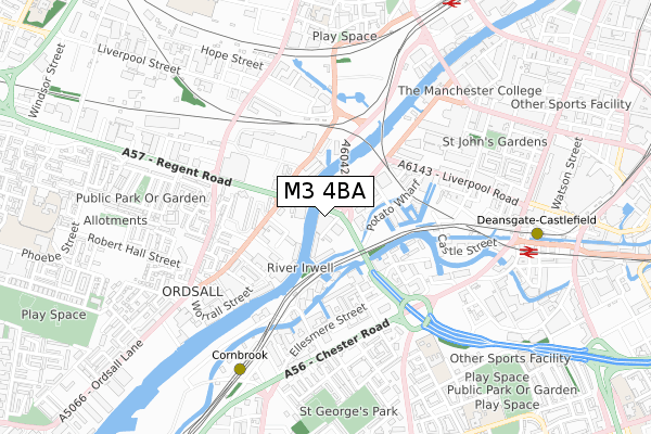
M3 4BA maps


Source: OS Open Zoomstack (Ordnance Survey)
Licence: Open Government Licence (requires attribution)
Attribution: Contains OS data © Crown copyright and database right 2025
Source: Open Postcode GeoLicence: Open Government Licence (requires attribution)
Attribution: Contains OS data © Crown copyright and database right 2025; Contains Royal Mail data © Royal Mail copyright and database right 2025; Source: Office for National Statistics licensed under the Open Government Licence v.3.0
M3 4BA geodata
| Easting | 382661 |
| Northing | 397647 |
| Latitude | 53.475279 |
| Longitude | -2.262702 |
Where is M3 4BA?
| Country | England |
| Postcode District | M3 |
Politics
| Ward | Hulme |
|---|
| Constituency | Manchester Central |
|---|
Transport
Nearest bus stops to M3 4BA
| Regent Rd/Water St (Regent Rd) | Castlefield | 28m |
| Regent Rd/Regent Bridge (Regent Rd) | Castlefield | 68m |
| Ordsall Ln/Regent Rd (Ordsall Ln) | Ordsall | 192m |
| Water St/New Elm Rd (Water St) | Castlefield | 216m |
| Regent Rd/Ordsall Ln (Regent Rd) | Ordsall | 257m |
Nearest underground/metro/tram to M3 4BA
| Cornbrook (Manchester Metrolink) | Cornbrook | 676m |
| Deansgate-castlefield (Manchester Metrolink) (Whitworth Street West) | Manchester City Centre | 758m |
| St Peters Square (Manchester Metrolink) (Peter Street) | Manchester City Centre | 1,340m |
| Salford Quays (Manchester Metrolink) (St Peters Quay) | Salford Quays | 1,520m |
| Pomona (Manchester Metrolink) (Pomona Strand) | Salford Quays | 1,531m |
Nearest railway stations to M3 4BA
| Deansgate Station | 0.8km |
| Salford Central Station | 1km |
| Manchester Oxford Road Station | 1.4km |
Broadband
Broadband access in M3 4BA (2020 data)
| Percentage of properties with Next Generation Access | 100.0% |
| Percentage of properties with Superfast Broadband | 100.0% |
| Percentage of properties with Ultrafast Broadband | 100.0% |
| Percentage of properties with Full Fibre Broadband | 100.0% |
Superfast Broadband is between 30Mbps and 300Mbps
Ultrafast Broadband is > 300Mbps
Broadband speed in M3 4BA (2019 data)
Download
| Median download speed | 50.0Mbps |
| Average download speed | 111.4Mbps |
| Maximum download speed | 350.00Mbps |
Upload
| Median upload speed | 1.1Mbps |
| Average upload speed | 1.0Mbps |
| Maximum upload speed | 1.17Mbps |
Broadband limitations in M3 4BA (2020 data)
| Percentage of properties unable to receive 2Mbps | 0.0% |
| Percentage of properties unable to receive 5Mbps | 0.0% |
| Percentage of properties unable to receive 10Mbps | 0.0% |
| Percentage of properties unable to receive 30Mbps | 0.0% |
Deprivation
47.8% of English postcodes are less deprived than
M3 4BA:
Food Standards Agency
Three nearest food hygiene ratings to M3 4BA (metres)
Grosvesnor Casino
Campanile Hotel
Party Delights Drinks and Alcohol
Unit B38 Big Yellow Self Storage
280m
➜ Get more ratings from the Food Standards Agency
Nearest post box to M3 4BA
| | Last Collection | |
|---|
| Location | Mon-Fri | Sat | Distance |
|---|
| Water Street | 19:00 | 12:00 | 299m |
| Slate Wharf Castlefield | 17:30 | 12:00 | 361m |
| Chester Road/Hulme Hall Road | 17:30 | 12:00 | 527m |
M3 4BA ITL and M3 4BA LAU
The below table lists the International Territorial Level (ITL) codes (formerly Nomenclature of Territorial Units for Statistics (NUTS) codes) and Local Administrative Units (LAU) codes for M3 4BA:
| ITL 1 Code | Name |
|---|
| TLD | North West (England) |
| ITL 2 Code | Name |
|---|
| TLD3 | Greater Manchester |
| ITL 3 Code | Name |
|---|
| TLD33 | Manchester |
| LAU 1 Code | Name |
|---|
| E08000003 | Manchester |
M3 4BA census areas
The below table lists the Census Output Area (OA), Lower Layer Super Output Area (LSOA), and Middle Layer Super Output Area (MSOA) for M3 4BA:
| Code | Name |
|---|
| OA | E00175916 | |
|---|
| LSOA | E01033673 | Manchester 059D |
|---|
| MSOA | E02006916 | Manchester 059 |
|---|
Nearest postcodes to M3 4BA


