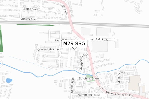
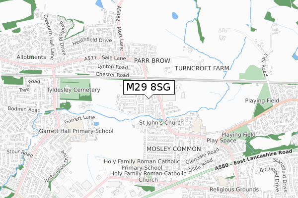
M29 8SG is located in the Tyldesley & Mosley Common electoral ward, within the metropolitan district of Wigan and the English Parliamentary constituency of Leigh. The Sub Integrated Care Board (ICB) Location is NHS Greater Manchester ICB - 02H and the police force is Greater Manchester. This postcode has been in use since April 2018.


GetTheData
Source: OS Open Zoomstack (Ordnance Survey)
Licence: Open Government Licence (requires attribution)
Attribution: Contains OS data © Crown copyright and database right 2025
Source: Open Postcode Geo
Licence: Open Government Licence (requires attribution)
Attribution: Contains OS data © Crown copyright and database right 2025; Contains Royal Mail data © Royal Mail copyright and database right 2025; Source: Office for National Statistics licensed under the Open Government Licence v.3.0
| Easting | 371276 |
| Northing | 401669 |
| Latitude | 53.510929 |
| Longitude | -2.434598 |
GetTheData
Source: Open Postcode Geo
Licence: Open Government Licence
| Country | England |
| Postcode District | M29 |
➜ See where M29 is on a map ➜ Where is Tyldesley? | |
GetTheData
Source: Land Registry Price Paid Data
Licence: Open Government Licence
| Ward | Tyldesley & Mosley Common |
| Constituency | Leigh |
GetTheData
Source: ONS Postcode Database
Licence: Open Government Licence
| Mosley Common Rd/Parr Brow (Mosley Common R) | Mosley Common | 100m |
| Mosley Common Rd/Parr Brow (Mosley Common R) | Mosley Common | 152m |
| Sale Ln (Guideway) | Mosley Common | 199m |
| Sale Ln (Guideway) | Mosley Common | 200m |
| Sale Ln/Wellington Dr (Sale Ln) | Mosley Common | 256m |
| Walkden Station | 2.7km |
| Atherton Station | 3.6km |
| Hag Fold Station | 4.7km |
GetTheData
Source: NaPTAN
Licence: Open Government Licence
| Percentage of properties with Next Generation Access | 100.0% |
| Percentage of properties with Superfast Broadband | 100.0% |
| Percentage of properties with Ultrafast Broadband | 100.0% |
| Percentage of properties with Full Fibre Broadband | 100.0% |
Superfast Broadband is between 30Mbps and 300Mbps
Ultrafast Broadband is > 300Mbps
| Percentage of properties unable to receive 2Mbps | 0.0% |
| Percentage of properties unable to receive 5Mbps | 0.0% |
| Percentage of properties unable to receive 10Mbps | 0.0% |
| Percentage of properties unable to receive 30Mbps | 0.0% |
GetTheData
Source: Ofcom
Licence: Ofcom Terms of Use (requires attribution)
GetTheData
Source: ONS Postcode Database
Licence: Open Government Licence


➜ Get more ratings from the Food Standards Agency
GetTheData
Source: Food Standards Agency
Licence: FSA terms & conditions
| Last Collection | |||
|---|---|---|---|
| Location | Mon-Fri | Sat | Distance |
| Mossley Common P.o. | 17:30 | 12:00 | 751m |
| Bodmin Road / Truro Road | 17:30 | 11:30 | 908m |
| Boothstown P.o. | 17:30 | 12:00 | 1,323m |
GetTheData
Source: Dracos
Licence: Creative Commons Attribution-ShareAlike
The below table lists the International Territorial Level (ITL) codes (formerly Nomenclature of Territorial Units for Statistics (NUTS) codes) and Local Administrative Units (LAU) codes for M29 8SG:
| ITL 1 Code | Name |
|---|---|
| TLD | North West (England) |
| ITL 2 Code | Name |
| TLD3 | Greater Manchester |
| ITL 3 Code | Name |
| TLD36 | Greater Manchester North West |
| LAU 1 Code | Name |
| E08000010 | Wigan |
GetTheData
Source: ONS Postcode Directory
Licence: Open Government Licence
The below table lists the Census Output Area (OA), Lower Layer Super Output Area (LSOA), and Middle Layer Super Output Area (MSOA) for M29 8SG:
| Code | Name | |
|---|---|---|
| OA | E00032339 | |
| LSOA | E01006380 | Wigan 029D |
| MSOA | E02001315 | Wigan 029 |
GetTheData
Source: ONS Postcode Directory
Licence: Open Government Licence
| M29 8PR | Mosley Common Road | 106m |
| M29 8QH | Bankfield Road | 148m |
| M28 1AR | St Johns Road | 303m |
| M29 8RH | Makants Close | 308m |
| M28 1AL | Highfield Avenue | 312m |
| M28 1AW | Garrett Hall Road | 331m |
| M29 8PS | Sale Lane | 332m |
| M29 8RA | Wellington Drive | 359m |
| M28 1AU | Richmond Road | 361m |
| M29 8PG | Sale Lane | 363m |
GetTheData
Source: Open Postcode Geo; Land Registry Price Paid Data
Licence: Open Government Licence