M20 1NE maps, stats, and open data
- Home
- Postcode
- M
- M20
- M20 1
M20 1NE is located in the Old Moat electoral ward, within the metropolitan district of Manchester and the English Parliamentary constituency of Manchester, Withington. The Sub Integrated Care Board (ICB) Location is NHS Greater Manchester ICB - 14L and the police force is Greater Manchester. This postcode has been in use since June 2019.
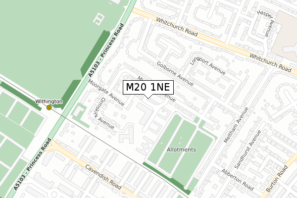
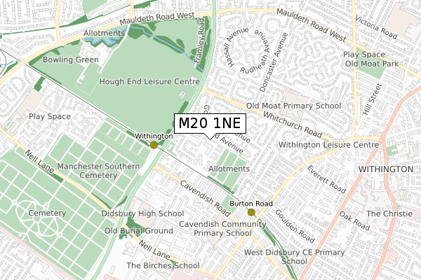
M20 1NE maps


Source: OS Open Zoomstack (Ordnance Survey)
Licence: Open Government Licence (requires attribution)
Attribution: Contains OS data © Crown copyright and database right 2025
Source: Open Postcode GeoLicence: Open Government Licence (requires attribution)
Attribution: Contains OS data © Crown copyright and database right 2025; Contains Royal Mail data © Royal Mail copyright and database right 2025; Source: Office for National Statistics licensed under the Open Government Licence v.3.0
M20 1NE geodata
| Easting | 383861 |
| Northing | 392947 |
| Latitude | 53.433072 |
| Longitude | -2.244381 |
Where is M20 1NE?
| Country | England |
| Postcode District | M20 |
Politics
| Ward | Old Moat |
|---|
| Constituency | Manchester, Withington |
|---|
Transport
Nearest bus stops to M20 1NE
| Dermot Murphy Cl/Minehead Ctr (Dermot Murphy C) | Withington | 50m |
| Minehead Ave (Nebd) (Minehead Avenue) | Withington | 193m |
| Withington Metrolink Stop (Princess Rd) | Withington | 212m |
| Golborne Ave (Wbd) (Golborne Avenue) | Withington | 219m |
| Princess Rd/Moorgate Ave (Princess Rd) | Withington | 225m |
Nearest underground/metro/tram to M20 1NE
| Withington (Manchester Metrolink) (Princess Road) | Withington | 335m |
| Burton Road (Manchester Metrolink) (Burton Road) | West Didsbury | 496m |
| West Didsbury (Manchester Metrolink) (Lapwing Lane) | West Didsbury | 1,105m |
| St Werburgh's Road (Manchester Metrolink) (St Werburgh's Road) | Chorlton | 1,535m |
Nearest railway stations to M20 1NE
| Burnage Station | 2.3km |
| Mauldeth Road Station | 2.3km |
| East Didsbury Station | 3km |
Broadband
Broadband access in M20 1NE (2020 data)
| Percentage of properties with Next Generation Access | 100.0% |
| Percentage of properties with Superfast Broadband | 100.0% |
| Percentage of properties with Ultrafast Broadband | 100.0% |
| Percentage of properties with Full Fibre Broadband | 100.0% |
Superfast Broadband is between 30Mbps and 300Mbps
Ultrafast Broadband is > 300Mbps
Broadband limitations in M20 1NE (2020 data)
| Percentage of properties unable to receive 2Mbps | 0.0% |
| Percentage of properties unable to receive 5Mbps | 0.0% |
| Percentage of properties unable to receive 10Mbps | 0.0% |
| Percentage of properties unable to receive 30Mbps | 0.0% |
Deprivation
94% of English postcodes are less deprived than
M20 1NE:
Food Standards Agency
Three nearest food hygiene ratings to M20 1NE (metres)
Dermot Murphy Centre
91 Dermot Murphy Close
70m
Supreme Start Ltd
Boulevard Deli
➜ Get more ratings from the Food Standards Agency
Nearest post box to M20 1NE
| | Last Collection | |
|---|
| Location | Mon-Fri | Sat | Distance |
|---|
| Dermot Murphey Close | 17:30 | 12:00 | 91m |
| Moorgate Avenue | 17:30 | 12:00 | 199m |
| 130 Whitchurch Road | 17:30 | 12:00 | 277m |
M20 1NE ITL and M20 1NE LAU
The below table lists the International Territorial Level (ITL) codes (formerly Nomenclature of Territorial Units for Statistics (NUTS) codes) and Local Administrative Units (LAU) codes for M20 1NE:
| ITL 1 Code | Name |
|---|
| TLD | North West (England) |
| ITL 2 Code | Name |
|---|
| TLD3 | Greater Manchester |
| ITL 3 Code | Name |
|---|
| TLD33 | Manchester |
| LAU 1 Code | Name |
|---|
| E08000003 | Manchester |
M20 1NE census areas
The below table lists the Census Output Area (OA), Lower Layer Super Output Area (LSOA), and Middle Layer Super Output Area (MSOA) for M20 1NE:
| Code | Name |
|---|
| OA | E00026749 | |
|---|
| LSOA | E01005272 | Manchester 035B |
|---|
| MSOA | E02001079 | Manchester 035 |
|---|
Nearest postcodes to M20 1NE


