Property/Postcode Data Search:
M2 3NX maps, stats, and open data
M2 3NX is located in the Deansgate electoral ward, within the metropolitan district of Manchester and the English Parliamentary constituency of Manchester Central. The Sub Integrated Care Board (ICB) Location is NHS Greater Manchester ICB - 14L and the police force is Greater Manchester. This postcode has been in use since April 2019.
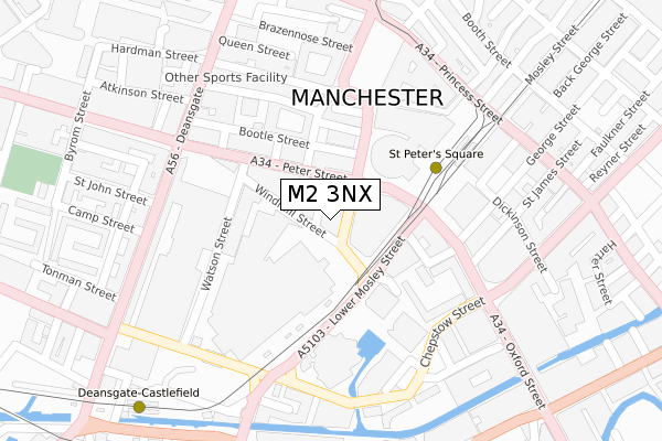
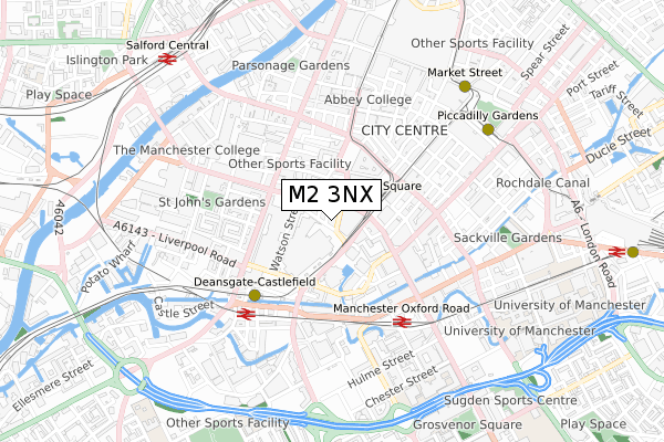
M2 3NX maps


Source: OS Open Zoomstack (Ordnance Survey)
Licence: Open Government Licence (requires attribution)
Attribution: Contains OS data © Crown copyright and database right 2025
Source: Open Postcode Geo
Licence: Open Government Licence (requires attribution)
Attribution: Contains OS data © Crown copyright and database right 2025; Contains Royal Mail data © Royal Mail copyright and database right 2025; Source: Office for National Statistics licensed under the Open Government Licence v.3.0
Licence: Open Government Licence (requires attribution)
Attribution: Contains OS data © Crown copyright and database right 2025
Source: Open Postcode Geo
Licence: Open Government Licence (requires attribution)
Attribution: Contains OS data © Crown copyright and database right 2025; Contains Royal Mail data © Royal Mail copyright and database right 2025; Source: Office for National Statistics licensed under the Open Government Licence v.3.0
M2 3NX geodata
| Easting | 383764 |
| Northing | 397865 |
| Latitude | 53.477274 |
| Longitude | -2.246095 |
Where is M2 3NX?
| Country | England |
| Postcode District | M2 |
Politics
| Ward | Deansgate |
|---|---|
| Constituency | Manchester Central |
Transport
Nearest bus stops to M2 3NX
| Mount St/Midland Hotel (Mount St) | Manchester City Centre | 17m |
| Peter St/Mount St (Peter St) | Manchester City Centre | 81m |
| Peter St/Edwardian Hotel (Peter St) | Manchester City Centre | 112m |
| Lwr Mosley St/Mcr Central (Lower Mosley St) | Manchester City Centre | 138m |
| Lwr Mosley St/Mcr Central (Lower Mosley St) | Manchester City Centre | 153m |
Nearest underground/metro/tram to M2 3NX
| St Peters Square (Manchester Metrolink) (Peter Street) | Manchester City Centre | 224m |
| Deansgate-castlefield (Manchester Metrolink) (Whitworth Street West) | Manchester City Centre | 445m |
| Market Street (Manchester Metrolink) (Market Street) | Manchester City Centre | 695m |
| Piccadilly Gardens (Manchester Metrolink) (Portland Street) | Piccadilly Gardens | 706m |
| Exchange Square (Manchester Metrolink) (Corporation St) | Manchester City Centre | 831m |
Nearest railway stations to M2 3NX
| Manchester Oxford Road Station | 0.5km |
| Deansgate Station | 0.5km |
| Salford Central Station | 0.9km |
Deprivation
59.6% of English postcodes are less deprived than M2 3NX:Food Standards Agency
Three nearest food hygiene ratings to M2 3NX (metres)
Thumbs Up Community Cafe - Moodswings

36 New Mount Street
29m
Haunt Mcr

58 Peter Street
31m
Exhibition

St Georges House
33m
➜ Get more ratings from the Food Standards Agency
Nearest post box to M2 3NX
| Last Collection | |||
|---|---|---|---|
| Location | Mon-Fri | Sat | Distance |
| Mount Street | 19:00 | 12:00 | 64m |
| George Street | 19:00 | 12:00 | 188m |
| 12 Albert Square/Lloyd Street | 19:00 | 12:00 | 201m |
M2 3NX ITL and M2 3NX LAU
The below table lists the International Territorial Level (ITL) codes (formerly Nomenclature of Territorial Units for Statistics (NUTS) codes) and Local Administrative Units (LAU) codes for M2 3NX:
| ITL 1 Code | Name |
|---|---|
| TLD | North West (England) |
| ITL 2 Code | Name |
| TLD3 | Greater Manchester |
| ITL 3 Code | Name |
| TLD33 | Manchester |
| LAU 1 Code | Name |
| E08000003 | Manchester |
M2 3NX census areas
The below table lists the Census Output Area (OA), Lower Layer Super Output Area (LSOA), and Middle Layer Super Output Area (MSOA) for M2 3NX:
| Code | Name | |
|---|---|---|
| OA | E00175962 | |
| LSOA | E01033677 | Manchester 060A |
| MSOA | E02006917 | Manchester 060 |
Nearest postcodes to M2 3NX
| M2 3NQ | Peter Street | 33m |
| M2 5GB | Peter Street | 112m |
| M3 4EE | Watson Street | 135m |
| M3 4EF | Watson Street | 135m |
| M3 4EH | Watson Street | 135m |
| M3 4EP | Watson Street | 135m |
| M2 5WR | Central Street | 155m |
| M2 5PE | Albert Square | 180m |
| M2 3WQ | Oxford Court | 215m |
| M2 5GU | Bootle Street | 237m |