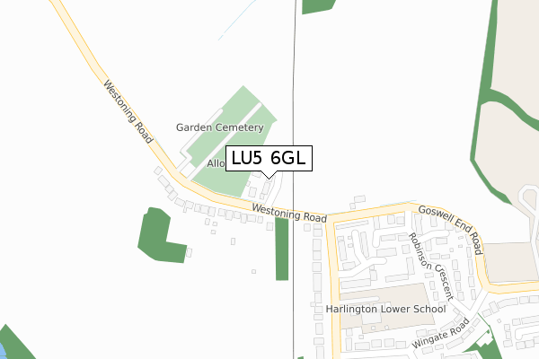
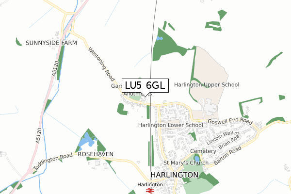
LU5 6GL is located in the Toddington electoral ward, within the unitary authority of Central Bedfordshire and the English Parliamentary constituency of Mid Bedfordshire. The Sub Integrated Care Board (ICB) Location is NHS Bedfordshire, Luton and Milton Keynes ICB - M1J4Y and the police force is Bedfordshire. This postcode has been in use since August 2019.


GetTheData
Source: OS Open Zoomstack (Ordnance Survey)
Licence: Open Government Licence (requires attribution)
Attribution: Contains OS data © Crown copyright and database right 2025
Source: Open Postcode Geo
Licence: Open Government Licence (requires attribution)
Attribution: Contains OS data © Crown copyright and database right 2025; Contains Royal Mail data © Royal Mail copyright and database right 2025; Source: Office for National Statistics licensed under the Open Government Licence v.3.0
| Easting | 503433 |
| Northing | 231116 |
| Latitude | 51.968914 |
| Longitude | -0.495771 |
GetTheData
Source: Open Postcode Geo
Licence: Open Government Licence
| Country | England |
| Postcode District | LU5 |
➜ See where LU5 is on a map ➜ Where is Harlington? | |
GetTheData
Source: Land Registry Price Paid Data
Licence: Open Government Licence
| Ward | Toddington |
| Constituency | Mid Bedfordshire |
GetTheData
Source: ONS Postcode Database
Licence: Open Government Licence
2023 11 AUG £400,000 |
2022 11 FEB £440,000 |
2019 4 SEP £405,000 |
2019 12 AUG £430,000 |
GetTheData
Source: HM Land Registry Price Paid Data
Licence: Contains HM Land Registry data © Crown copyright and database right 2025. This data is licensed under the Open Government Licence v3.0.
| Garden Cemetery (Westoning Road) | Harlington | 118m |
| Garden Cemetery (Westoning Road) | Harlington | 123m |
| Glebe Gardens (Westoning Road) | Harlington | 196m |
| Glebe Gardens (Westoning Road) | Harlington | 202m |
| Churchills (Church Road) | Harlington | 634m |
| Harlington (Beds) Station | 0.8km |
| Flitwick Station | 3.9km |
GetTheData
Source: NaPTAN
Licence: Open Government Licence
GetTheData
Source: ONS Postcode Database
Licence: Open Government Licence


➜ Get more ratings from the Food Standards Agency
GetTheData
Source: Food Standards Agency
Licence: FSA terms & conditions
| Last Collection | |||
|---|---|---|---|
| Location | Mon-Fri | Sat | Distance |
| Westoning Road | 17:00 | 09:00 | 348m |
| Post Office Lincoln Way | 17:15 | 11:00 | 684m |
| Lincoln Way Harlington | 17:00 | 08:45 | 933m |
GetTheData
Source: Dracos
Licence: Creative Commons Attribution-ShareAlike
The below table lists the International Territorial Level (ITL) codes (formerly Nomenclature of Territorial Units for Statistics (NUTS) codes) and Local Administrative Units (LAU) codes for LU5 6GL:
| ITL 1 Code | Name |
|---|---|
| TLH | East |
| ITL 2 Code | Name |
| TLH2 | Bedfordshire and Hertfordshire |
| ITL 3 Code | Name |
| TLH25 | Central Bedfordshire |
| LAU 1 Code | Name |
| E06000056 | Central Bedfordshire |
GetTheData
Source: ONS Postcode Directory
Licence: Open Government Licence
The below table lists the Census Output Area (OA), Lower Layer Super Output Area (LSOA), and Middle Layer Super Output Area (MSOA) for LU5 6GL:
| Code | Name | |
|---|---|---|
| OA | E00087917 | |
| LSOA | E01017409 | Central Bedfordshire 017C |
| MSOA | E02003615 | Central Bedfordshire 017 |
GetTheData
Source: ONS Postcode Directory
Licence: Open Government Licence
| LU5 6PA | Westoning Road | 123m |
| LU5 6NZ | Goswell End Road | 199m |
| LU5 6PQ | Browns Crescent | 237m |
| LU5 6PE | Glebe Gardens | 261m |
| LU5 6PH | Stivers Way | 341m |
| LU5 6NL | Robinson Crescent | 344m |
| LU5 6PB | Westoning Road | 356m |
| LU5 6NY | Goswell End Road | 382m |
| LU5 6NJ | Wingate Road | 407m |
| LU5 6PD | Westoning Road | 414m |
GetTheData
Source: Open Postcode Geo; Land Registry Price Paid Data
Licence: Open Government Licence