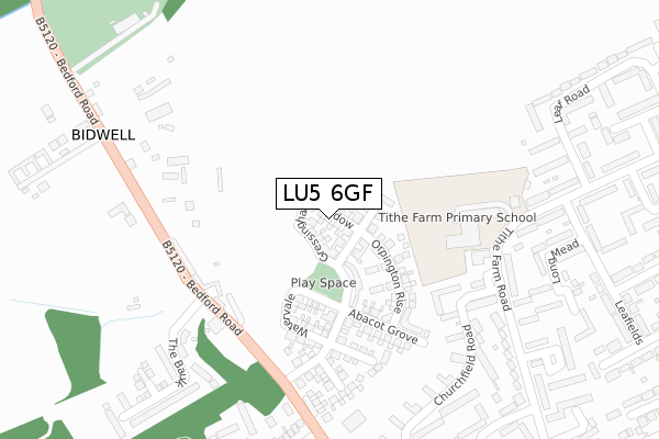
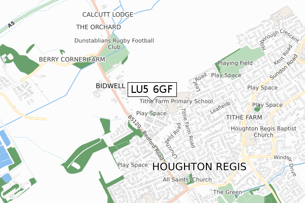
LU5 6GF is located in the Houghton Regis East electoral ward, within the unitary authority of Central Bedfordshire and the English Parliamentary constituency of South West Bedfordshire. The Sub Integrated Care Board (ICB) Location is NHS Bedfordshire, Luton and Milton Keynes ICB - M1J4Y and the police force is Bedfordshire. This postcode has been in use since January 2018.


GetTheData
Source: OS Open Zoomstack (Ordnance Survey)
Licence: Open Government Licence (requires attribution)
Attribution: Contains OS data © Crown copyright and database right 2025
Source: Open Postcode Geo
Licence: Open Government Licence (requires attribution)
Attribution: Contains OS data © Crown copyright and database right 2025; Contains Royal Mail data © Royal Mail copyright and database right 2025; Source: Office for National Statistics licensed under the Open Government Licence v.3.0
| Easting | 501557 |
| Northing | 224616 |
| Latitude | 51.910837 |
| Longitude | -0.524986 |
GetTheData
Source: Open Postcode Geo
Licence: Open Government Licence
| Country | England |
| Postcode District | LU5 |
➜ See where LU5 is on a map ➜ Where is Houghton Regis? | |
GetTheData
Source: Land Registry Price Paid Data
Licence: Open Government Licence
| Ward | Houghton Regis East |
| Constituency | South West Bedfordshire |
GetTheData
Source: ONS Postcode Database
Licence: Open Government Licence
27, GRESSINGHAM MEADOW, HOUGHTON REGIS, DUNSTABLE, LU5 6GF 2018 30 NOV £475,000 |
25, GRESSINGHAM MEADOW, HOUGHTON REGIS, DUNSTABLE, LU5 6GF 2018 2 NOV £460,000 |
16, GRESSINGHAM MEADOW, HOUGHTON REGIS, DUNSTABLE, LU5 6GF 2018 2 NOV £290,000 |
19, GRESSINGHAM MEADOW, HOUGHTON REGIS, DUNSTABLE, LU5 6GF 2018 31 OCT £395,000 |
17, GRESSINGHAM MEADOW, HOUGHTON REGIS, DUNSTABLE, LU5 6GF 2018 17 OCT £380,000 |
9, GRESSINGHAM MEADOW, HOUGHTON REGIS, DUNSTABLE, LU5 6GF 2018 17 AUG £375,000 |
GetTheData
Source: HM Land Registry Price Paid Data
Licence: Contains HM Land Registry data © Crown copyright and database right 2025. This data is licensed under the Open Government Licence v3.0.
| Tithe Farm Lower Sch (Tithe Farm Road) | Houghton Regis | 252m |
| Tithe Farm Lower School (Tithe Farm Road) | Houghton Regis | 298m |
| Roslyn Way (Bedford Road) | Houghton Regis | 313m |
| Roslyn Way (Bedford Road) | Houghton Regis | 333m |
| Beech Tree Way (Tithe Farm Road) | Houghton Regis | 473m |
| Leagrave Station | 4.6km |
GetTheData
Source: NaPTAN
Licence: Open Government Licence
| Percentage of properties with Next Generation Access | 100.0% |
| Percentage of properties with Superfast Broadband | 100.0% |
| Percentage of properties with Ultrafast Broadband | 100.0% |
| Percentage of properties with Full Fibre Broadband | 100.0% |
Superfast Broadband is between 30Mbps and 300Mbps
Ultrafast Broadband is > 300Mbps
| Median download speed | 360.0Mbps |
| Average download speed | 360.0Mbps |
| Maximum download speed | 360.00Mbps |
| Median upload speed | 360.0Mbps |
| Average upload speed | 360.0Mbps |
| Maximum upload speed | 360.00Mbps |
| Percentage of properties unable to receive 2Mbps | 0.0% |
| Percentage of properties unable to receive 5Mbps | 0.0% |
| Percentage of properties unable to receive 10Mbps | 0.0% |
| Percentage of properties unable to receive 30Mbps | 0.0% |
GetTheData
Source: Ofcom
Licence: Ofcom Terms of Use (requires attribution)
GetTheData
Source: ONS Postcode Database
Licence: Open Government Licence


➜ Get more ratings from the Food Standards Agency
GetTheData
Source: Food Standards Agency
Licence: FSA terms & conditions
| Last Collection | |||
|---|---|---|---|
| Location | Mon-Fri | Sat | Distance |
| Bidwell Roslyn Way | 17:30 | 11:30 | 288m |
| Delmont Road | 16:15 | 11:30 | 410m |
| Leaf Road | 17:00 | 11:30 | 514m |
GetTheData
Source: Dracos
Licence: Creative Commons Attribution-ShareAlike
The below table lists the International Territorial Level (ITL) codes (formerly Nomenclature of Territorial Units for Statistics (NUTS) codes) and Local Administrative Units (LAU) codes for LU5 6GF:
| ITL 1 Code | Name |
|---|---|
| TLH | East |
| ITL 2 Code | Name |
| TLH2 | Bedfordshire and Hertfordshire |
| ITL 3 Code | Name |
| TLH25 | Central Bedfordshire |
| LAU 1 Code | Name |
| E06000056 | Central Bedfordshire |
GetTheData
Source: ONS Postcode Directory
Licence: Open Government Licence
The below table lists the Census Output Area (OA), Lower Layer Super Output Area (LSOA), and Middle Layer Super Output Area (MSOA) for LU5 6GF:
| Code | Name | |
|---|---|---|
| OA | E00088935 | |
| LSOA | E01017618 | Central Bedfordshire 025D |
| MSOA | E02003642 | Central Bedfordshire 025 |
GetTheData
Source: ONS Postcode Directory
Licence: Open Government Licence
| LU5 6JP | 216m | |
| LU5 5HT | Dell Road | 261m |
| LU5 6JR | Bedford Road | 292m |
| LU5 5HN | Churchfield Road | 292m |
| LU5 5JB | Tithe Farm Road | 307m |
| LU5 5HW | Churchfield Road | 341m |
| LU5 6JF | Bankside Close | 348m |
| LU5 5HQ | The Link | 349m |
| LU5 5JS | Long Mead | 353m |
| LU5 6JY | Roslyn Way | 373m |
GetTheData
Source: Open Postcode Geo; Land Registry Price Paid Data
Licence: Open Government Licence