Property/Postcode Data Search:
LU2 9DQ maps, stats, and open data
LU2 9DQ is located in the Vauxhall electoral ward, within the unitary authority of Luton and the English Parliamentary constituency of Luton South. The Sub Integrated Care Board (ICB) Location is NHS Bedfordshire, Luton and Milton Keynes ICB - M1J4Y and the police force is Bedfordshire. This postcode has been in use since August 2017.
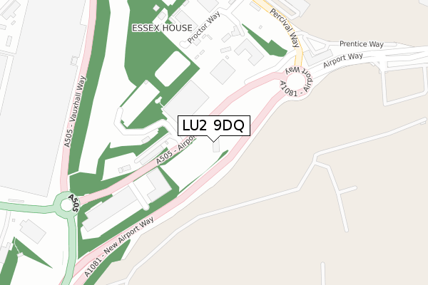
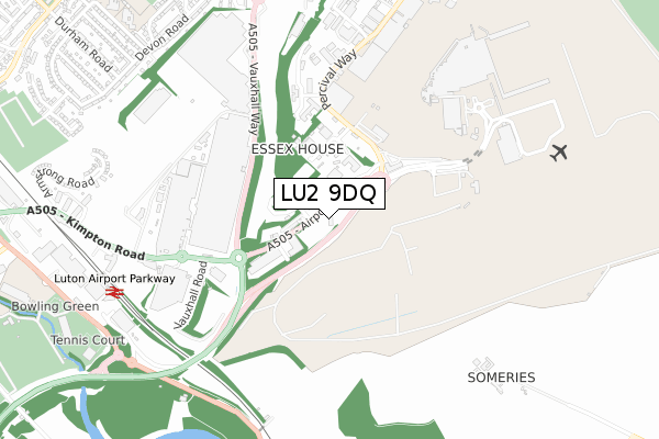
LU2 9DQ maps


Source: OS Open Zoomstack (Ordnance Survey)
Licence: Open Government Licence (requires attribution)
Attribution: Contains OS data © Crown copyright and database right 2025
Source: Open Postcode Geo
Licence: Open Government Licence (requires attribution)
Attribution: Contains OS data © Crown copyright and database right 2025; Contains Royal Mail data © Royal Mail copyright and database right 2025; Source: Office for National Statistics licensed under the Open Government Licence v.3.0
Licence: Open Government Licence (requires attribution)
Attribution: Contains OS data © Crown copyright and database right 2025
Source: Open Postcode Geo
Licence: Open Government Licence (requires attribution)
Attribution: Contains OS data © Crown copyright and database right 2025; Contains Royal Mail data © Royal Mail copyright and database right 2025; Source: Office for National Statistics licensed under the Open Government Licence v.3.0
LU2 9DQ geodata
| Easting | 511349 |
| Northing | 220826 |
| Latitude | 51.874906 |
| Longitude | -0.383915 |
Where is LU2 9DQ?
| Country | England |
| Postcode District | LU2 |
Politics
| Ward | Vauxhall |
|---|---|
| Constituency | Luton South |
Transport
Nearest bus stops to LU2 9DQ
| Ramada Encore (Airport Way) | Luton Airport | 116m |
| Ramada Encore (Airport Way) | Luton Airport | 133m |
| Express Holiday Inn (Airport Way) | Luton Airport | 319m |
| Proctor Way (Percival Way) | Luton Airport | 337m |
| Express Holiday Inn (Airport Way) | Luton Airport | 360m |
Nearest railway stations to LU2 9DQ
| Luton Airport Parkway Station | 0.9km |
| Luton Station | 2.2km |
Deprivation
11.9% of English postcodes are less deprived than LU2 9DQ:Food Standards Agency
Three nearest food hygiene ratings to LU2 9DQ (metres)
Courtyard by Marriott Luton Airport

Airport Way
157m
Holiday Inn

Airport Way
157m
IBIS London Luton Airport

Hotel Ibis
235m
➜ Get more ratings from the Food Standards Agency
Nearest post box to LU2 9DQ
| Last Collection | |||
|---|---|---|---|
| Location | Mon-Fri | Sat | Distance |
| Luton Airport Terminal Outside | 18:30 | 12:15 | 774m |
| Kimpton Road | 17:30 | 12:00 | 902m |
| Airport Approach | 18:30 | 972m | |
LU2 9DQ ITL and LU2 9DQ LAU
The below table lists the International Territorial Level (ITL) codes (formerly Nomenclature of Territorial Units for Statistics (NUTS) codes) and Local Administrative Units (LAU) codes for LU2 9DQ:
| ITL 1 Code | Name |
|---|---|
| TLH | East |
| ITL 2 Code | Name |
| TLH2 | Bedfordshire and Hertfordshire |
| ITL 3 Code | Name |
| TLH21 | Luton |
| LAU 1 Code | Name |
| E06000032 | Luton |
LU2 9DQ census areas
The below table lists the Census Output Area (OA), Lower Layer Super Output Area (LSOA), and Middle Layer Super Output Area (MSOA) for LU2 9DQ:
| Code | Name | |
|---|---|---|
| OA | E00079923 | |
| LSOA | E01015811 | Luton 014G |
| MSOA | E02003271 | Luton 014 |
Nearest postcodes to LU2 9DQ
| LU2 9NH | Barratt Industrial Park | 275m |
| LU2 9PE | Proctor Way | 294m |
| LU2 0SR | Harrowden Road | 883m |
| LU2 9PL | Someries Cottages | 911m |
| LU2 0RL | Devon Road | 923m |
| LU2 0SP | Harrowden Road | 934m |
| LU2 0RJ | Devon Road | 955m |
| LU2 9HB | Eaton Green Road | 981m |
| LU2 0RH | Devon Road | 986m |
| LU2 0RR | Gayland Avenue | 1006m |