LS9 0AW maps, stats, and open data
LS9 0AW is located in the Temple Newsam electoral ward, within the metropolitan district of Leeds and the English Parliamentary constituency of Leeds East. The Sub Integrated Care Board (ICB) Location is NHS West Yorkshire ICB - 15F and the police force is West Yorkshire. This postcode has been in use since September 2019.
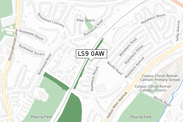
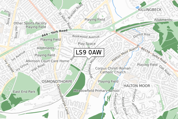
LS9 0AW maps


Licence: Open Government Licence (requires attribution)
Attribution: Contains OS data © Crown copyright and database right 2025
Source: Open Postcode Geo
Licence: Open Government Licence (requires attribution)
Attribution: Contains OS data © Crown copyright and database right 2025; Contains Royal Mail data © Royal Mail copyright and database right 2025; Source: Office for National Statistics licensed under the Open Government Licence v.3.0
LS9 0AW geodata
| Easting | 433586 |
| Northing | 433623 |
| Latitude | 53.797851 |
| Longitude | -1.491589 |
Where is LS9 0AW?
| Country | England |
| Postcode District | LS9 |
Politics
| Ward | Temple Newsam |
|---|---|
| Constituency | Leeds East |
House Prices
Sales of detached houses in LS9 0AW
2021 12 JUL £192,500 |
2021 30 JUN £187,500 |
27, BLENCARTHA CRESCENT, LEEDS, LS9 0AW 2020 28 FEB £184,995 |
26, BLENCARTHA CRESCENT, LEEDS, LS9 0AW 2019 28 OCT £181,995 |
2019 26 SEP £174,995 |
5, BLENCARTHA CRESCENT, LEEDS, LS9 0AW 2019 20 SEP £179,995 |
Licence: Contains HM Land Registry data © Crown copyright and database right 2025. This data is licensed under the Open Government Licence v3.0.
Transport
Nearest bus stops to LS9 0AW
| Halton Moor Avenue | Halton Moor | 249m |
| Halton Moor Avenue Neville Rd (Halton Moor Avenue) | Halton Moor | 261m |
| Halton Moor Avenue Neville Pl (Halton Moor Avenue) | Halton Moor | 362m |
| York Rd Gipton Approach (York Road) | Osmondthorpe | 416m |
| York Rd Harrison Crescent (York Road (Guided Bus Way)) | Osmondthorpe | 417m |
Nearest railway stations to LS9 0AW
| Cross Gates Station | 2.8km |
| Leeds Station | 3.7km |
| Woodlesford Station | 5.6km |
Broadband
Broadband access in LS9 0AW (2020 data)
| Percentage of properties with Next Generation Access | 100.0% |
| Percentage of properties with Superfast Broadband | 100.0% |
| Percentage of properties with Ultrafast Broadband | 100.0% |
| Percentage of properties with Full Fibre Broadband | 61.1% |
Superfast Broadband is between 30Mbps and 300Mbps
Ultrafast Broadband is > 300Mbps
Broadband limitations in LS9 0AW (2020 data)
| Percentage of properties unable to receive 2Mbps | 0.0% |
| Percentage of properties unable to receive 5Mbps | 0.0% |
| Percentage of properties unable to receive 10Mbps | 0.0% |
| Percentage of properties unable to receive 30Mbps | 0.0% |
Deprivation
97.8% of English postcodes are less deprived than LS9 0AW:Food Standards Agency
Three nearest food hygiene ratings to LS9 0AW (metres)


➜ Get more ratings from the Food Standards Agency
Nearest post box to LS9 0AW
| Last Collection | |||
|---|---|---|---|
| Location | Mon-Fri | Sat | Distance |
| Osmondthorpe P.o. | 18:45 | 12:00 | 273m |
| Doreen Hamilton Day Centre | 17:30 | 11:00 | 369m |
| Osmondthorpe Lane | 17:30 | 11:00 | 441m |
LS9 0AW ITL and LS9 0AW LAU
The below table lists the International Territorial Level (ITL) codes (formerly Nomenclature of Territorial Units for Statistics (NUTS) codes) and Local Administrative Units (LAU) codes for LS9 0AW:
| ITL 1 Code | Name |
|---|---|
| TLE | Yorkshire and The Humber |
| ITL 2 Code | Name |
| TLE4 | West Yorkshire |
| ITL 3 Code | Name |
| TLE42 | Leeds |
| LAU 1 Code | Name |
| E08000035 | Leeds |
LS9 0AW census areas
The below table lists the Census Output Area (OA), Lower Layer Super Output Area (LSOA), and Middle Layer Super Output Area (MSOA) for LS9 0AW:
| Code | Name | |
|---|---|---|
| OA | E00058592 | |
| LSOA | E01011622 | Leeds 072C |
| MSOA | E02002401 | Leeds 072 |
Nearest postcodes to LS9 0AW
| LS9 0NB | Rookwood Parade | 61m |
| LS9 0JB | Wykebeck Mount | 172m |
| LS9 0NJ | Rookwood Road | 185m |
| LS9 0HN | Wykebeck Mount | 193m |
| LS9 0NQ | Rookwood Square | 209m |
| LS9 0JG | Wykebeck Avenue | 211m |
| LS9 0NH | Rookwood Road | 215m |
| LS9 0HW | Wykebeck Mount | 225m |
| LS9 0JA | Wykebeck Road | 230m |
| LS9 0JE | Wykebeck Mount | 243m |