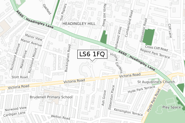
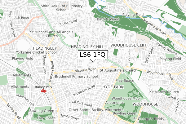
LS6 1FQ is located in the Headingley & Hyde Park electoral ward, within the metropolitan district of Leeds and the English Parliamentary constituency of Leeds North West. The Sub Integrated Care Board (ICB) Location is NHS West Yorkshire ICB - 15F and the police force is West Yorkshire. This postcode has been in use since June 2019.


GetTheData
Source: OS Open Zoomstack (Ordnance Survey)
Licence: Open Government Licence (requires attribution)
Attribution: Contains OS data © Crown copyright and database right 2025
Source: Open Postcode Geo
Licence: Open Government Licence (requires attribution)
Attribution: Contains OS data © Crown copyright and database right 2025; Contains Royal Mail data © Royal Mail copyright and database right 2025; Source: Office for National Statistics licensed under the Open Government Licence v.3.0
| Easting | 428556 |
| Northing | 435562 |
| Latitude | 53.815577 |
| Longitude | -1.567773 |
GetTheData
Source: Open Postcode Geo
Licence: Open Government Licence
| Country | England |
| Postcode District | LS6 |
➜ See where LS6 is on a map ➜ Where is Leeds? | |
GetTheData
Source: Land Registry Price Paid Data
Licence: Open Government Licence
| Ward | Headingley & Hyde Park |
| Constituency | Leeds North West |
GetTheData
Source: ONS Postcode Database
Licence: Open Government Licence
| Headingley Ln North Hill Road (Headingley Lane) | Hyde Park Corner | 103m |
| Headingley Ln North Hill Road (Headingley Lane) | Hyde Park Corner | 132m |
| Headingley Lane North Grange Rd (Headingley Lane) | Headingley | 138m |
| Victoria Rd Buckingham Road (Victoria Road) | Hyde Park | 150m |
| Headingley Ln North Grange Road (Headingley Lane) | Headingley | 158m |
| Burley Park Station | 0.8km |
| Headingley Station | 1.8km |
| Leeds Station | 2.6km |
GetTheData
Source: NaPTAN
Licence: Open Government Licence
| Percentage of properties with Next Generation Access | 100.0% |
| Percentage of properties with Superfast Broadband | 100.0% |
| Percentage of properties with Ultrafast Broadband | 100.0% |
| Percentage of properties with Full Fibre Broadband | 100.0% |
Superfast Broadband is between 30Mbps and 300Mbps
Ultrafast Broadband is > 300Mbps
| Percentage of properties unable to receive 2Mbps | 0.0% |
| Percentage of properties unable to receive 5Mbps | 0.0% |
| Percentage of properties unable to receive 10Mbps | 0.0% |
| Percentage of properties unable to receive 30Mbps | 0.0% |
GetTheData
Source: Ofcom
Licence: Ofcom Terms of Use (requires attribution)
GetTheData
Source: ONS Postcode Database
Licence: Open Government Licence


➜ Get more ratings from the Food Standards Agency
GetTheData
Source: Food Standards Agency
Licence: FSA terms & conditions
| Last Collection | |||
|---|---|---|---|
| Location | Mon-Fri | Sat | Distance |
| Ash Grove/61 Victoria Road | 17:30 | 11:15 | 110m |
| North Hill Road | 17:30 | 12:30 | 126m |
| Devonshire Road | 17:30 | 12:30 | 362m |
GetTheData
Source: Dracos
Licence: Creative Commons Attribution-ShareAlike
The below table lists the International Territorial Level (ITL) codes (formerly Nomenclature of Territorial Units for Statistics (NUTS) codes) and Local Administrative Units (LAU) codes for LS6 1FQ:
| ITL 1 Code | Name |
|---|---|
| TLE | Yorkshire and The Humber |
| ITL 2 Code | Name |
| TLE4 | West Yorkshire |
| ITL 3 Code | Name |
| TLE42 | Leeds |
| LAU 1 Code | Name |
| E08000035 | Leeds |
GetTheData
Source: ONS Postcode Directory
Licence: Open Government Licence
The below table lists the Census Output Area (OA), Lower Layer Super Output Area (LSOA), and Middle Layer Super Output Area (MSOA) for LS6 1FQ:
| Code | Name | |
|---|---|---|
| OA | E00057645 | |
| LSOA | E01011443 | Leeds 110B |
| MSOA | E02006861 | Leeds 110 |
GetTheData
Source: ONS Postcode Directory
Licence: Open Government Licence
| LS6 1PF | Victoria Road | 80m |
| LS6 1BL | Headingley Lane | 103m |
| LS6 1BP | Buckingham Road | 151m |
| LS6 1DJ | Buckingham Avenue | 180m |
| LS6 2BW | Headingley Lane | 188m |
| LS6 2EJ | Ashwood Villas | 189m |
| LS6 1AU | Ebberston Terrace | 192m |
| LS6 1BB | Chestnut Grove | 196m |
| LS6 1AY | Ash Grove | 197m |
| LS6 2EL | Headingley Lane | 198m |
GetTheData
Source: Open Postcode Geo; Land Registry Price Paid Data
Licence: Open Government Licence