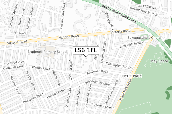
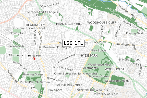
LS6 1FL is located in the Headingley & Hyde Park electoral ward, within the metropolitan district of Leeds and the English Parliamentary constituency of Leeds North West. The Sub Integrated Care Board (ICB) Location is NHS West Yorkshire ICB - 15F and the police force is West Yorkshire. This postcode has been in use since December 2017.


GetTheData
Source: OS Open Zoomstack (Ordnance Survey)
Licence: Open Government Licence (requires attribution)
Attribution: Contains OS data © Crown copyright and database right 2025
Source: Open Postcode Geo
Licence: Open Government Licence (requires attribution)
Attribution: Contains OS data © Crown copyright and database right 2025; Contains Royal Mail data © Royal Mail copyright and database right 2025; Source: Office for National Statistics licensed under the Open Government Licence v.3.0
| Easting | 428557 |
| Northing | 435338 |
| Latitude | 53.813564 |
| Longitude | -1.567778 |
GetTheData
Source: Open Postcode Geo
Licence: Open Government Licence
| Country | England |
| Postcode District | LS6 |
➜ See where LS6 is on a map ➜ Where is Leeds? | |
GetTheData
Source: Land Registry Price Paid Data
Licence: Open Government Licence
| Ward | Headingley & Hyde Park |
| Constituency | Leeds North West |
GetTheData
Source: ONS Postcode Database
Licence: Open Government Licence
| Brudenell Road Queens Rd (Brudenell Road) | Hyde Park | 141m |
| Chestnut Road Brudenell Rd (Chestnut Road) | Hyde Park | 157m |
| Victoria Rd Buckingham Road (Victoria Road) | Hyde Park | 172m |
| Queens Rd Brudenell Road (Queen's Road) | Hyde Park | 184m |
| Brudenell Road Queens Rd (Brudenell Road) | Hyde Park | 193m |
| Burley Park Station | 0.7km |
| Headingley Station | 1.8km |
| Leeds Station | 2.4km |
GetTheData
Source: NaPTAN
Licence: Open Government Licence
| Percentage of properties with Next Generation Access | 100.0% |
| Percentage of properties with Superfast Broadband | 100.0% |
| Percentage of properties with Ultrafast Broadband | 0.0% |
| Percentage of properties with Full Fibre Broadband | 0.0% |
Superfast Broadband is between 30Mbps and 300Mbps
Ultrafast Broadband is > 300Mbps
| Median download speed | 40.0Mbps |
| Average download speed | 42.3Mbps |
| Maximum download speed | 77.87Mbps |
| Median upload speed | 10.0Mbps |
| Average upload speed | 8.2Mbps |
| Maximum upload speed | 16.38Mbps |
| Percentage of properties unable to receive 2Mbps | 0.0% |
| Percentage of properties unable to receive 5Mbps | 0.0% |
| Percentage of properties unable to receive 10Mbps | 0.0% |
| Percentage of properties unable to receive 30Mbps | 0.0% |
GetTheData
Source: Ofcom
Licence: Ofcom Terms of Use (requires attribution)
GetTheData
Source: ONS Postcode Database
Licence: Open Government Licence


➜ Get more ratings from the Food Standards Agency
GetTheData
Source: Food Standards Agency
Licence: FSA terms & conditions
| Last Collection | |||
|---|---|---|---|
| Location | Mon-Fri | Sat | Distance |
| Ash Grove/61 Victoria Road | 17:30 | 11:15 | 135m |
| Brudenell Road P.o. | 17:30 | 12:00 | 217m |
| Brudenell Street | 17:30 | 11:15 | 344m |
GetTheData
Source: Dracos
Licence: Creative Commons Attribution-ShareAlike
The below table lists the International Territorial Level (ITL) codes (formerly Nomenclature of Territorial Units for Statistics (NUTS) codes) and Local Administrative Units (LAU) codes for LS6 1FL:
| ITL 1 Code | Name |
|---|---|
| TLE | Yorkshire and The Humber |
| ITL 2 Code | Name |
| TLE4 | West Yorkshire |
| ITL 3 Code | Name |
| TLE42 | Leeds |
| LAU 1 Code | Name |
| E08000035 | Leeds |
GetTheData
Source: ONS Postcode Directory
Licence: Open Government Licence
The below table lists the Census Output Area (OA), Lower Layer Super Output Area (LSOA), and Middle Layer Super Output Area (MSOA) for LS6 1FL:
| Code | Name | |
|---|---|---|
| OA | E00169612 | |
| LSOA | E01011444 | Leeds 110C |
| MSOA | E02006861 | Leeds 110 |
GetTheData
Source: ONS Postcode Directory
Licence: Open Government Licence
| LS6 1AY | Ash Grove | 52m |
| LS6 1AZ | Chestnut Avenue | 70m |
| LS6 1AX | Ash Grove | 85m |
| LS6 1BA | Chestnut Avenue | 92m |
| LS6 1EE | Welton Road | 97m |
| LS6 1HA | Brudenell Road | 108m |
| LS6 1ET | Welton Mount | 121m |
| LS6 1BB | Chestnut Grove | 133m |
| LS6 1AU | Ebberston Terrace | 143m |
| LS6 1PF | Victoria Road | 165m |
GetTheData
Source: Open Postcode Geo; Land Registry Price Paid Data
Licence: Open Government Licence