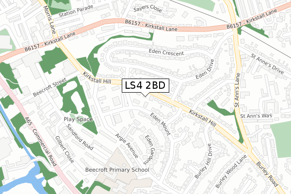
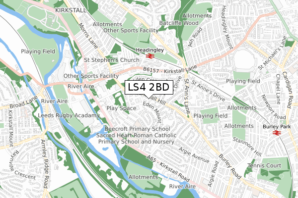
LS4 2BD is located in the Kirkstall electoral ward, within the metropolitan district of Leeds and the English Parliamentary constituency of Leeds West. The Sub Integrated Care Board (ICB) Location is NHS West Yorkshire ICB - 15F and the police force is West Yorkshire. This postcode has been in use since March 2019.


GetTheData
Source: OS Open Zoomstack (Ordnance Survey)
Licence: Open Government Licence (requires attribution)
Attribution: Contains OS data © Crown copyright and database right 2025
Source: Open Postcode Geo
Licence: Open Government Licence (requires attribution)
Attribution: Contains OS data © Crown copyright and database right 2025; Contains Royal Mail data © Royal Mail copyright and database right 2025; Source: Office for National Statistics licensed under the Open Government Licence v.3.0
| Easting | 426819 |
| Northing | 435458 |
| Latitude | 53.814735 |
| Longitude | -1.594162 |
GetTheData
Source: Open Postcode Geo
Licence: Open Government Licence
| Country | England |
| Postcode District | LS4 |
➜ See where LS4 is on a map ➜ Where is Leeds? | |
GetTheData
Source: Land Registry Price Paid Data
Licence: Open Government Licence
| Ward | Kirkstall |
| Constituency | Leeds West |
GetTheData
Source: ONS Postcode Database
Licence: Open Government Licence
| Kirkstall Hill Eden Road (Kirkstall Hill) | Kirkstall | 15m |
| Kirkstall Hill Eden Road (Kirkstall Hill) | Kirkstall | 45m |
| Kirkstall Hill Burley Hill Drive (Kirkstall Hill) | Burley | 183m |
| Argie Avenue Sacred Heart Rc School (Argie Avenue) | Kirkstall | 216m |
| Kirkstall Hill Burley Hill Drive (Kirkstall Hill) | Burley | 231m |
| Headingley Station | 0.4km |
| Burley Park Station | 1.1km |
| Kirkstall Forge Station | 2.1km |
GetTheData
Source: NaPTAN
Licence: Open Government Licence
| Percentage of properties with Next Generation Access | 100.0% |
| Percentage of properties with Superfast Broadband | 100.0% |
| Percentage of properties with Ultrafast Broadband | 0.0% |
| Percentage of properties with Full Fibre Broadband | 0.0% |
Superfast Broadband is between 30Mbps and 300Mbps
Ultrafast Broadband is > 300Mbps
| Percentage of properties unable to receive 2Mbps | 0.0% |
| Percentage of properties unable to receive 5Mbps | 0.0% |
| Percentage of properties unable to receive 10Mbps | 0.0% |
| Percentage of properties unable to receive 30Mbps | 0.0% |
GetTheData
Source: Ofcom
Licence: Ofcom Terms of Use (requires attribution)
GetTheData
Source: ONS Postcode Database
Licence: Open Government Licence


➜ Get more ratings from the Food Standards Agency
GetTheData
Source: Food Standards Agency
Licence: FSA terms & conditions
| Last Collection | |||
|---|---|---|---|
| Location | Mon-Fri | Sat | Distance |
| Eden Mount/Argie Avenue | 17:30 | 10:45 | 147m |
| Eden Drive/St Anns Lane | 17:30 | 10:45 | 372m |
| Gilbert Close | 17:30 | 11:30 | 372m |
GetTheData
Source: Dracos
Licence: Creative Commons Attribution-ShareAlike
The below table lists the International Territorial Level (ITL) codes (formerly Nomenclature of Territorial Units for Statistics (NUTS) codes) and Local Administrative Units (LAU) codes for LS4 2BD:
| ITL 1 Code | Name |
|---|---|
| TLE | Yorkshire and The Humber |
| ITL 2 Code | Name |
| TLE4 | West Yorkshire |
| ITL 3 Code | Name |
| TLE42 | Leeds |
| LAU 1 Code | Name |
| E08000035 | Leeds |
GetTheData
Source: ONS Postcode Directory
Licence: Open Government Licence
The below table lists the Census Output Area (OA), Lower Layer Super Output Area (LSOA), and Middle Layer Super Output Area (MSOA) for LS4 2BD:
| Code | Name | |
|---|---|---|
| OA | E00169607 | |
| LSOA | E01011477 | Leeds 045A |
| MSOA | E02002374 | Leeds 045 |
GetTheData
Source: ONS Postcode Directory
Licence: Open Government Licence
| LS4 2TH | Kirkstall Hill | 45m |
| LS4 2TP | Eden Crescent | 77m |
| LS4 2UB | Grayson Crest | 96m |
| LS4 2TT | Eden Road | 97m |
| LS4 2TX | Kirkstall Hill | 99m |
| LS4 2TW | Eden Crescent | 111m |
| LS4 2RL | Parkside Close | 113m |
| LS4 2TB | Eden Grove | 137m |
| LS4 2TU | Kirkstall Hill | 144m |
| LS4 2TR | Eden Crescent | 146m |
GetTheData
Source: Open Postcode Geo; Land Registry Price Paid Data
Licence: Open Government Licence