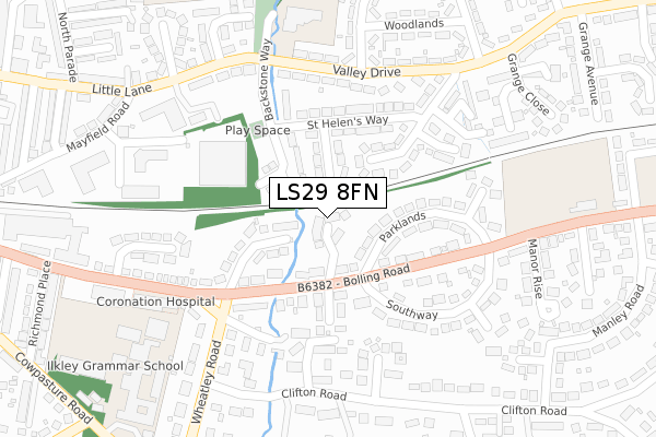
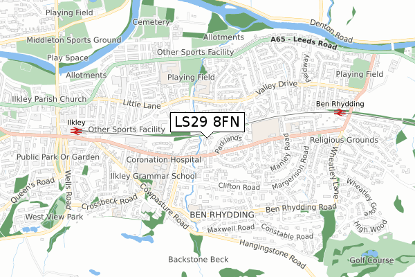
LS29 8FN is located in the Ilkley electoral ward, within the metropolitan district of Bradford and the English Parliamentary constituency of Keighley. The Sub Integrated Care Board (ICB) Location is NHS West Yorkshire ICB - 36J and the police force is West Yorkshire. This postcode has been in use since April 2019.


GetTheData
Source: OS Open Zoomstack (Ordnance Survey)
Licence: Open Government Licence (requires attribution)
Attribution: Contains OS data © Crown copyright and database right 2025
Source: Open Postcode Geo
Licence: Open Government Licence (requires attribution)
Attribution: Contains OS data © Crown copyright and database right 2025; Contains Royal Mail data © Royal Mail copyright and database right 2025; Source: Office for National Statistics licensed under the Open Government Licence v.3.0
| Easting | 412596 |
| Northing | 447596 |
| Latitude | 53.924363 |
| Longitude | -1.809683 |
GetTheData
Source: Open Postcode Geo
Licence: Open Government Licence
| Country | England |
| Postcode District | LS29 |
➜ See where LS29 is on a map ➜ Where is Ilkley? | |
GetTheData
Source: Land Registry Price Paid Data
Licence: Open Government Licence
| Ward | Ilkley |
| Constituency | Keighley |
GetTheData
Source: ONS Postcode Database
Licence: Open Government Licence
2024 19 JAN £862,500 |
2023 3 MAR £828,000 |
2021 26 AUG £699,950 |
5, THE HEATHERS, ILKLEY, LS29 8FN 2021 28 JUN £712,500 |
2021 15 APR £724,500 |
15, THE HEATHERS, ILKLEY, LS29 8FN 2021 17 FEB £745,000 |
7, THE HEATHERS, ILKLEY, LS29 8FN 2021 5 FEB £696,500 |
2020 28 AUG £637,500 |
11, THE HEATHERS, ILKLEY, LS29 8FN 2020 26 AUG £638,500 |
4, THE HEATHERS, ILKLEY, LS29 8FN 2020 29 MAY £680,000 |
GetTheData
Source: HM Land Registry Price Paid Data
Licence: Contains HM Land Registry data © Crown copyright and database right 2025. This data is licensed under the Open Government Licence v3.0.
| Bolling Road Marlborough Grove (Bolling Road) | Ben Rhydding | 98m |
| Bolling Road Marlborough Grove (Bolling Road) | Ben Rhydding | 106m |
| Bolling Road Southway (Bolling Road) | Ben Rhydding | 185m |
| Springs Lane Wheatley Rd (Springs Lane) | Ilkley | 204m |
| Springs Lane Wheatley Rd (Springs Lane) | Ilkley | 210m |
| Ilkley Station | 0.8km |
| Ben Rhydding Station | 0.8km |
| Burley-in-Wharfedale Station | 4.1km |
GetTheData
Source: NaPTAN
Licence: Open Government Licence
GetTheData
Source: ONS Postcode Database
Licence: Open Government Licence


➜ Get more ratings from the Food Standards Agency
GetTheData
Source: Food Standards Agency
Licence: FSA terms & conditions
| Last Collection | |||
|---|---|---|---|
| Location | Mon-Fri | Sat | Distance |
| Mayfield Road/Railway Road | 17:45 | 11:45 | 412m |
| In Wall Of 13 Wheatley Lane | 18:00 | 11:30 | 449m |
| Leeds Road P.o. | 17:45 | 12:00 | 554m |
GetTheData
Source: Dracos
Licence: Creative Commons Attribution-ShareAlike
The below table lists the International Territorial Level (ITL) codes (formerly Nomenclature of Territorial Units for Statistics (NUTS) codes) and Local Administrative Units (LAU) codes for LS29 8FN:
| ITL 1 Code | Name |
|---|---|
| TLE | Yorkshire and The Humber |
| ITL 2 Code | Name |
| TLE4 | West Yorkshire |
| ITL 3 Code | Name |
| TLE41 | Bradford |
| LAU 1 Code | Name |
| E08000032 | Bradford |
GetTheData
Source: ONS Postcode Directory
Licence: Open Government Licence
The below table lists the Census Output Area (OA), Lower Layer Super Output Area (LSOA), and Middle Layer Super Output Area (MSOA) for LS29 8FN:
| Code | Name | |
|---|---|---|
| OA | E00053972 | |
| LSOA | E01010696 | Bradford 002E |
| MSOA | E02002184 | Bradford 002 |
GetTheData
Source: ONS Postcode Directory
Licence: Open Government Licence
| LS29 8QA | Bolling Road | 82m |
| LS29 8NR | St Pauls Grove | 89m |
| LS29 8QB | Wharfedale Drive | 117m |
| LS29 8QD | Bolling Road | 122m |
| LS29 8NJ | Backstone Way | 130m |
| LS29 8QE | Marlborough Grove | 144m |
| LS29 8QF | Parklands | 149m |
| LS29 8NP | St Helens Way | 172m |
| LS29 8NW | Grange Estate | 179m |
| LS29 8TX | Briarfield Close | 211m |
GetTheData
Source: Open Postcode Geo; Land Registry Price Paid Data
Licence: Open Government Licence