Property/Postcode Data Search:
LS27 0GE maps, stats, and open data
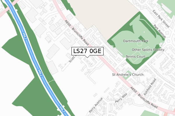
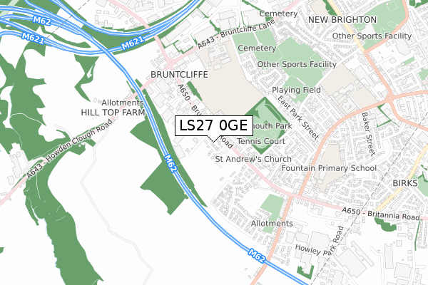
LS27 0GE is located in the Morley South electoral ward, within the metropolitan district of Leeds and the English Parliamentary constituency of Morley and Outwood. The Sub Integrated Care Board (ICB) Location is NHS West Yorkshire ICB - 15F and the police force is West Yorkshire. This postcode has been in use since December 2019.
LS27 0GE maps


Source: OS Open Zoomstack (Ordnance Survey)
Licence: Open Government Licence (requires attribution)
Attribution: Contains OS data © Crown copyright and database right 2025
Source: Open Postcode Geo
Licence: Open Government Licence (requires attribution)
Attribution: Contains OS data © Crown copyright and database right 2025; Contains Royal Mail data © Royal Mail copyright and database right 2025; Source: Office for National Statistics licensed under the Open Government Licence v.3.0
Licence: Open Government Licence (requires attribution)
Attribution: Contains OS data © Crown copyright and database right 2025
Source: Open Postcode Geo
Licence: Open Government Licence (requires attribution)
Attribution: Contains OS data © Crown copyright and database right 2025; Contains Royal Mail data © Royal Mail copyright and database right 2025; Source: Office for National Statistics licensed under the Open Government Licence v.3.0
LS27 0GE geodata
| Easting | 425168 |
| Northing | 427181 |
| Latitude | 53.740424 |
| Longitude | -1.619909 |
Where is LS27 0GE?
| Country | England |
| Postcode District | LS27 |
Politics
| Ward | Morley South |
|---|---|
| Constituency | Morley And Outwood |
House Prices
Sales of detached houses in LS27 0GE
4, CARSON GROVE, MORLEY, LEEDS, LS27 0GE 2020 28 FEB £284,995 |
12, CARSON GROVE, MORLEY, LEEDS, LS27 0GE 2020 31 JAN £284,995 |
2, CARSON GROVE, MORLEY, LEEDS, LS27 0GE 2019 19 DEC £293,995 |
Source: HM Land Registry Price Paid Data
Licence: Contains HM Land Registry data © Crown copyright and database right 2025. This data is licensed under the Open Government Licence v3.0.
Licence: Contains HM Land Registry data © Crown copyright and database right 2025. This data is licensed under the Open Government Licence v3.0.
Transport
Nearest bus stops to LS27 0GE
| Parkland Avenue (Bruntcliffe Road) | Morley | 69m |
| Parkland Avenue (Bruntcliffe Road) | Morley | 80m |
| Bruntcliffe Road Lewisham St (Bruntcliffe Road) | Morley | 222m |
| Bruntcliffe Road St Andrews Ave (Bruntcliffe Road) | Morley | 296m |
| Bruntcliffe Cross Roads (Bruntcliffe Road) | Morley | 415m |
Nearest railway stations to LS27 0GE
| Morley Station | 2.2km |
| Batley Station | 3.4km |
| Cottingley Station | 3.7km |
Deprivation
52.1% of English postcodes are less deprived than LS27 0GE:Food Standards Agency
Three nearest food hygiene ratings to LS27 0GE (metres)
The Old Vicarage Hotel

Bruntcliffe Road
177m
Sibu
Shell Victoria Service Station
184m
Morley Masonic Club

Bruntcliffe Road
354m
➜ Get more ratings from the Food Standards Agency
Nearest post box to LS27 0GE
| Last Collection | |||
|---|---|---|---|
| Location | Mon-Fri | Sat | Distance |
| Howden Clough Road | 18:15 | 12:00 | 500m |
| Scotchman Lane Top | 17:30 | 11:45 | 607m |
| Bruntcliffe Lane | 18:30 | 648m | |
LS27 0GE ITL and LS27 0GE LAU
The below table lists the International Territorial Level (ITL) codes (formerly Nomenclature of Territorial Units for Statistics (NUTS) codes) and Local Administrative Units (LAU) codes for LS27 0GE:
| ITL 1 Code | Name |
|---|---|
| TLE | Yorkshire and The Humber |
| ITL 2 Code | Name |
| TLE4 | West Yorkshire |
| ITL 3 Code | Name |
| TLE42 | Leeds |
| LAU 1 Code | Name |
| E08000035 | Leeds |
LS27 0GE census areas
The below table lists the Census Output Area (OA), Lower Layer Super Output Area (LSOA), and Middle Layer Super Output Area (MSOA) for LS27 0GE:
| Code | Name | |
|---|---|---|
| OA | E00058089 | |
| LSOA | E01011534 | Leeds 106B |
| MSOA | E02002435 | Leeds 106 |
Nearest postcodes to LS27 0GE
| LS27 0JZ | Bruntcliffe Road | 96m |
| LS27 0LG | Meadowbrook Court | 145m |
| LS27 0LB | Parkland Avenue | 160m |
| LS27 0LA | Lewisham Street | 178m |
| LS27 0LQ | Bruntcliffe Road | 249m |
| LS27 0FF | Guppy Walk | 253m |
| LS27 0JY | St Andrews Close | 325m |
| LS27 0JU | St Andrews Avenue | 331m |
| LS27 0FA | Perry Way | 334m |
| LS27 0FB | Perry Walk | 338m |