Property/Postcode Data Search:
LS26 9FE maps, stats, and open data
LS26 9FE is located in the Kippax & Methley electoral ward, within the metropolitan district of Leeds and the English Parliamentary constituency of Elmet and Rothwell. The Sub Integrated Care Board (ICB) Location is NHS West Yorkshire ICB - 15F and the police force is West Yorkshire. This postcode has been in use since April 2020.
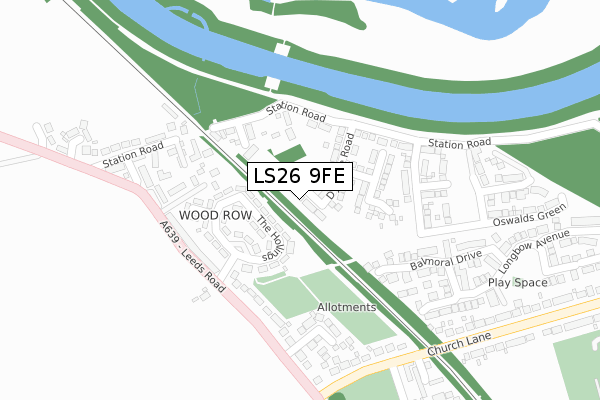
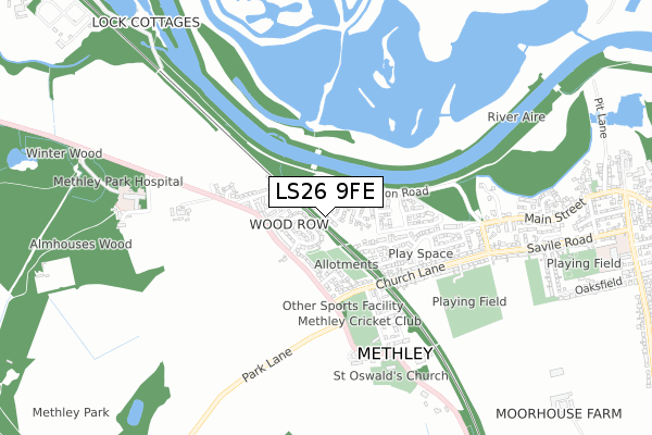
LS26 9FE maps


Source: OS Open Zoomstack (Ordnance Survey)
Licence: Open Government Licence (requires attribution)
Attribution: Contains OS data © Crown copyright and database right 2025
Source: Open Postcode Geo
Licence: Open Government Licence (requires attribution)
Attribution: Contains OS data © Crown copyright and database right 2025; Contains Royal Mail data © Royal Mail copyright and database right 2025; Source: Office for National Statistics licensed under the Open Government Licence v.3.0
Licence: Open Government Licence (requires attribution)
Attribution: Contains OS data © Crown copyright and database right 2025
Source: Open Postcode Geo
Licence: Open Government Licence (requires attribution)
Attribution: Contains OS data © Crown copyright and database right 2025; Contains Royal Mail data © Royal Mail copyright and database right 2025; Source: Office for National Statistics licensed under the Open Government Licence v.3.0
LS26 9FE geodata
| Easting | 438874 |
| Northing | 427185 |
| Latitude | 53.739623 |
| Longitude | -1.412121 |
Where is LS26 9FE?
| Country | England |
| Postcode District | LS26 |
Politics
| Ward | Kippax & Methley |
|---|---|
| Constituency | Elmet And Rothwell |
House Prices
Sales of detached houses in LS26 9FE
35, WELLES AVENUE, METHLEY, LEEDS, LS26 9FE 2021 11 MAR £264,995 |
49, WELLES AVENUE, METHLEY, LEEDS, LS26 9FE 2020 26 OCT £315,995 |
53, WELLES AVENUE, METHLEY, LEEDS, LS26 9FE 2020 12 JUN £359,995 |
61, WELLES AVENUE, METHLEY, LEEDS, LS26 9FE 2020 27 MAR £294,995 |
51, WELLES AVENUE, METHLEY, LEEDS, LS26 9FE 2020 13 MAR £372,995 |
Source: HM Land Registry Price Paid Data
Licence: Contains HM Land Registry data © Crown copyright and database right 2025. This data is licensed under the Open Government Licence v3.0.
Licence: Contains HM Land Registry data © Crown copyright and database right 2025. This data is licensed under the Open Government Licence v3.0.
Transport
Nearest bus stops to LS26 9FE
| Leeds Road Wood Row (Leeds Road) | Methley | 220m |
| Leeds Road Wood Row (Leeds Road) | Methley | 240m |
| Church Lane Little Church Ln (Church Lane) | Methley | 286m |
| Church Lane Little Church Ln (Church Lane) | Methley | 298m |
| Leeds Rd Church Lane (Leeds Road) | Methley | 306m |
Nearest railway stations to LS26 9FE
| Woodlesford Station | 2.8km |
| Castleford Station | 4.2km |
| Normanton Station | 4.4km |
Deprivation
32.4% of English postcodes are less deprived than LS26 9FE:Food Standards Agency
Three nearest food hygiene ratings to LS26 9FE (metres)
The Green House

Shann Hall
121m
Rivers Meet

102 Leeds Road
278m
Methley Cricket Club

Little Church Lane
387m
➜ Get more ratings from the Food Standards Agency
Nearest post box to LS26 9FE
| Last Collection | |||
|---|---|---|---|
| Location | Mon-Fri | Sat | Distance |
| Station Road | 17:00 | 11:30 | 247m |
| Opp Bowling Green Church Side | 17:00 | 11:15 | 559m |
| 86 Mickletown Road | 17:00 | 11:15 | 621m |
LS26 9FE ITL and LS26 9FE LAU
The below table lists the International Territorial Level (ITL) codes (formerly Nomenclature of Territorial Units for Statistics (NUTS) codes) and Local Administrative Units (LAU) codes for LS26 9FE:
| ITL 1 Code | Name |
|---|---|
| TLE | Yorkshire and The Humber |
| ITL 2 Code | Name |
| TLE4 | West Yorkshire |
| ITL 3 Code | Name |
| TLE42 | Leeds |
| LAU 1 Code | Name |
| E08000035 | Leeds |
LS26 9FE census areas
The below table lists the Census Output Area (OA), Lower Layer Super Output Area (LSOA), and Middle Layer Super Output Area (MSOA) for LS26 9FE:
| Code | Name | |
|---|---|---|
| OA | E00057427 | |
| LSOA | E01011393 | Leeds 103C |
| MSOA | E02002432 | Leeds 103 |
Nearest postcodes to LS26 9FE
| LS26 9EJ | The Hollings | 124m |
| LS26 9EW | Wood Row | 167m |
| LS26 9EQ | Leeds Road | 189m |
| LS26 9EL | Leeds Road | 209m |
| LS26 9EA | Station Road | 217m |
| LS26 9EN | Albert Place | 219m |
| LS26 9EB | Mulberry Gardens | 221m |
| LS26 9LE | Balmoral Drive | 221m |
| LS26 9ES | Claytons Close | 229m |
| LS26 9LF | Parsley Mews | 254m |