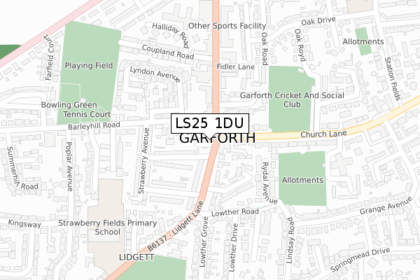
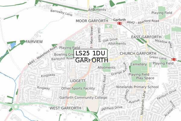
LS25 1DU lies on Main Street in Garforth, Leeds. LS25 1DU is located in the Garforth & Swillington electoral ward, within the metropolitan district of Leeds and the English Parliamentary constituency of Elmet and Rothwell. The Sub Integrated Care Board (ICB) Location is NHS West Yorkshire ICB - 15F and the police force is West Yorkshire. This postcode has been in use since October 2018.


GetTheData
Source: OS Open Zoomstack (Ordnance Survey)
Licence: Open Government Licence (requires attribution)
Attribution: Contains OS data © Crown copyright and database right 2025
Source: Open Postcode Geo
Licence: Open Government Licence (requires attribution)
Attribution: Contains OS data © Crown copyright and database right 2025; Contains Royal Mail data © Royal Mail copyright and database right 2025; Source: Office for National Statistics licensed under the Open Government Licence v.3.0
| Easting | 440376 |
| Northing | 433035 |
| Latitude | 53.792086 |
| Longitude | -1.388588 |
GetTheData
Source: Open Postcode Geo
Licence: Open Government Licence
| Street | Main Street |
| Locality | Garforth |
| Town/City | Leeds |
| Country | England |
| Postcode District | LS25 |
➜ See where LS25 is on a map ➜ Where is Garforth? | |
GetTheData
Source: Land Registry Price Paid Data
Licence: Open Government Licence
| Ward | Garforth & Swillington |
| Constituency | Elmet And Rothwell |
GetTheData
Source: ONS Postcode Database
Licence: Open Government Licence
| Barleyhill Road Lyndon Ave (Barleyhill Road) | Garforth | 66m |
| Lidgett Lane Beech Grove Ter (Lidgett Lane) | Garforth | 80m |
| Barleyhill Road Lyndon Ave (Barleyhill Road) | Garforth | 82m |
| Main St Fidler Lane (Main Street) | Garforth | 102m |
| Cricket Ground Church Lane (Church Lane) | Garforth | 110m |
| Garforth Station | 0.6km |
| East Garforth Station | 1.2km |
| Micklefield Station | 4.1km |
GetTheData
Source: NaPTAN
Licence: Open Government Licence
GetTheData
Source: ONS Postcode Database
Licence: Open Government Licence


➜ Get more ratings from the Food Standards Agency
GetTheData
Source: Food Standards Agency
Licence: FSA terms & conditions
| Last Collection | |||
|---|---|---|---|
| Location | Mon-Fri | Sat | Distance |
| By Police Station Lidgett Lane | 18:00 | 10:15 | 17m |
| Garforth P.o. | 18:00 | 11:30 | 143m |
| Church Lane/Grange Avenue | 17:45 | 10:00 | 445m |
GetTheData
Source: Dracos
Licence: Creative Commons Attribution-ShareAlike
The below table lists the International Territorial Level (ITL) codes (formerly Nomenclature of Territorial Units for Statistics (NUTS) codes) and Local Administrative Units (LAU) codes for LS25 1DU:
| ITL 1 Code | Name |
|---|---|
| TLE | Yorkshire and The Humber |
| ITL 2 Code | Name |
| TLE4 | West Yorkshire |
| ITL 3 Code | Name |
| TLE42 | Leeds |
| LAU 1 Code | Name |
| E08000035 | Leeds |
GetTheData
Source: ONS Postcode Directory
Licence: Open Government Licence
The below table lists the Census Output Area (OA), Lower Layer Super Output Area (LSOA), and Middle Layer Super Output Area (MSOA) for LS25 1DU:
| Code | Name | |
|---|---|---|
| OA | E00057444 | |
| LSOA | E01011396 | Leeds 074A |
| MSOA | E02002403 | Leeds 074 |
GetTheData
Source: ONS Postcode Directory
Licence: Open Government Licence
| LS25 1DW | Barley Hill Lane | 27m |
| LS25 1HB | Church Lane | 79m |
| LS25 1JH | Mortimer Close | 86m |
| LS25 1EH | Lidgett Lane | 90m |
| LS25 1DS | Main Street | 91m |
| LS25 1QN | St Josephs Court | 93m |
| LS25 1EQ | Lidgett Lane | 101m |
| LS25 1EF | Beech Grove Avenue | 108m |
| LS25 1EJ | Moorland Terrace | 110m |
| LS25 1EZ | Main Street | 129m |
GetTheData
Source: Open Postcode Geo; Land Registry Price Paid Data
Licence: Open Government Licence