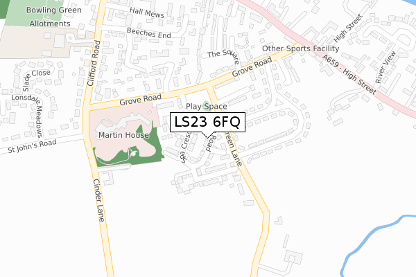
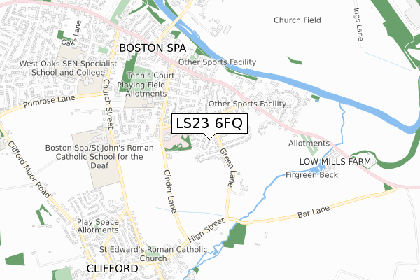
LS23 6FQ maps, stats, and open data
LS23 6FQ is located in the Wetherby electoral ward, within the metropolitan district of Leeds and the English Parliamentary constituency of Elmet and Rothwell. The Sub Integrated Care Board (ICB) Location is NHS West Yorkshire ICB - 15F and the police force is West Yorkshire. This postcode has been in use since March 2018.
LS23 6FQ maps


Licence: Open Government Licence (requires attribution)
Attribution: Contains OS data © Crown copyright and database right 2025
Source: Open Postcode Geo
Licence: Open Government Licence (requires attribution)
Attribution: Contains OS data © Crown copyright and database right 2025; Contains Royal Mail data © Royal Mail copyright and database right 2025; Source: Office for National Statistics licensed under the Open Government Licence v.3.0
LS23 6FQ geodata
| Easting | 443395 |
| Northing | 445041 |
| Latitude | 53.899746 |
| Longitude | -1.341073 |
Where is LS23 6FQ?
| Country | England |
| Postcode District | LS23 |
Politics
| Ward | Wetherby |
|---|---|
| Constituency | Elmet And Rothwell |
Transport
Nearest bus stops to LS23 6FQ
| Grove Rd Green Lane (Grove Road) | Boston Spa | 122m |
| Grove Rd Green Lane (Grove Road) | Boston Spa | 128m |
| Grove Rd Cinder Lane (Grove Road) | Boston Spa | 237m |
| Grove Rd Cinder Lane (Grove Road) | Boston Spa | 240m |
| High Street Grove Rd (High Street) | Boston Spa | 318m |
Broadband
Broadband access in LS23 6FQ (2020 data)
| Percentage of properties with Next Generation Access | 100.0% |
| Percentage of properties with Superfast Broadband | 100.0% |
| Percentage of properties with Ultrafast Broadband | 100.0% |
| Percentage of properties with Full Fibre Broadband | 100.0% |
Superfast Broadband is between 30Mbps and 300Mbps
Ultrafast Broadband is > 300Mbps
Broadband speed in LS23 6FQ (2019 data)
Download
| Median download speed | 100.0Mbps |
| Average download speed | 125.0Mbps |
| Maximum download speed | 350.00Mbps |
Upload
Ofcom does not currently provide upload speed data for LS23 6FQ. This is because there are less than four broadband connections in this postcode.
Broadband limitations in LS23 6FQ (2020 data)
| Percentage of properties unable to receive 2Mbps | 0.0% |
| Percentage of properties unable to receive 5Mbps | 0.0% |
| Percentage of properties unable to receive 10Mbps | 0.0% |
| Percentage of properties unable to receive 30Mbps | 0.0% |
Deprivation
5.7% of English postcodes are less deprived than LS23 6FQ:Food Standards Agency
Three nearest food hygiene ratings to LS23 6FQ (metres)


➜ Get more ratings from the Food Standards Agency
Nearest post box to LS23 6FQ
| Last Collection | |||
|---|---|---|---|
| Location | Mon-Fri | Sat | Distance |
| Boston Spa P.o. | 17:30 | 12:00 | 539m |
| Heath Drive | 17:00 | 08:45 | 1,489m |
| West End/West End Dale | 16:00 | 09:00 | 1,765m |
LS23 6FQ ITL and LS23 6FQ LAU
The below table lists the International Territorial Level (ITL) codes (formerly Nomenclature of Territorial Units for Statistics (NUTS) codes) and Local Administrative Units (LAU) codes for LS23 6FQ:
| ITL 1 Code | Name |
|---|---|
| TLE | Yorkshire and The Humber |
| ITL 2 Code | Name |
| TLE4 | West Yorkshire |
| ITL 3 Code | Name |
| TLE42 | Leeds |
| LAU 1 Code | Name |
| E08000035 | Leeds |
LS23 6FQ census areas
The below table lists the Census Output Area (OA), Lower Layer Super Output Area (LSOA), and Middle Layer Super Output Area (MSOA) for LS23 6FQ:
| Code | Name | |
|---|---|---|
| OA | E00058990 | |
| LSOA | E01011709 | Leeds 005B |
| MSOA | E02002334 | Leeds 005 |
Nearest postcodes to LS23 6FQ
| LS23 6SU | Green Lea Close | 133m |
| LS23 6AZ | Green Lane | 144m |
| LS23 6JE | Boston Mews | 149m |
| LS23 6AY | Grove Crescent South | 160m |
| LS23 6AX | Grove Crescent | 165m |
| LS23 6AR | The Grove | 186m |
| LS23 6JG | Chestnut End | 194m |
| LS23 6AS | Grove Terrace | 195m |
| LS23 6AP | Grove Road | 199m |
| LS23 6AU | The Square | 219m |