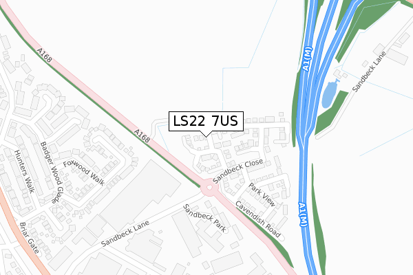
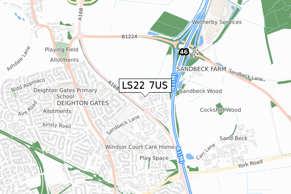
LS22 7US is located in the Wetherby electoral ward, within the metropolitan district of Leeds and the English Parliamentary constituency of Elmet and Rothwell. The Sub Integrated Care Board (ICB) Location is NHS West Yorkshire ICB - 15F and the police force is West Yorkshire. This postcode has been in use since October 2017.


GetTheData
Source: OS Open Zoomstack (Ordnance Survey)
Licence: Open Government Licence (requires attribution)
Attribution: Contains OS data © Crown copyright and database right 2025
Source: Open Postcode Geo
Licence: Open Government Licence (requires attribution)
Attribution: Contains OS data © Crown copyright and database right 2025; Contains Royal Mail data © Royal Mail copyright and database right 2025; Source: Office for National Statistics licensed under the Open Government Licence v.3.0
| Easting | 440850 |
| Northing | 449525 |
| Latitude | 53.940250 |
| Longitude | -1.379206 |
GetTheData
Source: Open Postcode Geo
Licence: Open Government Licence
| Country | England |
| Postcode District | LS22 |
➜ See where LS22 is on a map ➜ Where is Wetherby? | |
GetTheData
Source: Land Registry Price Paid Data
Licence: Open Government Licence
| Ward | Wetherby |
| Constituency | Elmet And Rothwell |
GetTheData
Source: ONS Postcode Database
Licence: Open Government Licence
2023 25 AUG £475,000 |
2023 25 AUG £490,000 |
2021 11 JUN £375,000 |
4, FIELD VIEW, WETHERBY, LS22 7US 2019 14 JUN £399,995 |
8, FIELD VIEW, WETHERBY, LS22 7US 2019 7 JUN £399,995 |
2019 10 MAY £399,995 |
12, CASTLE GROVE, WETHERBY, LS22 7US 2019 29 MAR £414,995 |
7, FIELD VIEW, WETHERBY, LS22 7US 2019 22 FEB £434,995 |
2018 21 DEC £409,995 |
1, FIELD VIEW, WETHERBY, LS22 7US 2018 21 DEC £429,995 |
GetTheData
Source: HM Land Registry Price Paid Data
Licence: Contains HM Land Registry data © Crown copyright and database right 2025. This data is licensed under the Open Government Licence v3.0.
| Sandbeck Way | Wetherby | 347m |
| Sandbeck Way (Audby Lane) | Wetherby | 484m |
| Sandbeck Way (Audby Lane) | Wetherby | 505m |
| Deighton Rd Sandbeck Lane (Deighton Road) | Wetherby | 507m |
| Deighton Rd Sandbeck Lane (Deighton Road) | Wetherby | 520m |
GetTheData
Source: NaPTAN
Licence: Open Government Licence
| Percentage of properties with Next Generation Access | 100.0% |
| Percentage of properties with Superfast Broadband | 100.0% |
| Percentage of properties with Ultrafast Broadband | 100.0% |
| Percentage of properties with Full Fibre Broadband | 100.0% |
Superfast Broadband is between 30Mbps and 300Mbps
Ultrafast Broadband is > 300Mbps
| Percentage of properties unable to receive 2Mbps | 0.0% |
| Percentage of properties unable to receive 5Mbps | 0.0% |
| Percentage of properties unable to receive 10Mbps | 0.0% |
| Percentage of properties unable to receive 30Mbps | 0.0% |
GetTheData
Source: Ofcom
Licence: Ofcom Terms of Use (requires attribution)
GetTheData
Source: ONS Postcode Database
Licence: Open Government Licence

➜ Get more ratings from the Food Standards Agency
GetTheData
Source: Food Standards Agency
Licence: FSA terms & conditions
| Last Collection | |||
|---|---|---|---|
| Location | Mon-Fri | Sat | Distance |
| Sandbeck Way | 17:30 | 12:00 | 392m |
| Deighton Gates | 17:30 | 12:00 | 551m |
| 47 Ainsty Road Wetherby | 17:30 | 12:30 | 613m |
GetTheData
Source: Dracos
Licence: Creative Commons Attribution-ShareAlike
The below table lists the International Territorial Level (ITL) codes (formerly Nomenclature of Territorial Units for Statistics (NUTS) codes) and Local Administrative Units (LAU) codes for LS22 7US:
| ITL 1 Code | Name |
|---|---|
| TLE | Yorkshire and The Humber |
| ITL 2 Code | Name |
| TLE4 | West Yorkshire |
| ITL 3 Code | Name |
| TLE42 | Leeds |
| LAU 1 Code | Name |
| E08000035 | Leeds |
GetTheData
Source: ONS Postcode Directory
Licence: Open Government Licence
The below table lists the Census Output Area (OA), Lower Layer Super Output Area (LSOA), and Middle Layer Super Output Area (MSOA) for LS22 7US:
| Code | Name | |
|---|---|---|
| OA | E00170579 | |
| LSOA | E01011704 | Leeds 002C |
| MSOA | E02002331 | Leeds 002 |
GetTheData
Source: ONS Postcode Directory
Licence: Open Government Licence
| LS22 7TW | Sandbeck Lane | 213m |
| LS22 7XT | Otterwood Bank | 269m |
| LS22 7XP | Beech Spinney | 314m |
| LS22 7XS | Foxwood Walk | 332m |
| LS22 7XW | Cedar Covert | 386m |
| LS22 7XR | Badgerwood Glade | 402m |
| LS22 7DN | Sandbeck Way | 407m |
| LS22 7XX | Hunters Walk | 433m |
| LS22 7XU | Pine Close | 440m |
| LS22 7TJ | Knights Croft | 469m |
GetTheData
Source: Open Postcode Geo; Land Registry Price Paid Data
Licence: Open Government Licence