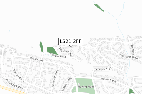
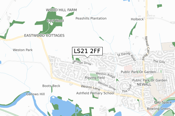
LS21 2FF is located in the Otley & Yeadon electoral ward, within the metropolitan district of Leeds and the English Parliamentary constituency of Leeds North West. The Sub Integrated Care Board (ICB) Location is NHS West Yorkshire ICB - 15F and the police force is West Yorkshire. This postcode has been in use since June 2019.


GetTheData
Source: OS Open Zoomstack (Ordnance Survey)
Licence: Open Government Licence (requires attribution)
Attribution: Contains OS data © Crown copyright and database right 2025
Source: Open Postcode Geo
Licence: Open Government Licence (requires attribution)
Attribution: Contains OS data © Crown copyright and database right 2025; Contains Royal Mail data © Royal Mail copyright and database right 2025; Source: Office for National Statistics licensed under the Open Government Licence v.3.0
| Easting | 419172 |
| Northing | 446734 |
| Latitude | 53.916416 |
| Longitude | -1.709602 |
GetTheData
Source: Open Postcode Geo
Licence: Open Government Licence
| Country | England |
| Postcode District | LS21 |
➜ See where LS21 is on a map ➜ Where is Otley? | |
GetTheData
Source: Land Registry Price Paid Data
Licence: Open Government Licence
| Ward | Otley & Yeadon |
| Constituency | Leeds North West |
GetTheData
Source: ONS Postcode Database
Licence: Open Government Licence
23, WHARFE MEADOW AVENUE, OTLEY, LS21 2FF 2025 17 JAN £313,625 |
23, WHARFE MEADOW AVENUE, OTLEY, LS21 2FF 2025 17 JAN £482,500 |
2022 23 JUN £460,000 |
2021 19 AUG £470,000 |
2021 30 JUN £445,000 |
31, WHARFE MEADOW AVENUE, OTLEY, LS21 2FF 2021 23 MAR £445,000 |
26, WHARFE MEADOW AVENUE, OTLEY, LS21 2FF 2021 26 FEB £460,000 |
14, WHARFE MEADOW AVENUE, OTLEY, LS21 2FF 2021 20 JAN £415,000 |
41, WHARFE MEADOW AVENUE, OTLEY, LS21 2FF 2021 7 JAN £445,000 |
33, WHARFE MEADOW AVENUE, OTLEY, LS21 2FF 2020 4 DEC £441,000 |
GetTheData
Source: HM Land Registry Price Paid Data
Licence: Contains HM Land Registry data © Crown copyright and database right 2025. This data is licensed under the Open Government Licence v3.0.
| Meagill Rise Northwell Gate (Meagill Rise) | Newall | 158m |
| Meagill Rise Weston Drive (Meagill Rise) | Newall | 293m |
| Weston Dr Birkeston Way (Weston Drive) | Newall | 352m |
| Meagill Rise Rombalds View (Meagill Rise) | Newall | 391m |
| Weston Drive Ridding Gate (Weston Drive) | Newall | 421m |
| Burley-in-Wharfedale Station | 3km |
| Menston Station | 3.2km |
| Guiseley Station | 4.5km |
GetTheData
Source: NaPTAN
Licence: Open Government Licence
| Percentage of properties with Next Generation Access | 100.0% |
| Percentage of properties with Superfast Broadband | 100.0% |
| Percentage of properties with Ultrafast Broadband | 100.0% |
| Percentage of properties with Full Fibre Broadband | 100.0% |
Superfast Broadband is between 30Mbps and 300Mbps
Ultrafast Broadband is > 300Mbps
| Percentage of properties unable to receive 2Mbps | 0.0% |
| Percentage of properties unable to receive 5Mbps | 0.0% |
| Percentage of properties unable to receive 10Mbps | 0.0% |
| Percentage of properties unable to receive 30Mbps | 0.0% |
GetTheData
Source: Ofcom
Licence: Ofcom Terms of Use (requires attribution)
GetTheData
Source: ONS Postcode Database
Licence: Open Government Licence


➜ Get more ratings from the Food Standards Agency
GetTheData
Source: Food Standards Agency
Licence: FSA terms & conditions
| Last Collection | |||
|---|---|---|---|
| Location | Mon-Fri | Sat | Distance |
| 76 Weston Drive | 17:15 | 11:30 | 320m |
| Wilkinson Way | 17:15 | 11:30 | 460m |
| Bottomof Carr Bank/Street | 17:30 | 09:30 | 793m |
GetTheData
Source: Dracos
Licence: Creative Commons Attribution-ShareAlike
The below table lists the International Territorial Level (ITL) codes (formerly Nomenclature of Territorial Units for Statistics (NUTS) codes) and Local Administrative Units (LAU) codes for LS21 2FF:
| ITL 1 Code | Name |
|---|---|
| TLE | Yorkshire and The Humber |
| ITL 2 Code | Name |
| TLE4 | West Yorkshire |
| ITL 3 Code | Name |
| TLE42 | Leeds |
| LAU 1 Code | Name |
| E08000035 | Leeds |
GetTheData
Source: ONS Postcode Directory
Licence: Open Government Licence
The below table lists the Census Output Area (OA), Lower Layer Super Output Area (LSOA), and Middle Layer Super Output Area (MSOA) for LS21 2FF:
| Code | Name | |
|---|---|---|
| OA | E00058339 | |
| LSOA | E01011581 | Leeds 003A |
| MSOA | E02002332 | Leeds 003 |
GetTheData
Source: ONS Postcode Directory
Licence: Open Government Licence
| LS21 2EQ | Meagill Rise | 148m |
| LS21 2EJ | Meagill Rise | 196m |
| LS21 2RQ | St Davids Road | 227m |
| LS21 2DN | Northwell Gate | 240m |
| LS21 2DL | Northwell Gate | 241m |
| LS21 2DH | Bickerton Way | 255m |
| LS21 2RE | Rumplecroft | 259m |
| LS21 2DW | Hollin Gate | 281m |
| LS21 2EF | Weston Ridge | 286m |
| LS21 2DP | Hollin Gate | 294m |
GetTheData
Source: Open Postcode Geo; Land Registry Price Paid Data
Licence: Open Government Licence