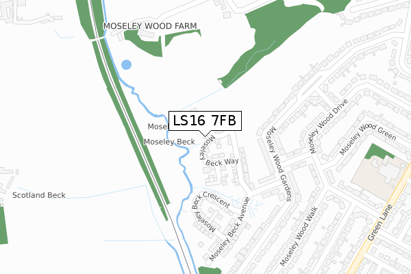
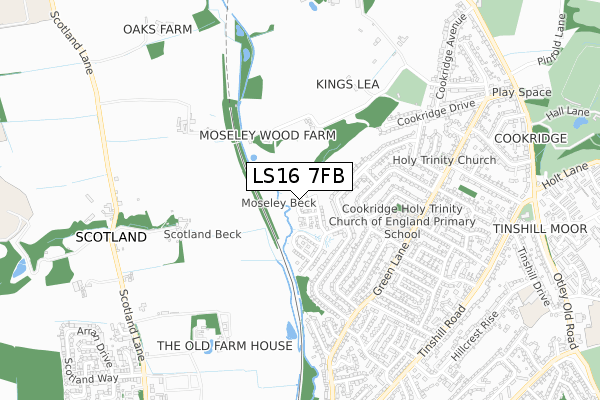
LS16 7FB is located in the Adel & Wharfedale electoral ward, within the metropolitan district of Leeds and the English Parliamentary constituency of Leeds North West. The Sub Integrated Care Board (ICB) Location is NHS West Yorkshire ICB - 15F and the police force is West Yorkshire. This postcode has been in use since December 2019.


GetTheData
Source: OS Open Zoomstack (Ordnance Survey)
Licence: Open Government Licence (requires attribution)
Attribution: Contains OS data © Crown copyright and database right 2025
Source: Open Postcode Geo
Licence: Open Government Licence (requires attribution)
Attribution: Contains OS data © Crown copyright and database right 2025; Contains Royal Mail data © Royal Mail copyright and database right 2025; Source: Office for National Statistics licensed under the Open Government Licence v.3.0
| Easting | 424425 |
| Northing | 440412 |
| Latitude | 53.859376 |
| Longitude | -1.630130 |
GetTheData
Source: Open Postcode Geo
Licence: Open Government Licence
| Country | England |
| Postcode District | LS16 |
➜ See where LS16 is on a map ➜ Where is Leeds? | |
GetTheData
Source: Land Registry Price Paid Data
Licence: Open Government Licence
| Ward | Adel & Wharfedale |
| Constituency | Leeds North West |
GetTheData
Source: ONS Postcode Database
Licence: Open Government Licence
2025 23 JAN £505,000 |
2024 23 AUG £517,500 |
2024 27 JUN £517,000 |
6, MOSELEY BECK DRIVE, LEEDS, LS16 7FB 2021 28 MAY £426,545 |
2021 23 APR £448,995 |
10, MOSELEY BECK DRIVE, LEEDS, LS16 7FB 2021 26 MAR £454,995 |
11, MOSELEY BECK DRIVE, LEEDS, LS16 7FB 2020 14 SEP £409,995 |
9, MOSELEY BECK DRIVE, LEEDS, LS16 7FB 2020 11 SEP £448,995 |
17, MOSELEY BECK DRIVE, LEEDS, LS16 7FB 2020 10 SEP £414,995 |
15, MOSELEY BECK DRIVE, LEEDS, LS16 7FB 2020 28 AUG £448,995 |
GetTheData
Source: HM Land Registry Price Paid Data
Licence: Contains HM Land Registry data © Crown copyright and database right 2025. This data is licensed under the Open Government Licence v3.0.
| Holy Trinity School (Green Lane) | Cookridge | 507m |
| Holy Trinity School (Green Lane) | Cookridge | 513m |
| Green Lane Kirkwood Grove (Green Lane) | Cookridge | 513m |
| Green Lane Moseley Wood Approach (Green Lane) | Cookridge | 541m |
| Green Lane Mosely Wood Cl (Green Lane) | Cookridge | 610m |
| Horsforth Station | 1.3km |
| Kirkstall Forge Station | 4km |
| Headingley Station | 5.2km |
GetTheData
Source: NaPTAN
Licence: Open Government Licence
GetTheData
Source: ONS Postcode Database
Licence: Open Government Licence


➜ Get more ratings from the Food Standards Agency
GetTheData
Source: Food Standards Agency
Licence: FSA terms & conditions
| Last Collection | |||
|---|---|---|---|
| Location | Mon-Fri | Sat | Distance |
| Moseley Wood Drive | 18:15 | 11:00 | 319m |
| Cookridge Village P.o. | 18:15 | 12:00 | 523m |
| Moseley Wood Gardens | 18:15 | 11:00 | 560m |
GetTheData
Source: Dracos
Licence: Creative Commons Attribution-ShareAlike
The below table lists the International Territorial Level (ITL) codes (formerly Nomenclature of Territorial Units for Statistics (NUTS) codes) and Local Administrative Units (LAU) codes for LS16 7FB:
| ITL 1 Code | Name |
|---|---|
| TLE | Yorkshire and The Humber |
| ITL 2 Code | Name |
| TLE4 | West Yorkshire |
| ITL 3 Code | Name |
| TLE42 | Leeds |
| LAU 1 Code | Name |
| E08000035 | Leeds |
GetTheData
Source: ONS Postcode Directory
Licence: Open Government Licence
The below table lists the Census Output Area (OA), Lower Layer Super Output Area (LSOA), and Middle Layer Super Output Area (MSOA) for LS16 7FB:
| Code | Name | |
|---|---|---|
| OA | E00057353 | |
| LSOA | E01011376 | Leeds 013A |
| MSOA | E02002342 | Leeds 013 |
GetTheData
Source: ONS Postcode Directory
Licence: Open Government Licence
| LS16 7HU | Moseley Wood Gardens | 153m |
| LS16 7HZ | Moseley Wood Rise | 197m |
| LS16 7HX | Moseley Wood Gardens | 207m |
| LS16 7JA | Moseley Wood Rise | 235m |
| LS16 7HY | Moseley Wood Bank | 248m |
| LS16 7NG | Smithy Lane | 280m |
| LS16 7HT | Moseley Wood Grove | 297m |
| LS16 7JB | Moseley Wood Gardens | 299m |
| LS16 7JD | Moseley Wood Gardens | 303m |
| LS16 7HD | Moseley Wood Drive | 331m |
GetTheData
Source: Open Postcode Geo; Land Registry Price Paid Data
Licence: Open Government Licence