Property/Postcode Data Search:
LS16 5BY maps, stats, and open data
LS16 5BY is located in the Weetwood electoral ward, within the metropolitan district of Leeds and the English Parliamentary constituency of Leeds North West. The Sub Integrated Care Board (ICB) Location is NHS West Yorkshire ICB - 15F and the police force is West Yorkshire. This postcode has been in use since November 2019.
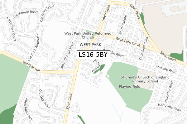
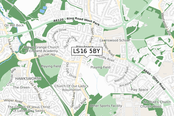
LS16 5BY maps


Source: OS Open Zoomstack (Ordnance Survey)
Licence: Open Government Licence (requires attribution)
Attribution: Contains OS data © Crown copyright and database right 2025
Source: Open Postcode Geo
Licence: Open Government Licence (requires attribution)
Attribution: Contains OS data © Crown copyright and database right 2025; Contains Royal Mail data © Royal Mail copyright and database right 2025; Source: Office for National Statistics licensed under the Open Government Licence v.3.0
Licence: Open Government Licence (requires attribution)
Attribution: Contains OS data © Crown copyright and database right 2025
Source: Open Postcode Geo
Licence: Open Government Licence (requires attribution)
Attribution: Contains OS data © Crown copyright and database right 2025; Contains Royal Mail data © Royal Mail copyright and database right 2025; Source: Office for National Statistics licensed under the Open Government Licence v.3.0
LS16 5BY geodata
| Easting | 426302 |
| Northing | 437523 |
| Latitude | 53.833320 |
| Longitude | -1.601839 |
Where is LS16 5BY?
| Country | England |
| Postcode District | LS16 |
Politics
| Ward | Weetwood |
|---|---|
| Constituency | Leeds North West |
House Prices
Sales of detached houses in LS16 5BY
2025 21 MAR £377,500 |
2025 6 JAN £472,500 |
24, PARKVIEW PLACE, WEST PARK, LEEDS, LS16 5BY 2021 8 JAN £465,000 |
20, PARKVIEW PLACE, WEST PARK, LEEDS, LS16 5BY 2020 13 NOV £400,000 |
1, PARKVIEW PLACE, WEST PARK, LEEDS, LS16 5BY 2020 14 OCT £450,000 |
36, PARKVIEW PLACE, WEST PARK, LEEDS, LS16 5BY 2020 5 OCT £355,000 |
4, PARKVIEW PLACE, WEST PARK, LEEDS, LS16 5BY 2020 30 SEP £410,000 |
10, PARKVIEW PLACE, WEST PARK, LEEDS, LS16 5BY 2020 30 SEP £400,000 |
2020 28 AUG £410,000 |
2, PARKVIEW PLACE, WEST PARK, LEEDS, LS16 5BY 2020 14 AUG £425,000 |
Source: HM Land Registry Price Paid Data
Licence: Contains HM Land Registry data © Crown copyright and database right 2025. This data is licensed under the Open Government Licence v3.0.
Licence: Contains HM Land Registry data © Crown copyright and database right 2025. This data is licensed under the Open Government Licence v3.0.
Transport
Nearest bus stops to LS16 5BY
| Spen Lane Butcher Hill (Spen Lane) | West Park | 92m |
| Spen Lane Butcher Hill (Spen Lane) | West Park | 105m |
| Butcher Hill Old Oak Drive (Butcher Hill) | West Park | 262m |
| Butcher Hill Old Oak Drive (Butcher Hill) | West Park | 272m |
| Spen Ln West Park Drive (Spen Lane) | West Park | 278m |
Nearest railway stations to LS16 5BY
| Kirkstall Forge Station | 1.7km |
| Headingley Station | 1.8km |
| Horsforth Station | 2.5km |
Deprivation
10.3% of English postcodes are less deprived than LS16 5BY:Food Standards Agency
Three nearest food hygiene ratings to LS16 5BY (metres)
Vitos Pizza

291 Spen Lane
122m
The Heat

293 - 295 Spen Lane
122m
Lloyds Pharmacy
195 - 197 Butcher Hill
164m
➜ Get more ratings from the Food Standards Agency
Nearest post box to LS16 5BY
| Last Collection | |||
|---|---|---|---|
| Location | Mon-Fri | Sat | Distance |
| Butcher Hill P.o. | 17:45 | 12:15 | 278m |
| Moor Grange Drive | 17:30 | 12:00 | 341m |
| Greenhead Road | 17:30 | 12:00 | 353m |
LS16 5BY ITL and LS16 5BY LAU
The below table lists the International Territorial Level (ITL) codes (formerly Nomenclature of Territorial Units for Statistics (NUTS) codes) and Local Administrative Units (LAU) codes for LS16 5BY:
| ITL 1 Code | Name |
|---|---|
| TLE | Yorkshire and The Humber |
| ITL 2 Code | Name |
| TLE4 | West Yorkshire |
| ITL 3 Code | Name |
| TLE42 | Leeds |
| LAU 1 Code | Name |
| E08000035 | Leeds |
LS16 5BY census areas
The below table lists the Census Output Area (OA), Lower Layer Super Output Area (LSOA), and Middle Layer Super Output Area (MSOA) for LS16 5BY:
| Code | Name | |
|---|---|---|
| OA | E00169583 | |
| LSOA | E01011685 | Leeds 109A |
| MSOA | E02006852 | Leeds 109 |
Nearest postcodes to LS16 5BY
| LS16 5BD | Spen Lane | 115m |
| LS16 5BH | Moor Grange View | 145m |
| LS16 5QB | North Parade | 156m |
| LS16 5BQ | Butcher Hill | 167m |
| LS16 5BJ | Moor Grange View | 183m |
| LS16 5BG | Butcher Hill | 191m |
| LS16 5AP | Arncliffe Road | 191m |
| LS16 5AS | West Park Drive | 200m |
| LS16 5BL | West Park Drive | 209m |
| LS16 5BA | Spen Lane | 220m |