LS16 5BX maps, stats, and open data
- Home
- Postcode
- LS
- LS16
- LS16 5
LS16 5BX is located in the Weetwood electoral ward, within the metropolitan district of Leeds and the English Parliamentary constituency of Leeds North West. The Sub Integrated Care Board (ICB) Location is NHS West Yorkshire ICB - 15F and the police force is West Yorkshire. This postcode has been in use since July 2019.
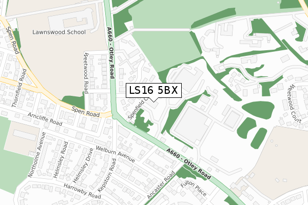
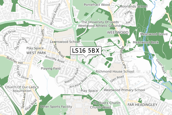
LS16 5BX maps


Source: OS Open Zoomstack (Ordnance Survey)
Licence: Open Government Licence (requires attribution)
Attribution: Contains OS data © Crown copyright and database right 2025
Source: Open Postcode GeoLicence: Open Government Licence (requires attribution)
Attribution: Contains OS data © Crown copyright and database right 2025; Contains Royal Mail data © Royal Mail copyright and database right 2025; Source: Office for National Statistics licensed under the Open Government Licence v.3.0
LS16 5BX geodata
| Easting | 426997 |
| Northing | 437574 |
| Latitude | 53.833743 |
| Longitude | -1.591274 |
Where is LS16 5BX?
| Country | England |
| Postcode District | LS16 |
Politics
| Ward | Weetwood |
|---|
| Constituency | Leeds North West |
|---|
Transport
Nearest bus stops to LS16 5BX
| Otley Rd Kepstorn Road (Otley Road) | West Park | 102m |
| Otley Road Welburn Grove (Otley Road) | West Park | 119m |
| Otley Rd Ancaster Road (Otley Road) | West Park | 199m |
| Otley Rd Ancaster Road (Otley Road) | West Park | 217m |
| Lawnswood School (Otley Road) | West Park | 311m |
Nearest railway stations to LS16 5BX
| Headingley Station | 1.8km |
| Kirkstall Forge Station | 2.3km |
| Burley Park Station | 2.6km |
Broadband
Broadband access in LS16 5BX (2020 data)
| Percentage of properties with Next Generation Access | 100.0% |
| Percentage of properties with Superfast Broadband | 100.0% |
| Percentage of properties with Ultrafast Broadband | 0.0% |
| Percentage of properties with Full Fibre Broadband | 0.0% |
Superfast Broadband is between 30Mbps and 300Mbps
Ultrafast Broadband is > 300Mbps
Broadband limitations in LS16 5BX (2020 data)
| Percentage of properties unable to receive 2Mbps | 0.0% |
| Percentage of properties unable to receive 5Mbps | 0.0% |
| Percentage of properties unable to receive 10Mbps | 0.0% |
| Percentage of properties unable to receive 30Mbps | 0.0% |
Deprivation
10.3% of English postcodes are less deprived than
LS16 5BX:
Food Standards Agency
Three nearest food hygiene ratings to LS16 5BX (metres)
Village Hotel And Leisure Club
El Greco
Three Bears Day Nursery
➜ Get more ratings from the Food Standards Agency
Nearest post box to LS16 5BX
| | Last Collection | |
|---|
| Location | Mon-Fri | Sat | Distance |
|---|
| West Park P.o. | 18:30 | 12:00 | 122m |
| Kepstorn Road | 17:30 | 12:00 | 348m |
| Greenhead Road | 17:30 | 12:00 | 348m |
LS16 5BX ITL and LS16 5BX LAU
The below table lists the International Territorial Level (ITL) codes (formerly Nomenclature of Territorial Units for Statistics (NUTS) codes) and Local Administrative Units (LAU) codes for LS16 5BX:
| ITL 1 Code | Name |
|---|
| TLE | Yorkshire and The Humber |
| ITL 2 Code | Name |
|---|
| TLE4 | West Yorkshire |
| ITL 3 Code | Name |
|---|
| TLE42 | Leeds |
| LAU 1 Code | Name |
|---|
| E08000035 | Leeds |
LS16 5BX census areas
The below table lists the Census Output Area (OA), Lower Layer Super Output Area (LSOA), and Middle Layer Super Output Area (MSOA) for LS16 5BX:
| Code | Name |
|---|
| OA | E00058951 | |
|---|
| LSOA | E01011685 | Leeds 109A |
|---|
| MSOA | E02006852 | Leeds 109 |
|---|
Nearest postcodes to LS16 5BX


