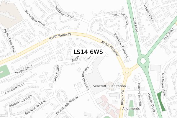
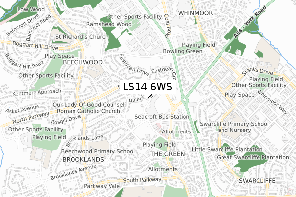
LS14 6WS is located in the Killingbeck & Seacroft electoral ward, within the metropolitan district of Leeds and the English Parliamentary constituency of Leeds East. The Sub Integrated Care Board (ICB) Location is NHS West Yorkshire ICB - 15F and the police force is West Yorkshire. This postcode has been in use since October 2018.


GetTheData
Source: OS Open Zoomstack (Ordnance Survey)
Licence: Open Government Licence (requires attribution)
Attribution: Contains OS data © Crown copyright and database right 2025
Source: Open Postcode Geo
Licence: Open Government Licence (requires attribution)
Attribution: Contains OS data © Crown copyright and database right 2025; Contains Royal Mail data © Royal Mail copyright and database right 2025; Source: Office for National Statistics licensed under the Open Government Licence v.3.0
| Easting | 435562 |
| Northing | 436416 |
| Latitude | 53.822823 |
| Longitude | -1.461271 |
GetTheData
Source: Open Postcode Geo
Licence: Open Government Licence
| Country | England |
| Postcode District | LS14 |
➜ See where LS14 is on a map ➜ Where is Leeds? | |
GetTheData
Source: Land Registry Price Paid Data
Licence: Open Government Licence
| Ward | Killingbeck & Seacroft |
| Constituency | Leeds East |
GetTheData
Source: ONS Postcode Database
Licence: Open Government Licence
| North Parkway Eastdean Gate (North Parkway) | Seacroft | 133m |
| North Parkway Eastdean Gate (North Parkway) | Seacroft | 163m |
| Baileys Ln Baileys Hill (Bailey's Lane) | Seacroft | 176m |
| Baileys Lane Rosgill Dr (Baileys Lane) | Seacroft | 210m |
| North Parkway Baileys Lane (North Parkway) | Seacroft | 228m |
| Cross Gates Station | 2.1km |
GetTheData
Source: NaPTAN
Licence: Open Government Licence
| Percentage of properties with Next Generation Access | 100.0% |
| Percentage of properties with Superfast Broadband | 100.0% |
| Percentage of properties with Ultrafast Broadband | 0.0% |
| Percentage of properties with Full Fibre Broadband | 0.0% |
Superfast Broadband is between 30Mbps and 300Mbps
Ultrafast Broadband is > 300Mbps
| Median download speed | 12.9Mbps |
| Average download speed | 32.4Mbps |
| Maximum download speed | 70.99Mbps |
| Median upload speed | 1.0Mbps |
| Average upload speed | 7.6Mbps |
| Maximum upload speed | 20.00Mbps |
| Percentage of properties unable to receive 2Mbps | 0.0% |
| Percentage of properties unable to receive 5Mbps | 0.0% |
| Percentage of properties unable to receive 10Mbps | 0.0% |
| Percentage of properties unable to receive 30Mbps | 0.0% |
GetTheData
Source: Ofcom
Licence: Ofcom Terms of Use (requires attribution)
GetTheData
Source: ONS Postcode Database
Licence: Open Government Licence


➜ Get more ratings from the Food Standards Agency
GetTheData
Source: Food Standards Agency
Licence: FSA terms & conditions
| Last Collection | |||
|---|---|---|---|
| Location | Mon-Fri | Sat | Distance |
| Baileys Lane/Towers | 17:45 | 12:30 | 272m |
| Ramshead Drive/Approach | 17:30 | 11:30 | 513m |
| North Parkway | 17:30 | 11:30 | 562m |
GetTheData
Source: Dracos
Licence: Creative Commons Attribution-ShareAlike
The below table lists the International Territorial Level (ITL) codes (formerly Nomenclature of Territorial Units for Statistics (NUTS) codes) and Local Administrative Units (LAU) codes for LS14 6WS:
| ITL 1 Code | Name |
|---|---|
| TLE | Yorkshire and The Humber |
| ITL 2 Code | Name |
| TLE4 | West Yorkshire |
| ITL 3 Code | Name |
| TLE42 | Leeds |
| LAU 1 Code | Name |
| E08000035 | Leeds |
GetTheData
Source: ONS Postcode Directory
Licence: Open Government Licence
The below table lists the Census Output Area (OA), Lower Layer Super Output Area (LSOA), and Middle Layer Super Output Area (MSOA) for LS14 6WS:
| Code | Name | |
|---|---|---|
| OA | E00058784 | |
| LSOA | E01011661 | Leeds 035D |
| MSOA | E02002364 | Leeds 035 |
GetTheData
Source: ONS Postcode Directory
Licence: Open Government Licence
| LS14 6PS | Baileys Hill | 45m |
| LS14 6JD | Seacroft Avenue | 76m |
| LS14 6PT | Baileys Lawn | 86m |
| LS14 6PX | North Parkway | 104m |
| LS14 1EX | North Parkway | 155m |
| LS14 1HD | Eastdean Gardens | 190m |
| LS14 1HB | Seacroft Gate | 208m |
| LS14 6PP | Baileys Lane | 211m |
| LS14 1EY | Eastdean Rise | 211m |
| LS14 1HE | Eastdean Grove | 270m |
GetTheData
Source: Open Postcode Geo; Land Registry Price Paid Data
Licence: Open Government Licence