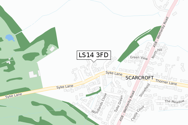
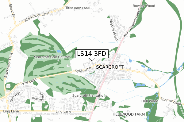
LS14 3FD is located in the Harewood electoral ward, within the metropolitan district of Leeds and the English Parliamentary constituency of Elmet and Rothwell. The Sub Integrated Care Board (ICB) Location is NHS West Yorkshire ICB - 15F and the police force is West Yorkshire. This postcode has been in use since September 2019.


GetTheData
Source: OS Open Zoomstack (Ordnance Survey)
Licence: Open Government Licence (requires attribution)
Attribution: Contains OS data © Crown copyright and database right 2025
Source: Open Postcode Geo
Licence: Open Government Licence (requires attribution)
Attribution: Contains OS data © Crown copyright and database right 2025; Contains Royal Mail data © Royal Mail copyright and database right 2025; Source: Office for National Statistics licensed under the Open Government Licence v.3.0
| Easting | 436252 |
| Northing | 441966 |
| Latitude | 53.872656 |
| Longitude | -1.450138 |
GetTheData
Source: Open Postcode Geo
Licence: Open Government Licence
| Country | England |
| Postcode District | LS14 |
➜ See where LS14 is on a map ➜ Where is Scarcroft? | |
GetTheData
Source: Land Registry Price Paid Data
Licence: Open Government Licence
| Ward | Harewood |
| Constituency | Elmet And Rothwell |
GetTheData
Source: ONS Postcode Database
Licence: Open Government Licence
1, BRACKEN CHASE, SCARCROFT, LEEDS, LS14 3FD 2021 19 FEB £770,000 |
BRACKEN HOUSE, 9, BRACKEN CHASE, SCARCROFT, LEEDS, LS14 3FD 2021 12 JAN £664,000 |
2020 20 NOV £725,000 |
3, BRACKEN CHASE, SCARCROFT, LEEDS, LS14 3FD 2020 24 AUG £622,500 |
4, BRACKEN CHASE, SCARCROFT, LEEDS, LS14 3FD 2020 14 AUG £565,000 |
6, BRACKEN CHASE, SCARCROFT, LEEDS, LS14 3FD 2020 28 MAY £560,000 |
7, BRACKEN CHASE, SCARCROFT, LEEDS, LS14 3FD 2019 8 NOV £770,000 |
5, BRACKEN CHASE, SCARCROFT, LEEDS, LS14 3FD 2019 4 OCT £765,000 |
8, BRACKEN CHASE, SCARCROFT, LEEDS, LS14 3FD 2019 20 SEP £750,000 |
GetTheData
Source: HM Land Registry Price Paid Data
Licence: Contains HM Land Registry data © Crown copyright and database right 2025. This data is licensed under the Open Government Licence v3.0.
| Syke Lane | Scarcroft | 249m |
| Wetherby Road Green View (Wetherby Road) | Scarcroft | 279m |
| Wetherby Rd Thorner Lane (Wetherby Road) | Scarcroft | 282m |
| Wetherby Road Scarcroft Village Hall (Wetherby Road) | Scarcroft | 421m |
| Wetherby Road Scarcroft Village Hall (Wetherby Road) | Scarcroft | 447m |
GetTheData
Source: NaPTAN
Licence: Open Government Licence
GetTheData
Source: ONS Postcode Database
Licence: Open Government Licence


➜ Get more ratings from the Food Standards Agency
GetTheData
Source: Food Standards Agency
Licence: FSA terms & conditions
| Last Collection | |||
|---|---|---|---|
| Location | Mon-Fri | Sat | Distance |
| Scarcroft | 17:30 | 10:00 | 242m |
| Scarcroft Grange | 18:00 | 09:00 | 717m |
| Bracken Park/Skye Lane | 17:45 | 09:00 | 1,135m |
GetTheData
Source: Dracos
Licence: Creative Commons Attribution-ShareAlike
The below table lists the International Territorial Level (ITL) codes (formerly Nomenclature of Territorial Units for Statistics (NUTS) codes) and Local Administrative Units (LAU) codes for LS14 3FD:
| ITL 1 Code | Name |
|---|---|
| TLE | Yorkshire and The Humber |
| ITL 2 Code | Name |
| TLE4 | West Yorkshire |
| ITL 3 Code | Name |
| TLE42 | Leeds |
| LAU 1 Code | Name |
| E08000035 | Leeds |
GetTheData
Source: ONS Postcode Directory
Licence: Open Government Licence
The below table lists the Census Output Area (OA), Lower Layer Super Output Area (LSOA), and Middle Layer Super Output Area (MSOA) for LS14 3FD:
| Code | Name | |
|---|---|---|
| OA | E00058963 | |
| LSOA | E01011713 | Leeds 006E |
| MSOA | E02002335 | Leeds 006 |
GetTheData
Source: ONS Postcode Directory
Licence: Open Government Licence
| LS14 3BQ | Syke Lane | 71m |
| LS14 3DS | Malthouse Close | 96m |
| LS14 3BL | Moss Syke | 105m |
| LS14 3BH | Syke Lane | 134m |
| LS14 3DT | Aspen Drive | 171m |
| LS14 3BJ | Greenway | 194m |
| LS14 3JU | Woodlands Park | 231m |
| LS14 3AY | Green View | 237m |
| LS14 3AU | Wetherby Road | 258m |
| LS14 3BS | Syke Green | 272m |
GetTheData
Source: Open Postcode Geo; Land Registry Price Paid Data
Licence: Open Government Licence