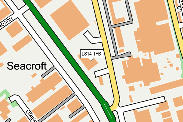
LS14 1FB is located in the Cross Gates & Whinmoor electoral ward, within the metropolitan district of Leeds and the English Parliamentary constituency of Leeds East. The Sub Integrated Care Board (ICB) Location is NHS West Yorkshire ICB - 15F and the police force is West Yorkshire. This postcode has been in use since March 2017.


GetTheData
Source: OS OpenMap – Local (Ordnance Survey)
Source: OS VectorMap District (Ordnance Survey)
Licence: Open Government Licence (requires attribution)
| Easting | 435665 |
| Northing | 437102 |
| Latitude | 53.828981 |
| Longitude | -1.459627 |
GetTheData
Source: Open Postcode Geo
Licence: Open Government Licence
| Country | England |
| Postcode District | LS14 |
➜ See where LS14 is on a map ➜ Where is Leeds? | |
GetTheData
Source: Land Registry Price Paid Data
Licence: Open Government Licence
| Ward | Cross Gates & Whinmoor |
| Constituency | Leeds East |
GetTheData
Source: ONS Postcode Database
Licence: Open Government Licence
| Coal Road | Whinmoor | 50m |
| Ring Rd Industrial Estate (Ring Road Seacroft) | Seacroft | 73m |
| Ring Rd Industrial Estate (Ring Road Seacroft) | Seacroft | 86m |
| Coal Rd Sports Ground (Coal Road) | Whinmoor | 105m |
| Coal Rd Sports Ground (Coal Road) | Whinmoor | 133m |
| Cross Gates Station | 2.7km |
GetTheData
Source: NaPTAN
Licence: Open Government Licence
GetTheData
Source: ONS Postcode Database
Licence: Open Government Licence


➜ Get more ratings from the Food Standards Agency
GetTheData
Source: Food Standards Agency
Licence: FSA terms & conditions
| Last Collection | |||
|---|---|---|---|
| Location | Mon-Fri | Sat | Distance |
| Limewood Road/Ring Road | 17:30 | 11:15 | 176m |
| Seacroft Delivery Office | 235m | ||
| Sherburn Road North | 18:30 | 12:00 | 303m |
GetTheData
Source: Dracos
Licence: Creative Commons Attribution-ShareAlike
The below table lists the International Territorial Level (ITL) codes (formerly Nomenclature of Territorial Units for Statistics (NUTS) codes) and Local Administrative Units (LAU) codes for LS14 1FB:
| ITL 1 Code | Name |
|---|---|
| TLE | Yorkshire and The Humber |
| ITL 2 Code | Name |
| TLE4 | West Yorkshire |
| ITL 3 Code | Name |
| TLE42 | Leeds |
| LAU 1 Code | Name |
| E08000035 | Leeds |
GetTheData
Source: ONS Postcode Directory
Licence: Open Government Licence
The below table lists the Census Output Area (OA), Lower Layer Super Output Area (LSOA), and Middle Layer Super Output Area (MSOA) for LS14 1FB:
| Code | Name | |
|---|---|---|
| OA | E00059075 | |
| LSOA | E01011720 | Leeds 029E |
| MSOA | E02002358 | Leeds 029 |
GetTheData
Source: ONS Postcode Directory
Licence: Open Government Licence
| LS14 2LB | The Courtyards | 280m |
| LS14 2BT | Sherburn Road North | 315m |
| LS14 2BU | Sherburn Road North | 328m |
| LS14 2BS | Sherburn Road North | 331m |
| LS14 1PW | Ramshead Approach | 339m |
| LS14 2DE | Naburn Chase | 368m |
| LS14 2AY | Sherburn Road North | 368m |
| LS14 2BP | Naburn Fold | 388m |
| LS14 2BR | Naburn Fold | 392m |
| LS14 2BX | Sherburn Road North | 396m |
GetTheData
Source: Open Postcode Geo; Land Registry Price Paid Data
Licence: Open Government Licence