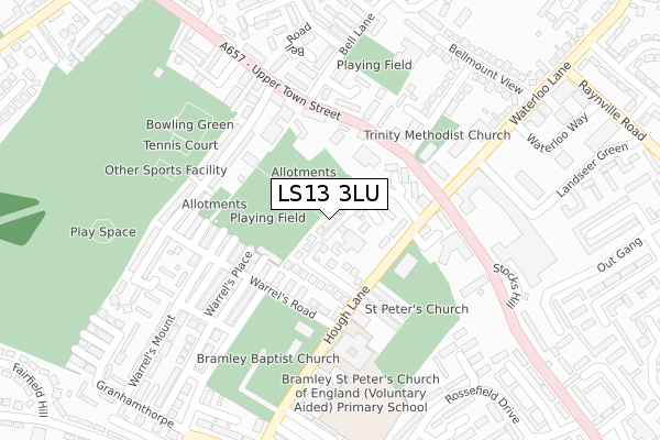
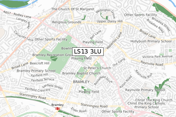
LS13 3LU is located in the Bramley & Stanningley electoral ward, within the metropolitan district of Leeds and the English Parliamentary constituency of Leeds West. The Sub Integrated Care Board (ICB) Location is NHS West Yorkshire ICB - 15F and the police force is West Yorkshire. This postcode has been in use since June 2018.


GetTheData
Source: OS Open Zoomstack (Ordnance Survey)
Licence: Open Government Licence (requires attribution)
Attribution: Contains OS data © Crown copyright and database right 2025
Source: Open Postcode Geo
Licence: Open Government Licence (requires attribution)
Attribution: Contains OS data © Crown copyright and database right 2025; Contains Royal Mail data © Royal Mail copyright and database right 2025; Source: Office for National Statistics licensed under the Open Government Licence v.3.0
| Easting | 424409 |
| Northing | 435119 |
| Latitude | 53.811806 |
| Longitude | -1.630791 |
GetTheData
Source: Open Postcode Geo
Licence: Open Government Licence
| Country | England |
| Postcode District | LS13 |
➜ See where LS13 is on a map ➜ Where is Leeds? | |
GetTheData
Source: Land Registry Price Paid Data
Licence: Open Government Licence
| Ward | Bramley & Stanningley |
| Constituency | Leeds West |
GetTheData
Source: ONS Postcode Database
Licence: Open Government Licence
3, HOLLIES CLOSE, BRAMLEY, LEEDS, LS13 3LU 2018 15 JUN £261,000 |
GetTheData
Source: HM Land Registry Price Paid Data
Licence: Contains HM Land Registry data © Crown copyright and database right 2025. This data is licensed under the Open Government Licence v3.0.
| Upper Town St Waterloo Lane (Upper Town Street) | Bramley | 148m |
| Upper Town St Waterloo Lane (Upper Town Street) | Bramley | 166m |
| Upper Town St Westover Road (Upper Town Street) | Bramley | 221m |
| Waterloo Lane Bell Mount View (Waterloo Lane) | Bramley | 249m |
| Upper Town St Westover Road (Upper Town Street) | Bramley | 263m |
| Bramley (West Yorks) Station | 0.8km |
| Kirkstall Forge Station | 1.4km |
| Headingley Station | 2.5km |
GetTheData
Source: NaPTAN
Licence: Open Government Licence
| Percentage of properties with Next Generation Access | 100.0% |
| Percentage of properties with Superfast Broadband | 100.0% |
| Percentage of properties with Ultrafast Broadband | 100.0% |
| Percentage of properties with Full Fibre Broadband | 0.0% |
Superfast Broadband is between 30Mbps and 300Mbps
Ultrafast Broadband is > 300Mbps
| Percentage of properties unable to receive 2Mbps | 0.0% |
| Percentage of properties unable to receive 5Mbps | 0.0% |
| Percentage of properties unable to receive 10Mbps | 0.0% |
| Percentage of properties unable to receive 30Mbps | 0.0% |
GetTheData
Source: Ofcom
Licence: Ofcom Terms of Use (requires attribution)
GetTheData
Source: ONS Postcode Database
Licence: Open Government Licence


➜ Get more ratings from the Food Standards Agency
GetTheData
Source: Food Standards Agency
Licence: FSA terms & conditions
| Last Collection | |||
|---|---|---|---|
| Location | Mon-Fri | Sat | Distance |
| Warrels Road | 17:30 | 11:00 | 142m |
| Bell Lane | 17:30 | 11:00 | 201m |
| Bramley P.o. | 18:30 | 12:00 | 272m |
GetTheData
Source: Dracos
Licence: Creative Commons Attribution-ShareAlike
The below table lists the International Territorial Level (ITL) codes (formerly Nomenclature of Territorial Units for Statistics (NUTS) codes) and Local Administrative Units (LAU) codes for LS13 3LU:
| ITL 1 Code | Name |
|---|---|
| TLE | Yorkshire and The Humber |
| ITL 2 Code | Name |
| TLE4 | West Yorkshire |
| ITL 3 Code | Name |
| TLE42 | Leeds |
| LAU 1 Code | Name |
| E08000035 | Leeds |
GetTheData
Source: ONS Postcode Directory
Licence: Open Government Licence
The below table lists the Census Output Area (OA), Lower Layer Super Output Area (LSOA), and Middle Layer Super Output Area (MSOA) for LS13 3LU:
| Code | Name | |
|---|---|---|
| OA | E00057110 | |
| LSOA | E01011331 | Leeds 058A |
| MSOA | E02002387 | Leeds 058 |
GetTheData
Source: ONS Postcode Directory
Licence: Open Government Licence
| LS13 3JP | Prospect Avenue | 21m |
| LS13 3JR | Prospect Terrace | 41m |
| LS13 3JW | Prospect Place | 55m |
| LS13 3EH | St Peters Gardens | 66m |
| LS13 3JS | Prospect View | 87m |
| LS13 3NH | Hayleigh Street | 116m |
| LS13 3NJ | Hayleigh Avenue | 118m |
| LS13 3NQ | Hayleigh Terrace | 121m |
| LS13 3NG | Warrels Road | 138m |
| LS13 3NL | Warrels Grove | 159m |
GetTheData
Source: Open Postcode Geo; Land Registry Price Paid Data
Licence: Open Government Licence