LS12 6EJ maps, stats, and open data
LS12 6EJ is located in the Farnley & Wortley electoral ward, within the metropolitan district of Leeds and the English Parliamentary constituency of Leeds West. The Sub Integrated Care Board (ICB) Location is NHS West Yorkshire ICB - 15F and the police force is West Yorkshire. This postcode has been in use since November 2018.
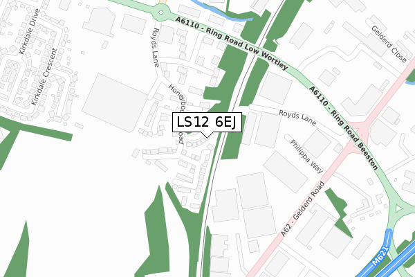
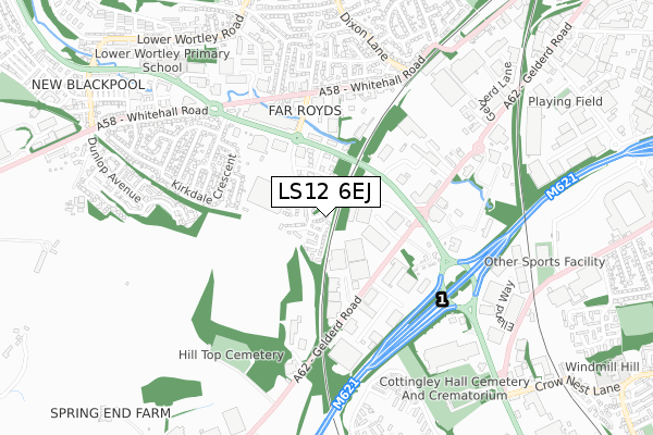
LS12 6EJ maps


Licence: Open Government Licence (requires attribution)
Attribution: Contains OS data © Crown copyright and database right 2025
Source: Open Postcode Geo
Licence: Open Government Licence (requires attribution)
Attribution: Contains OS data © Crown copyright and database right 2025; Contains Royal Mail data © Royal Mail copyright and database right 2025; Source: Office for National Statistics licensed under the Open Government Licence v.3.0
LS12 6EJ geodata
| Easting | 427135 |
| Northing | 431324 |
| Latitude | 53.777563 |
| Longitude | -1.589726 |
Where is LS12 6EJ?
| Country | England |
| Postcode District | LS12 |
Politics
| Ward | Farnley & Wortley |
|---|---|
| Constituency | Leeds West |
House Prices
Sales of detached houses in LS12 6EJ
10, PULLMAN CRESCENT, LEEDS, LS12 6EJ 2018 19 DEC £304,995 |
12, PULLMAN CRESCENT, LEEDS, LS12 6EJ 2018 18 DEC £314,995 |
6, PULLMAN CRESCENT, LEEDS, LS12 6EJ 2018 12 DEC £314,995 |
8, PULLMAN CRESCENT, LEEDS, LS12 6EJ 2018 7 DEC £304,995 |
Licence: Contains HM Land Registry data © Crown copyright and database right 2025. This data is licensed under the Open Government Licence v3.0.
Transport
Nearest bus stops to LS12 6EJ
| Ring Road Pavillion Business Park (Ring Road Low Wortley) | Wortley | 276m |
| Ring Rd Royds Lane (Ring Road Low Wortley) | Wortley | 297m |
| Ring Rd Gelderd Road (Ring Road Beeston) | Wortley | 309m |
| Gelderd Road | Beeston Royds | 321m |
| Gelderd Road | Beeston Royds | 331m |
Nearest railway stations to LS12 6EJ
| Cottingley Station | 1.1km |
| Morley Station | 3.1km |
| Leeds Station | 3.4km |
Broadband
Broadband access in LS12 6EJ (2020 data)
| Percentage of properties with Next Generation Access | 91.7% |
| Percentage of properties with Superfast Broadband | 91.7% |
| Percentage of properties with Ultrafast Broadband | 91.7% |
| Percentage of properties with Full Fibre Broadband | 0.0% |
Superfast Broadband is between 30Mbps and 300Mbps
Ultrafast Broadband is > 300Mbps
Broadband speed in LS12 6EJ (2019 data)
Download
| Median download speed | 100.0Mbps |
| Average download speed | 106.9Mbps |
| Maximum download speed | 350.00Mbps |
Upload
| Median upload speed | 0.9Mbps |
| Average upload speed | 0.9Mbps |
| Maximum upload speed | 1.00Mbps |
Broadband limitations in LS12 6EJ (2020 data)
| Percentage of properties unable to receive 2Mbps | 0.0% |
| Percentage of properties unable to receive 5Mbps | 0.0% |
| Percentage of properties unable to receive 10Mbps | 8.3% |
| Percentage of properties unable to receive 30Mbps | 8.3% |
Deprivation
43.1% of English postcodes are less deprived than LS12 6EJ:Food Standards Agency
Three nearest food hygiene ratings to LS12 6EJ (metres)


➜ Get more ratings from the Food Standards Agency
Nearest post box to LS12 6EJ
| Last Collection | |||
|---|---|---|---|
| Location | Mon-Fri | Sat | Distance |
| Beeston Royd | 18:30 | 11:00 | 317m |
| Gelderd Road | 319m | ||
| Royds Lane | 13:30 | 403m | |
LS12 6EJ ITL and LS12 6EJ LAU
The below table lists the International Territorial Level (ITL) codes (formerly Nomenclature of Territorial Units for Statistics (NUTS) codes) and Local Administrative Units (LAU) codes for LS12 6EJ:
| ITL 1 Code | Name |
|---|---|
| TLE | Yorkshire and The Humber |
| ITL 2 Code | Name |
| TLE4 | West Yorkshire |
| ITL 3 Code | Name |
| TLE42 | Leeds |
| LAU 1 Code | Name |
| E08000035 | Leeds |
LS12 6EJ census areas
The below table lists the Census Output Area (OA), Lower Layer Super Output Area (LSOA), and Middle Layer Super Output Area (MSOA) for LS12 6EJ:
| Code | Name | |
|---|---|---|
| OA | E00059161 | |
| LSOA | E01011734 | Leeds 083A |
| MSOA | E02002412 | Leeds 083 |
Nearest postcodes to LS12 6EJ
| LS12 6AJ | Pavilion Business Park | 183m |
| LS12 6BA | Kirkdale Terrace | 373m |
| LS12 6AY | Kirkdale Crescent | 407m |
| LS12 6EY | Beeston Royds Industrial Estate | 409m |
| LS12 6AS | Kirkdale Crescent | 436m |
| LS12 6AQ | Whitehall Road | 473m |
| LS12 6AZ | Kirkdale Mount | 511m |
| LS12 4TG | Whitehall Road | 519m |
| LS12 6AW | Kirkdale Drive | 523m |
| LS12 6HP | Dixon Court | 533m |