LS12 6BX maps, stats, and open data
- Home
- Postcode
- LS
- LS12
- LS12 6
LS12 6BX is located in the Farnley & Wortley electoral ward, within the metropolitan district of Leeds and the English Parliamentary constituency of Leeds West. The Sub Integrated Care Board (ICB) Location is NHS West Yorkshire ICB - 15F and the police force is West Yorkshire. This postcode has been in use since September 2018.
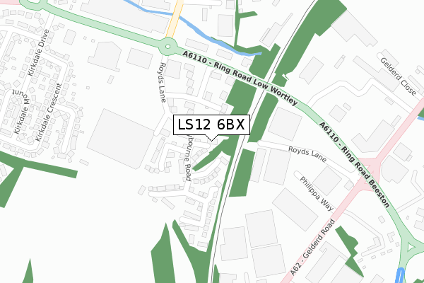
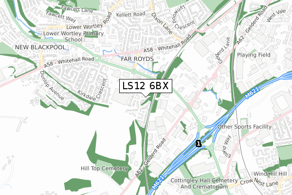
LS12 6BX maps


Source: OS Open Zoomstack (Ordnance Survey)
Licence: Open Government Licence (requires attribution)
Attribution: Contains OS data © Crown copyright and database right 2025
Source: Open Postcode GeoLicence: Open Government Licence (requires attribution)
Attribution: Contains OS data © Crown copyright and database right 2025; Contains Royal Mail data © Royal Mail copyright and database right 2025; Source: Office for National Statistics licensed under the Open Government Licence v.3.0
LS12 6BX geodata
| Easting | 427127 |
| Northing | 431404 |
| Latitude | 53.778282 |
| Longitude | -1.589840 |
Where is LS12 6BX?
| Country | England |
| Postcode District | LS12 |
Politics
| Ward | Farnley & Wortley |
|---|
| Constituency | Leeds West |
|---|
Transport
Nearest bus stops to LS12 6BX
| Ring Road Pavillion Business Park (Ring Road Low Wortley) | Wortley | 196m |
| Ring Rd Royds Lane (Ring Road Low Wortley) | Wortley | 217m |
| Ring Rd Gelderd Road (Ring Road Beeston) | Wortley | 316m |
| Whitehall Rd Walkers Lane (Whitehall Road) | Wortley | 396m |
| Gelderd Road | Beeston Royds | 397m |
Nearest railway stations to LS12 6BX
| Cottingley Station | 1.2km |
| Morley Station | 3.2km |
| Leeds Station | 3.4km |
Broadband
Broadband access in LS12 6BX (2020 data)
| Percentage of properties with Next Generation Access | 100.0% |
| Percentage of properties with Superfast Broadband | 100.0% |
| Percentage of properties with Ultrafast Broadband | 100.0% |
| Percentage of properties with Full Fibre Broadband | 0.0% |
Superfast Broadband is between 30Mbps and 300Mbps
Ultrafast Broadband is > 300Mbps
Broadband limitations in LS12 6BX (2020 data)
| Percentage of properties unable to receive 2Mbps | 0.0% |
| Percentage of properties unable to receive 5Mbps | 0.0% |
| Percentage of properties unable to receive 10Mbps | 0.0% |
| Percentage of properties unable to receive 30Mbps | 0.0% |
Deprivation
43.1% of English postcodes are less deprived than
LS12 6BX:
Food Standards Agency
Three nearest food hygiene ratings to LS12 6BX (metres)
Booker Leeds
Salon Services Ltd
Betsys
➜ Get more ratings from the Food Standards Agency
Nearest post box to LS12 6BX
| | Last Collection | |
|---|
| Location | Mon-Fri | Sat | Distance |
|---|
| Royds Lane | 13:30 | | 323m |
| Royds Lane/Royds Close | 18:45 | 11:00 | 327m |
| Beeston Royd | 18:30 | 11:00 | 393m |
LS12 6BX ITL and LS12 6BX LAU
The below table lists the International Territorial Level (ITL) codes (formerly Nomenclature of Territorial Units for Statistics (NUTS) codes) and Local Administrative Units (LAU) codes for LS12 6BX:
| ITL 1 Code | Name |
|---|
| TLE | Yorkshire and The Humber |
| ITL 2 Code | Name |
|---|
| TLE4 | West Yorkshire |
| ITL 3 Code | Name |
|---|
| TLE42 | Leeds |
| LAU 1 Code | Name |
|---|
| E08000035 | Leeds |
LS12 6BX census areas
The below table lists the Census Output Area (OA), Lower Layer Super Output Area (LSOA), and Middle Layer Super Output Area (MSOA) for LS12 6BX:
| Code | Name |
|---|
| OA | E00059163 | |
|---|
| LSOA | E01011734 | Leeds 083A |
|---|
| MSOA | E02002412 | Leeds 083 |
|---|
Nearest postcodes to LS12 6BX


