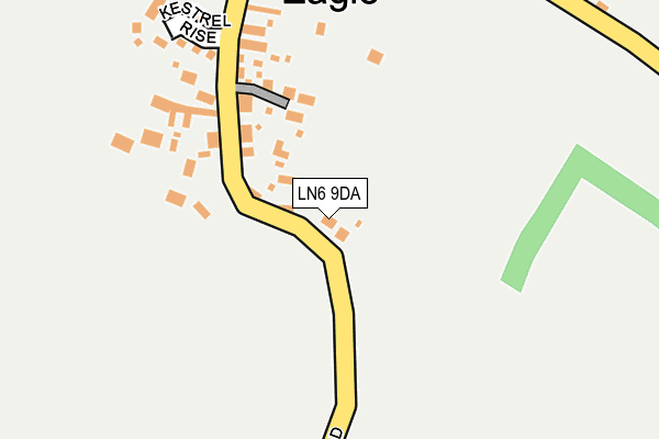
LN6 9DA is located in the Hykeham Fosse electoral ward, within the local authority district of North Kesteven and the English Parliamentary constituency of Sleaford and North Hykeham. The Sub Integrated Care Board (ICB) Location is NHS Lincolnshire ICB - 71E and the police force is Lincolnshire. This postcode has been in use since June 2017.


GetTheData
Source: OS OpenMap – Local (Ordnance Survey)
Source: OS VectorMap District (Ordnance Survey)
Licence: Open Government Licence (requires attribution)
| Easting | 493110 |
| Northing | 365615 |
| Latitude | 53.179522 |
| Longitude | -0.608256 |
GetTheData
Source: Open Postcode Geo
Licence: Open Government Licence
| Country | England |
| Postcode District | LN6 |
➜ See where LN6 is on a map ➜ Where is North Hykeham? | |
GetTheData
Source: Land Registry Price Paid Data
Licence: Open Government Licence
| Ward | Hykeham Fosse |
| Constituency | Sleaford And North Hykeham |
GetTheData
Source: ONS Postcode Database
Licence: Open Government Licence
2023 28 JUL £347,000 |
2021 30 SEP £280,000 |
2017 14 DEC £279,995 |
2017 26 OCT £249,995 |
9, AURELIUS WAY, NORTH HYKEHAM, LINCOLN, LN6 9DA 2017 28 SEP £222,995 |
GetTheData
Source: HM Land Registry Price Paid Data
Licence: Contains HM Land Registry data © Crown copyright and database right 2025. This data is licensed under the Open Government Licence v3.0.
| Vespasian Way (Tiber Road) | North Hykeham | 296m |
| Oak Farm Paddock (Newark Road) | North Hykeham | 327m |
| Remus Court (Tiber Road) | North Hykeham | 340m |
| Grandfield Way (Newark Road) | North Hykeham | 353m |
| Grandfield Way (Newark Road) | North Hykeham | 353m |
| Hykeham Station | 1.8km |
GetTheData
Source: NaPTAN
Licence: Open Government Licence
| Percentage of properties with Next Generation Access | 100.0% |
| Percentage of properties with Superfast Broadband | 100.0% |
| Percentage of properties with Ultrafast Broadband | 90.0% |
| Percentage of properties with Full Fibre Broadband | 90.0% |
Superfast Broadband is between 30Mbps and 300Mbps
Ultrafast Broadband is > 300Mbps
| Percentage of properties unable to receive 2Mbps | 0.0% |
| Percentage of properties unable to receive 5Mbps | 0.0% |
| Percentage of properties unable to receive 10Mbps | 0.0% |
| Percentage of properties unable to receive 30Mbps | 0.0% |
GetTheData
Source: Ofcom
Licence: Ofcom Terms of Use (requires attribution)
GetTheData
Source: ONS Postcode Database
Licence: Open Government Licence


➜ Get more ratings from the Food Standards Agency
GetTheData
Source: Food Standards Agency
Licence: FSA terms & conditions
| Last Collection | |||
|---|---|---|---|
| Location | Mon-Fri | Sat | Distance |
| Thorpe Lane | 17:00 | 11:30 | 598m |
| Macmillan Avenue | 17:00 | 11:15 | 777m |
| Hykeham Moor P.o. | 17:15 | 12:15 | 1,277m |
GetTheData
Source: Dracos
Licence: Creative Commons Attribution-ShareAlike
The below table lists the International Territorial Level (ITL) codes (formerly Nomenclature of Territorial Units for Statistics (NUTS) codes) and Local Administrative Units (LAU) codes for LN6 9DA:
| ITL 1 Code | Name |
|---|---|
| TLF | East Midlands (England) |
| ITL 2 Code | Name |
| TLF3 | Lincolnshire |
| ITL 3 Code | Name |
| TLF30 | Lincolnshire CC |
| LAU 1 Code | Name |
| E07000139 | North Kesteven |
GetTheData
Source: ONS Postcode Directory
Licence: Open Government Licence
The below table lists the Census Output Area (OA), Lower Layer Super Output Area (LSOA), and Middle Layer Super Output Area (MSOA) for LN6 9DA:
| Code | Name | |
|---|---|---|
| OA | E00169359 | |
| LSOA | E01032989 | North Kesteven 013C |
| MSOA | E02006866 | North Kesteven 013 |
GetTheData
Source: ONS Postcode Directory
Licence: Open Government Licence
| LN6 9FQ | Arvina Close | 123m |
| LN6 9FJ | Taurus Avenue | 143m |
| LN6 9FY | Brutus Court | 144m |
| LN6 9FN | Caesar Road | 164m |
| LN6 8JT | Maximus Road | 167m |
| LN6 8JP | Nero Way | 187m |
| LN6 9FZ | Capito Drive | 195m |
| LN6 9LL | Julius Way | 195m |
| LN6 9YS | Quintus Place | 198m |
| LN6 8JS | Hadrians Walk | 216m |
GetTheData
Source: Open Postcode Geo; Land Registry Price Paid Data
Licence: Open Government Licence