Property/Postcode Data Search:
LN5 8FA maps, stats, and open data
LN5 8FA is located in the Park electoral ward, within the local authority district of Lincoln and the English Parliamentary constituency of Lincoln. The Sub Integrated Care Board (ICB) Location is NHS Lincolnshire ICB - 71E and the police force is Lincolnshire. This postcode has been in use since October 2019.
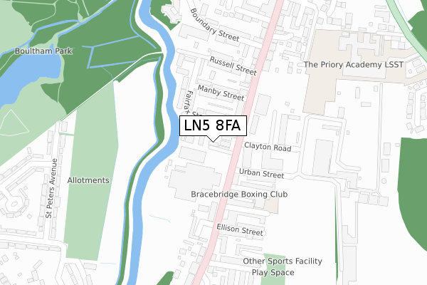
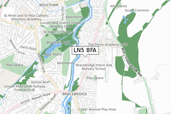
LN5 8FA maps


Source: OS Open Zoomstack (Ordnance Survey)
Licence: Open Government Licence (requires attribution)
Attribution: Contains OS data © Crown copyright and database right 2025
Source: Open Postcode Geo
Licence: Open Government Licence (requires attribution)
Attribution: Contains OS data © Crown copyright and database right 2025; Contains Royal Mail data © Royal Mail copyright and database right 2025; Source: Office for National Statistics licensed under the Open Government Licence v.3.0
Licence: Open Government Licence (requires attribution)
Attribution: Contains OS data © Crown copyright and database right 2025
Source: Open Postcode Geo
Licence: Open Government Licence (requires attribution)
Attribution: Contains OS data © Crown copyright and database right 2025; Contains Royal Mail data © Royal Mail copyright and database right 2025; Source: Office for National Statistics licensed under the Open Government Licence v.3.0
LN5 8FA geodata
| Easting | 496846 |
| Northing | 368701 |
| Latitude | 53.206588 |
| Longitude | -0.551440 |
Where is LN5 8FA?
| Country | England |
| Postcode District | LN5 |
Politics
| Ward | Park |
|---|---|
| Constituency | Lincoln |
Transport
Nearest bus stops to LN5 8FA
| Manby Street (Newark Road) | Bracebridge | 133m |
| Manby Street (Newark Road) | Bracebridge | 163m |
| Ellison Street (Newark Road) | Bracebridge | 164m |
| Ellison Street (Newark Road) | Bracebridge | 212m |
| Otter's Cottages (Newark Road) | Bracebridge | 440m |
Nearest railway stations to LN5 8FA
| Lincoln Central Station | 2.3km |
| Hykeham Station | 3.5km |
Deprivation
86.9% of English postcodes are less deprived than LN5 8FA:Food Standards Agency
Three nearest food hygiene ratings to LN5 8FA (metres)
Aldi

233 Newark Road
30m
Dine Contract Catering

255 Newark Road
67m
Walkers Snack Foods
255 Newark Road
67m
➜ Get more ratings from the Food Standards Agency
Nearest post box to LN5 8FA
| Last Collection | |||
|---|---|---|---|
| Location | Mon-Fri | Sat | Distance |
| Newark Road | 17:30 | 12:00 | 160m |
| Bracebridge Post Office | 17:30 | 12:00 | 358m |
| Cross O'cliffe Hill | 17:30 | 12:45 | 507m |
LN5 8FA ITL and LN5 8FA LAU
The below table lists the International Territorial Level (ITL) codes (formerly Nomenclature of Territorial Units for Statistics (NUTS) codes) and Local Administrative Units (LAU) codes for LN5 8FA:
| ITL 1 Code | Name |
|---|---|
| TLF | East Midlands (England) |
| ITL 2 Code | Name |
| TLF3 | Lincolnshire |
| ITL 3 Code | Name |
| TLF30 | Lincolnshire CC |
| LAU 1 Code | Name |
| E07000138 | Lincoln |
LN5 8FA census areas
The below table lists the Census Output Area (OA), Lower Layer Super Output Area (LSOA), and Middle Layer Super Output Area (MSOA) for LN5 8FA:
| Code | Name | |
|---|---|---|
| OA | E00132899 | |
| LSOA | E01026175 | Lincoln 010E |
| MSOA | E02005451 | Lincoln 010 |
Nearest postcodes to LN5 8FA
| LN5 8NY | Park Lane | 31m |
| LN5 8NT | Newark Road | 41m |
| LN5 8QD | Newark Road | 96m |
| LN5 8NP | Newark Road | 102m |
| LN5 8NR | Fairfax Street | 111m |
| LN5 8NW | Manby Street | 131m |
| LN5 8QF | Newark Road | 135m |
| LN5 8QB | Urban Street | 137m |
| LN5 8QE | Ewart Street | 148m |
| LN5 8PA | Newark Road | 167m |