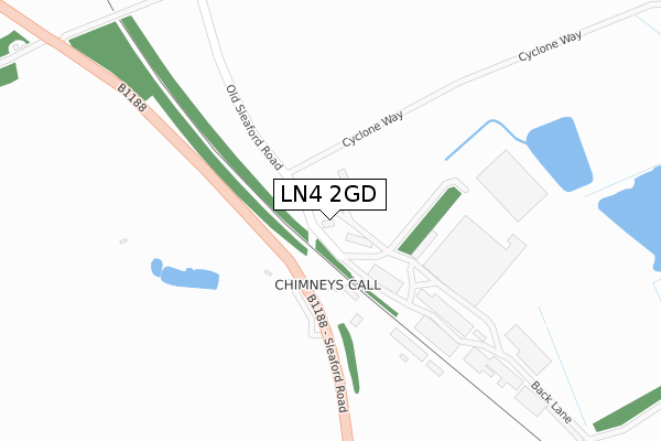
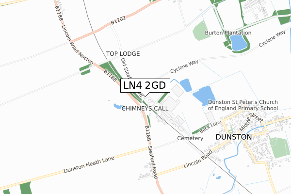
LN4 2GD is located in the Metheringham Rural electoral ward, within the local authority district of North Kesteven and the English Parliamentary constituency of Sleaford and North Hykeham. The Sub Integrated Care Board (ICB) Location is NHS Lincolnshire ICB - 71E and the police force is Lincolnshire. This postcode has been in use since February 2019.


GetTheData
Source: OS Open Zoomstack (Ordnance Survey)
Licence: Open Government Licence (requires attribution)
Attribution: Contains OS data © Crown copyright and database right 2025
Source: Open Postcode Geo
Licence: Open Government Licence (requires attribution)
Attribution: Contains OS data © Crown copyright and database right 2025; Contains Royal Mail data © Royal Mail copyright and database right 2025; Source: Office for National Statistics licensed under the Open Government Licence v.3.0
| Easting | 505624 |
| Northing | 363164 |
| Latitude | 53.155166 |
| Longitude | -0.421889 |
GetTheData
Source: Open Postcode Geo
Licence: Open Government Licence
| Country | England |
| Postcode District | LN4 |
➜ See where LN4 is on a map | |
GetTheData
Source: Land Registry Price Paid Data
Licence: Open Government Licence
| Ward | Metheringham Rural |
| Constituency | Sleaford And North Hykeham |
GetTheData
Source: ONS Postcode Database
Licence: Open Government Licence
| Lincoln Road (Sleaford Road) | Dunston | 475m |
| Lincoln Road (Sleaford Road) | Dunston | 486m |
| Railway Bridge (Lincoln Road) | Dunston | 629m |
| Railway Bridge (Lincoln Road) | Dunston | 640m |
| Village Hall (Chapel Lane) | Dunston | 785m |
| Metheringham Station | 2.7km |
GetTheData
Source: NaPTAN
Licence: Open Government Licence
GetTheData
Source: ONS Postcode Database
Licence: Open Government Licence


➜ Get more ratings from the Food Standards Agency
GetTheData
Source: Food Standards Agency
Licence: FSA terms & conditions
| Last Collection | |||
|---|---|---|---|
| Location | Mon-Fri | Sat | Distance |
| Metheringham P.o. | 17:30 | 12:15 | 2,092m |
| Potterhanworth P.o. | 17:30 | 12:30 | 3,024m |
| The Firs Scopwick | 16:45 | 11:15 | 4,865m |
GetTheData
Source: Dracos
Licence: Creative Commons Attribution-ShareAlike
The below table lists the International Territorial Level (ITL) codes (formerly Nomenclature of Territorial Units for Statistics (NUTS) codes) and Local Administrative Units (LAU) codes for LN4 2GD:
| ITL 1 Code | Name |
|---|---|
| TLF | East Midlands (England) |
| ITL 2 Code | Name |
| TLF3 | Lincolnshire |
| ITL 3 Code | Name |
| TLF30 | Lincolnshire CC |
| LAU 1 Code | Name |
| E07000139 | North Kesteven |
GetTheData
Source: ONS Postcode Directory
Licence: Open Government Licence
The below table lists the Census Output Area (OA), Lower Layer Super Output Area (LSOA), and Middle Layer Super Output Area (MSOA) for LN4 2GD:
| Code | Name | |
|---|---|---|
| OA | E00133093 | |
| LSOA | E01026211 | North Kesteven 005C |
| MSOA | E02005457 | North Kesteven 005 |
GetTheData
Source: ONS Postcode Directory
Licence: Open Government Licence
| LN4 2HA | Station Yard | 136m |
| LN4 2EZ | Main Road | 540m |
| LN4 2EY | Shirley Avenue | 603m |
| LN4 2EL | Vicarage Lane | 638m |
| LN4 2EX | Lincoln Road | 669m |
| LN4 2EJ | Back Lane | 671m |
| LN4 2EH | Back Lane | 693m |
| LN4 2HJ | Halls Court | 729m |
| LN4 2EN | Church Hill | 735m |
| LN4 2EW | Middle Street | 842m |
GetTheData
Source: Open Postcode Geo; Land Registry Price Paid Data
Licence: Open Government Licence