Property/Postcode Data Search:
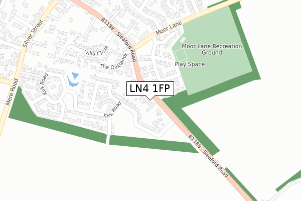
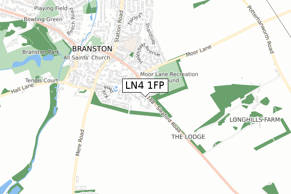
LN4 1FP maps, stats, and open data
LN4 1FP is located in the Branston electoral ward, within the local authority district of North Kesteven and the English Parliamentary constituency of Sleaford and North Hykeham. The Sub Integrated Care Board (ICB) Location is NHS Lincolnshire ICB - 71E and the police force is Lincolnshire. This postcode has been in use since October 2019.
LN4 1FP maps


Source: OS Open Zoomstack (Ordnance Survey)
Licence: Open Government Licence (requires attribution)
Attribution: Contains OS data © Crown copyright and database right 2025
Source: Open Postcode Geo
Licence: Open Government Licence (requires attribution)
Attribution: Contains OS data © Crown copyright and database right 2025; Contains Royal Mail data © Royal Mail copyright and database right 2025; Source: Office for National Statistics licensed under the Open Government Licence v.3.0
Licence: Open Government Licence (requires attribution)
Attribution: Contains OS data © Crown copyright and database right 2025
Source: Open Postcode Geo
Licence: Open Government Licence (requires attribution)
Attribution: Contains OS data © Crown copyright and database right 2025; Contains Royal Mail data © Royal Mail copyright and database right 2025; Source: Office for National Statistics licensed under the Open Government Licence v.3.0
LN4 1FP geodata
| Easting | 502254 |
| Northing | 366978 |
| Latitude | 53.190094 |
| Longitude | -0.471050 |
Where is LN4 1FP?
| Country | England |
| Postcode District | LN4 |
Politics
| Ward | Branston |
|---|---|
| Constituency | Sleaford And North Hykeham |
House Prices
Sales of detached houses in LN4 1FP
2021 1 APR £333,000 |
2, TAYLOR CLOSE, BRANSTON, LINCOLN, LN4 1FP 2020 10 SEP £250,000 |
11, TAYLOR CLOSE, BRANSTON, LINCOLN, LN4 1FP 2020 7 SEP £355,000 |
12, TAYLOR CLOSE, BRANSTON, LINCOLN, LN4 1FP 2020 24 JUL £325,000 |
9, TAYLOR CLOSE, BRANSTON, LINCOLN, LN4 1FP 2020 14 APR £360,000 |
7, TAYLOR CLOSE, BRANSTON, LINCOLN, LN4 1FP 2019 18 DEC £395,000 |
2019 18 DEC £318,500 |
10, TAYLOR CLOSE, BRANSTON, LINCOLN, LN4 1FP 2019 16 DEC £315,000 |
14, TAYLOR CLOSE, BRANSTON, LINCOLN, LN4 1FP 2019 6 DEC £235,000 |
Source: HM Land Registry Price Paid Data
Licence: Contains HM Land Registry data © Crown copyright and database right 2025. This data is licensed under the Open Government Licence v3.0.
Licence: Contains HM Land Registry data © Crown copyright and database right 2025. This data is licensed under the Open Government Licence v3.0.
Transport
Nearest bus stops to LN4 1FP
| Station Road (Sleaford Road) | Branston | 352m |
| Station Road (Sleaford Road) | Branston | 367m |
| 99 Sleaford Road (Sleaford Road) | Branston | 401m |
| 99 Sleaford Road (Sleaford Road) | Branston | 413m |
| Curtois Close (Station Road) | Branston | 416m |
Nearest railway stations to LN4 1FP
| Lincoln Central Station | 6.1km |
Deprivation
60.9% of English postcodes are less deprived than LN4 1FP:Food Standards Agency
Three nearest food hygiene ratings to LN4 1FP (metres)
Waggon and Horses

Waggon & Horses
373m
Branston Cafe

Rectory Lane
380m
Branston (Lincoln) Home Guard Social Club

12 High Street
383m
➜ Get more ratings from the Food Standards Agency
Nearest post box to LN4 1FP
| Last Collection | |||
|---|---|---|---|
| Location | Mon-Fri | Sat | Distance |
| Branston P.o. | 17:30 | 12:00 | 447m |
| Heighington Post Office | 17:15 | 11:45 | 2,629m |
| Potterhanworth P.o. | 17:30 | 12:30 | 3,306m |
LN4 1FP ITL and LN4 1FP LAU
The below table lists the International Territorial Level (ITL) codes (formerly Nomenclature of Territorial Units for Statistics (NUTS) codes) and Local Administrative Units (LAU) codes for LN4 1FP:
| ITL 1 Code | Name |
|---|---|
| TLF | East Midlands (England) |
| ITL 2 Code | Name |
| TLF3 | Lincolnshire |
| ITL 3 Code | Name |
| TLF30 | Lincolnshire CC |
| LAU 1 Code | Name |
| E07000139 | North Kesteven |
LN4 1FP census areas
The below table lists the Census Output Area (OA), Lower Layer Super Output Area (LSOA), and Middle Layer Super Output Area (MSOA) for LN4 1FP:
| Code | Name | |
|---|---|---|
| OA | E00132976 | |
| LSOA | E01026190 | North Kesteven 004D |
| MSOA | E02005456 | North Kesteven 004 |
Nearest postcodes to LN4 1FP
| LN4 1LF | Silver Street | 113m |
| LN4 1LT | Thackers Lane | 182m |
| LN4 1LA | Chapel Lane | 205m |
| LN4 1LR | Silver Street | 211m |
| LN4 1LW | Villa Close | 222m |
| LN4 1LS | Chapel Road | 224m |
| LN4 1FD | Chapel Yard | 233m |
| LN4 1FE | Oaklands | 238m |
| LN4 1UB | Melville Close | 249m |
| LN4 1LY | Hall Lane | 258m |