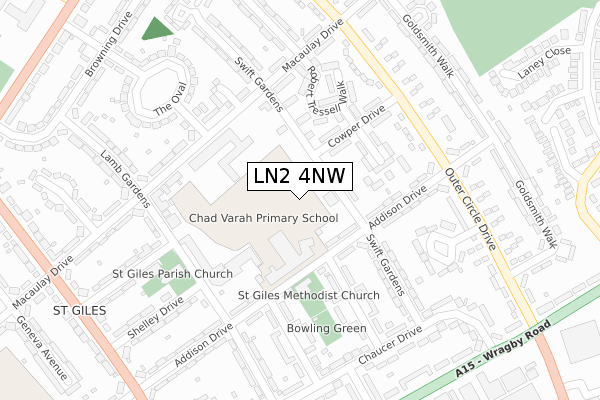
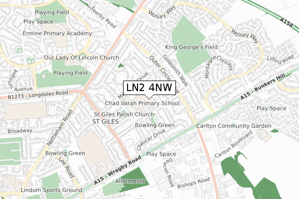
LN2 4NW is located in the Nettleham electoral ward, within the local authority district of West Lindsey and the English Parliamentary constituency of Gainsborough. The Sub Integrated Care Board (ICB) Location is NHS Lincolnshire ICB - 71E and the police force is Lincolnshire. This postcode has been in use since October 2019.


GetTheData
Source: OS Open Zoomstack (Ordnance Survey)
Licence: Open Government Licence (requires attribution)
Attribution: Contains OS data © Crown copyright and database right 2025
Source: Open Postcode Geo
Licence: Open Government Licence (requires attribution)
Attribution: Contains OS data © Crown copyright and database right 2025; Contains Royal Mail data © Royal Mail copyright and database right 2025; Source: Office for National Statistics licensed under the Open Government Licence v.3.0
| Easting | 499848 |
| Northing | 373677 |
| Latitude | 53.250747 |
| Longitude | -0.504954 |
GetTheData
Source: Open Postcode Geo
Licence: Open Government Licence
| Country | England |
| Postcode District | LN2 |
➜ See where LN2 is on a map ➜ Where is Lincoln? | |
GetTheData
Source: Land Registry Price Paid Data
Licence: Open Government Licence
| Ward | Nettleham |
| Constituency | Gainsborough |
GetTheData
Source: ONS Postcode Database
Licence: Open Government Licence
61, GIBSON ROAD, LINCOLN, LN2 4NW 2024 23 AUG £325,950 |
57, GIBSON ROAD, LINCOLN, LN2 4NW 2024 21 JUN £364,950 |
43, GIBSON ROAD, LINCOLN, LN2 4NW 2024 18 JUN £365,000 |
49, GIBSON ROAD, LINCOLN, LN2 4NW 2024 18 APR £319,950 |
45, GIBSON ROAD, LINCOLN, LN2 4NW 2024 23 FEB £410,000 |
39, GIBSON ROAD, LINCOLN, LN2 4NW 2023 15 DEC £339,950 |
47, GIBSON ROAD, LINCOLN, LN2 4NW 2023 8 DEC £289,950 |
41, GIBSON ROAD, LINCOLN, LN2 4NW 2023 16 NOV £395,000 |
LOBLEY HOUSE, 37, GIBSON ROAD, LINCOLN, LN2 4NW 2023 27 OCT £319,950 |
33, GIBSON ROAD, LINCOLN, LN2 4NW 2023 18 AUG £390,000 |
GetTheData
Source: HM Land Registry Price Paid Data
Licence: Contains HM Land Registry data © Crown copyright and database right 2025. This data is licensed under the Open Government Licence v3.0.
| Larkspur Road (Wolsey Way) | Glebe Park | 156m |
| Larkspur Road (Wolsey Way) | Glebe Park | 201m |
| Swayne Close (Wolsey Way) | Glebe Park | 261m |
| Swayne Close (Wolsey Way) | Glebe Park | 274m |
| Arabis Close (Wolsey Way) | Nettleham Fields | 401m |
| Lincoln Central Station | 3.6km |
GetTheData
Source: NaPTAN
Licence: Open Government Licence
GetTheData
Source: ONS Postcode Database
Licence: Open Government Licence


➜ Get more ratings from the Food Standards Agency
GetTheData
Source: Food Standards Agency
Licence: FSA terms & conditions
| Last Collection | |||
|---|---|---|---|
| Location | Mon-Fri | Sat | Distance |
| Wolsey Way | 17:30 | 12:15 | 500m |
| Lincoln Road | 17:30 | 12:45 | 729m |
| Bunkers Hill P.o. | 17:45 | 12:00 | 1,601m |
GetTheData
Source: Dracos
Licence: Creative Commons Attribution-ShareAlike
The below table lists the International Territorial Level (ITL) codes (formerly Nomenclature of Territorial Units for Statistics (NUTS) codes) and Local Administrative Units (LAU) codes for LN2 4NW:
| ITL 1 Code | Name |
|---|---|
| TLF | East Midlands (England) |
| ITL 2 Code | Name |
| TLF3 | Lincolnshire |
| ITL 3 Code | Name |
| TLF30 | Lincolnshire CC |
| LAU 1 Code | Name |
| E07000142 | West Lindsey |
GetTheData
Source: ONS Postcode Directory
Licence: Open Government Licence
The below table lists the Census Output Area (OA), Lower Layer Super Output Area (LSOA), and Middle Layer Super Output Area (MSOA) for LN2 4NW:
| Code | Name | |
|---|---|---|
| OA | E00134097 | |
| LSOA | E01026394 | West Lindsey 010B |
| MSOA | E02005501 | West Lindsey 010 |
GetTheData
Source: ONS Postcode Directory
Licence: Open Government Licence
| LN2 4SF | Beaufort Close | 112m |
| LN2 4SP | Wolsey Way | 160m |
| LN2 4TW | Wolsey Way | 165m |
| LN2 4SE | Beaufort Road | 170m |
| LN2 4SL | Chedworth Road | 214m |
| LN2 4TX | Hurstwood Close | 252m |
| LN2 4SS | Larkspur Road | 252m |
| LN2 4SB | Wolsey Way | 258m |
| LN2 4FA | Alexander Road | 280m |
| LN2 4SQ | Atwater Court | 290m |
GetTheData
Source: Open Postcode Geo; Land Registry Price Paid Data
Licence: Open Government Licence