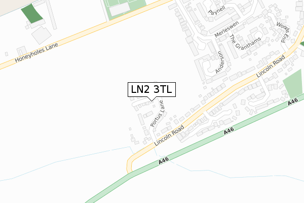
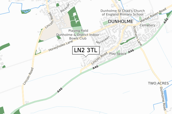
LN2 3TL is located in the Dunholme and Welton electoral ward, within the local authority district of West Lindsey and the English Parliamentary constituency of Gainsborough. The Sub Integrated Care Board (ICB) Location is NHS Lincolnshire ICB - 71E and the police force is Lincolnshire. This postcode has been in use since February 2020.


GetTheData
Source: OS Open Zoomstack (Ordnance Survey)
Licence: Open Government Licence (requires attribution)
Attribution: Contains OS data © Crown copyright and database right 2025
Source: Open Postcode Geo
Licence: Open Government Licence (requires attribution)
Attribution: Contains OS data © Crown copyright and database right 2025; Contains Royal Mail data © Royal Mail copyright and database right 2025; Source: Office for National Statistics licensed under the Open Government Licence v.3.0
| Easting | 501648 |
| Northing | 378840 |
| Latitude | 53.296799 |
| Longitude | -0.476338 |
GetTheData
Source: Open Postcode Geo
Licence: Open Government Licence
| Country | England |
| Postcode District | LN2 |
➜ See where LN2 is on a map ➜ Where is Dunholme? | |
GetTheData
Source: Land Registry Price Paid Data
Licence: Open Government Licence
| Ward | Dunholme And Welton |
| Constituency | Gainsborough |
GetTheData
Source: ONS Postcode Database
Licence: Open Government Licence
34, DIXON PLACE, DUNHOLME, LINCOLN, LN2 3TL 2024 31 JUL £417,052 |
42, DIXON PLACE, DUNHOLME, LINCOLN, LN2 3TL 2024 31 JUL £394,950 |
2024 28 JUN £290,000 |
36, DIXON PLACE, DUNHOLME, LINCOLN, LN2 3TL 2024 31 MAY £339,950 |
7, DIXON PLACE, DUNHOLME, LINCOLN, LN2 3TL 2020 4 DEC £308,702 |
1, DIXON PLACE, DUNHOLME, LINCOLN, LN2 3TL 2020 16 OCT £254,950 |
9, DIXON PLACE, DUNHOLME, LINCOLN, LN2 3TL 2020 6 MAR £339,950 |
2019 22 NOV £256,950 |
GetTheData
Source: HM Land Registry Price Paid Data
Licence: Contains HM Land Registry data © Crown copyright and database right 2025. This data is licensed under the Open Government Licence v3.0.
| Monckton Way (Lincoln Road) | Dunholme | 189m |
| Monckton Way (Lincoln Road) | Dunholme | 244m |
| Kennington Close (Lincoln Road) | Dunholme | 301m |
| Kennington Close (Lincoln Road) | Dunholme | 362m |
| Oak Avenue (Lincoln Road) | Dunholme | 590m |
GetTheData
Source: NaPTAN
Licence: Open Government Licence
GetTheData
Source: ONS Postcode Database
Licence: Open Government Licence

➜ Get more ratings from the Food Standards Agency
GetTheData
Source: Food Standards Agency
Licence: FSA terms & conditions
| Last Collection | |||
|---|---|---|---|
| Location | Mon-Fri | Sat | Distance |
| Honeyholes Lane | 17:00 | 11:00 | 525m |
| Dunholme | 17:15 | 12:15 | 784m |
| Welton Post Office | 17:00 | 11:45 | 1,206m |
GetTheData
Source: Dracos
Licence: Creative Commons Attribution-ShareAlike
The below table lists the International Territorial Level (ITL) codes (formerly Nomenclature of Territorial Units for Statistics (NUTS) codes) and Local Administrative Units (LAU) codes for LN2 3TL:
| ITL 1 Code | Name |
|---|---|
| TLF | East Midlands (England) |
| ITL 2 Code | Name |
| TLF3 | Lincolnshire |
| ITL 3 Code | Name |
| TLF30 | Lincolnshire CC |
| LAU 1 Code | Name |
| E07000142 | West Lindsey |
GetTheData
Source: ONS Postcode Directory
Licence: Open Government Licence
The below table lists the Census Output Area (OA), Lower Layer Super Output Area (LSOA), and Middle Layer Super Output Area (MSOA) for LN2 3TL:
| Code | Name | |
|---|---|---|
| OA | E00133969 | |
| LSOA | E01026372 | West Lindsey 008A |
| MSOA | E02005499 | West Lindsey 008 |
GetTheData
Source: ONS Postcode Directory
Licence: Open Government Licence
| LN2 3SS | Kneeland | 240m |
| LN2 3QL | Monckton Way | 252m |
| LN2 3SR | Anderson | 271m |
| LN2 3ST | Merleswen | 305m |
| LN2 3QY | Lincoln Road | 367m |
| LN2 3SU | Honeyholes Lane | 379m |
| LN2 3SW | Paynell | 391m |
| LN2 3SQ | Honeyholes Lane | 404m |
| LN2 3QN | Kennington Close | 406m |
| LN2 3SP | The Granthams | 412m |
GetTheData
Source: Open Postcode Geo; Land Registry Price Paid Data
Licence: Open Government Licence