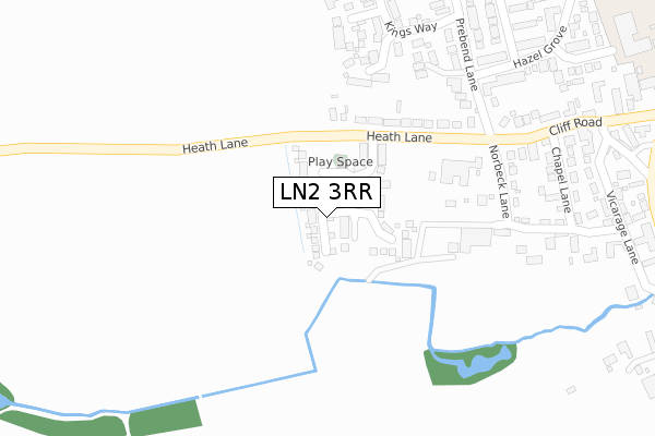
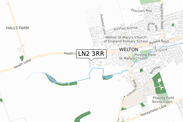
LN2 3RR is located in the Dunholme and Welton electoral ward, within the local authority district of West Lindsey and the English Parliamentary constituency of Gainsborough. The Sub Integrated Care Board (ICB) Location is NHS Lincolnshire ICB - 71E and the police force is Lincolnshire. This postcode has been in use since June 2018.


GetTheData
Source: OS Open Zoomstack (Ordnance Survey)
Licence: Open Government Licence (requires attribution)
Attribution: Contains OS data © Crown copyright and database right 2025
Source: Open Postcode Geo
Licence: Open Government Licence (requires attribution)
Attribution: Contains OS data © Crown copyright and database right 2025; Contains Royal Mail data © Royal Mail copyright and database right 2025; Source: Office for National Statistics licensed under the Open Government Licence v.3.0
| Easting | 500591 |
| Northing | 379712 |
| Latitude | 53.304835 |
| Longitude | -0.491915 |
GetTheData
Source: Open Postcode Geo
Licence: Open Government Licence
| Country | England |
| Postcode District | LN2 |
➜ See where LN2 is on a map ➜ Where is Welton? | |
GetTheData
Source: Land Registry Price Paid Data
Licence: Open Government Licence
| Ward | Dunholme And Welton |
| Constituency | Gainsborough |
GetTheData
Source: ONS Postcode Database
Licence: Open Government Licence
2024 29 AUG £362,000 |
9, FISHPONDS WAY, WELTON, LINCOLN, LN2 3RR 2019 19 SEP £319,950 |
2, FISHPONDS WAY, WELTON, LINCOLN, LN2 3RR 2019 19 SEP £276,000 |
7, FISHPONDS WAY, WELTON, LINCOLN, LN2 3RR 2019 27 AUG £369,950 |
5, FISHPONDS WAY, WELTON, LINCOLN, LN2 3RR 2019 23 AUG £319,950 |
2019 26 JUL £270,000 |
8, FISHPONDS WAY, WELTON, LINCOLN, LN2 3RR 2019 28 JUN £299,950 |
10, FISHPONDS WAY, WELTON, LINCOLN, LN2 3RR 2019 28 JUN £359,950 |
26, FISHPONDS WAY, WELTON, LINCOLN, LN2 3RR 2019 28 JUN £359,950 |
22, FISHPONDS WAY, WELTON, LINCOLN, LN2 3RR 2019 27 JUN £269,950 |
GetTheData
Source: HM Land Registry Price Paid Data
Licence: Contains HM Land Registry data © Crown copyright and database right 2025. This data is licensed under the Open Government Licence v3.0.
| Black Bull Inn (Manor Lane) | Welton | 496m |
| Black Bull Inn (Lincoln Road) | Welton | 504m |
| Hazel Grove (Rivehall Avenue) | Welton | 615m |
| William Farr School (Lincoln Road) | Welton | 623m |
| William Farr School (Lincoln Road) | Welton | 633m |
GetTheData
Source: NaPTAN
Licence: Open Government Licence
| Percentage of properties with Next Generation Access | 100.0% |
| Percentage of properties with Superfast Broadband | 100.0% |
| Percentage of properties with Ultrafast Broadband | 81.3% |
| Percentage of properties with Full Fibre Broadband | 81.3% |
Superfast Broadband is between 30Mbps and 300Mbps
Ultrafast Broadband is > 300Mbps
| Percentage of properties unable to receive 2Mbps | 0.0% |
| Percentage of properties unable to receive 5Mbps | 0.0% |
| Percentage of properties unable to receive 10Mbps | 0.0% |
| Percentage of properties unable to receive 30Mbps | 0.0% |
GetTheData
Source: Ofcom
Licence: Ofcom Terms of Use (requires attribution)
GetTheData
Source: ONS Postcode Database
Licence: Open Government Licence


➜ Get more ratings from the Food Standards Agency
GetTheData
Source: Food Standards Agency
Licence: FSA terms & conditions
| Last Collection | |||
|---|---|---|---|
| Location | Mon-Fri | Sat | Distance |
| Prebend Lane | 16:45 | 11:45 | 428m |
| Welton Post Office | 17:00 | 11:45 | 536m |
| Poachers Rest | 16:45 | 11:15 | 1,145m |
GetTheData
Source: Dracos
Licence: Creative Commons Attribution-ShareAlike
The below table lists the International Territorial Level (ITL) codes (formerly Nomenclature of Territorial Units for Statistics (NUTS) codes) and Local Administrative Units (LAU) codes for LN2 3RR:
| ITL 1 Code | Name |
|---|---|
| TLF | East Midlands (England) |
| ITL 2 Code | Name |
| TLF3 | Lincolnshire |
| ITL 3 Code | Name |
| TLF30 | Lincolnshire CC |
| LAU 1 Code | Name |
| E07000142 | West Lindsey |
GetTheData
Source: ONS Postcode Directory
Licence: Open Government Licence
The below table lists the Census Output Area (OA), Lower Layer Super Output Area (LSOA), and Middle Layer Super Output Area (MSOA) for LN2 3RR:
| Code | Name | |
|---|---|---|
| OA | E00134199 | |
| LSOA | E01026412 | West Lindsey 008B |
| MSOA | E02005499 | West Lindsey 008 |
GetTheData
Source: ONS Postcode Directory
Licence: Open Government Licence
| LN2 3JN | Cliff Road | 186m |
| LN2 3FR | Bishops Place | 254m |
| LN2 3NT | Chancel Court | 270m |
| LN2 3FS | Chapter Close | 289m |
| LN2 3JP | Norbeck Lane | 306m |
| LN2 3JW | Chapel Lane | 351m |
| LN2 3JX | Hazel Grove | 359m |
| LN2 3JU | Prebend Lane | 371m |
| LN2 3FQ | Kings Way | 387m |
| LN2 3JZ | Hazel Grove | 392m |
GetTheData
Source: Open Postcode Geo; Land Registry Price Paid Data
Licence: Open Government Licence