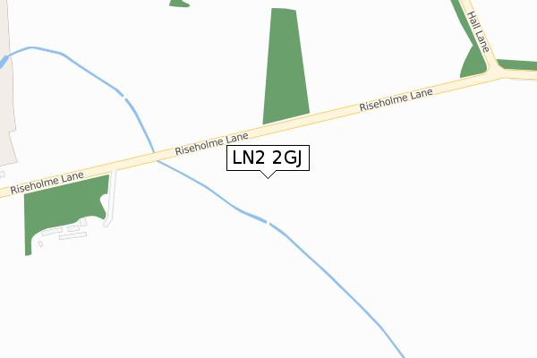
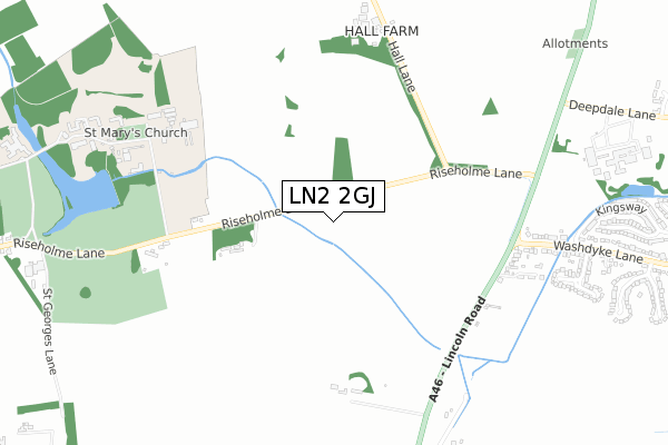
LN2 2GJ is located in the Sudbrooke electoral ward, within the local authority district of West Lindsey and the English Parliamentary constituency of Gainsborough. The Sub Integrated Care Board (ICB) Location is NHS Lincolnshire ICB - 71E and the police force is Lincolnshire. This postcode has been in use since September 2019.


GetTheData
Source: OS Open Zoomstack (Ordnance Survey)
Licence: Open Government Licence (requires attribution)
Attribution: Contains OS data © Crown copyright and database right 2025
Source: Open Postcode Geo
Licence: Open Government Licence (requires attribution)
Attribution: Contains OS data © Crown copyright and database right 2025; Contains Royal Mail data © Royal Mail copyright and database right 2025; Source: Office for National Statistics licensed under the Open Government Licence v.3.0
| Easting | 504557 |
| Northing | 375725 |
| Latitude | 53.268244 |
| Longitude | -0.433732 |
GetTheData
Source: Open Postcode Geo
Licence: Open Government Licence
| Country | England |
| Postcode District | LN2 |
➜ See where LN2 is on a map ➜ Where is Sudbrooke? | |
GetTheData
Source: Land Registry Price Paid Data
Licence: Open Government Licence
| Ward | Sudbrooke |
| Constituency | Gainsborough |
GetTheData
Source: ONS Postcode Database
Licence: Open Government Licence
2024 30 AUG £660,000 |
HAWTHORNE HOUSE, ASH GROVE, SUDBROOKE, LINCOLN, LN2 2GJ 2022 29 JUL £700,000 |
WILLOW HOUSE, 6, ASH GROVE, SUDBROOKE, LINCOLN, LN2 2GJ 2021 30 SEP £650,000 |
2021 26 JUL £599,950 |
2021 17 JUN £599,950 |
ALDER HOUSE, ASH GROVE, SUDBROOKE, LINCOLN, LN2 2GJ 2021 15 APR £750,000 |
HOLLY HOUSE, ASH GROVE, SUDBROOKE, LINCOLN, LN2 2GJ 2021 30 MAR £520,000 |
HOLLY HOUSE, ASH GROVE, SUDBROOKE, LINCOLN, LN2 2GJ 2020 14 DEC £115,000 |
1, ASH GROVE, SUDBROOKE, LINCOLN, LN2 2GJ 2020 9 OCT £620,000 |
GetTheData
Source: HM Land Registry Price Paid Data
Licence: Contains HM Land Registry data © Crown copyright and database right 2025. This data is licensed under the Open Government Licence v3.0.
| Lodge Entrance (Wragby Road East) | Sudbrooke | 424m |
| Lodge Entrance (Wragby Road East) | Sudbrooke | 442m |
| Windsor Close (Green Way) | Sudbrooke | 694m |
| Maple Drive (Elm Drive) | Sudbrooke | 946m |
| Maple Drive (Elm Drive) | Sudbrooke | 957m |
GetTheData
Source: NaPTAN
Licence: Open Government Licence
GetTheData
Source: ONS Postcode Database
Licence: Open Government Licence


➜ Get more ratings from the Food Standards Agency
GetTheData
Source: Food Standards Agency
Licence: FSA terms & conditions
| Last Collection | |||
|---|---|---|---|
| Location | Mon-Fri | Sat | Distance |
| Scothern Post Office | 16:00 | 11:30 | 1,964m |
| Reepham P.o. | 16:45 | 12:00 | 2,013m |
| Heath Lea | 16:15 | 11:30 | 2,130m |
GetTheData
Source: Dracos
Licence: Creative Commons Attribution-ShareAlike
The below table lists the International Territorial Level (ITL) codes (formerly Nomenclature of Territorial Units for Statistics (NUTS) codes) and Local Administrative Units (LAU) codes for LN2 2GJ:
| ITL 1 Code | Name |
|---|---|
| TLF | East Midlands (England) |
| ITL 2 Code | Name |
| TLF3 | Lincolnshire |
| ITL 3 Code | Name |
| TLF30 | Lincolnshire CC |
| LAU 1 Code | Name |
| E07000142 | West Lindsey |
GetTheData
Source: ONS Postcode Directory
Licence: Open Government Licence
The below table lists the Census Output Area (OA), Lower Layer Super Output Area (LSOA), and Middle Layer Super Output Area (MSOA) for LN2 2GJ:
| Code | Name | |
|---|---|---|
| OA | E00134162 | |
| LSOA | E01026406 | West Lindsey 010E |
| MSOA | E02005501 | West Lindsey 010 |
GetTheData
Source: ONS Postcode Directory
Licence: Open Government Licence
| LN2 2QX | Wragby Road | 173m |
| LN2 2BN | Fox Covert | 522m |
| LN2 2QY | Main Drive | 535m |
| LN2 2RE | Park Close | 559m |
| LN2 2QZ | West Drive | 655m |
| LN2 2RF | Cedar Close | 688m |
| LN2 2YA | Green Way | 715m |
| LN2 2SF | Holme Drive | 740m |
| LN2 2RB | Chestnut Drive | 761m |
| LN2 2YD | Windsor Close | 764m |
GetTheData
Source: Open Postcode Geo; Land Registry Price Paid Data
Licence: Open Government Licence