Property/Postcode Data Search:
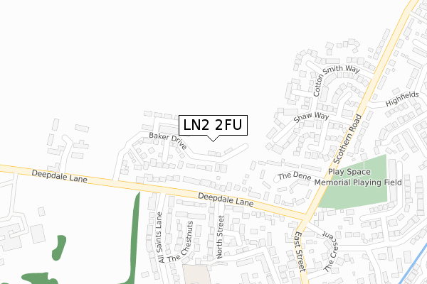
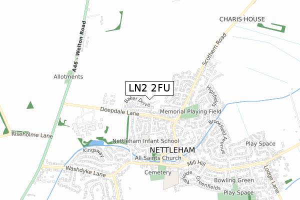
LN2 2FU maps, stats, and open data
LN2 2FU is located in the Nettleham electoral ward, within the local authority district of West Lindsey and the English Parliamentary constituency of Gainsborough. The Sub Integrated Care Board (ICB) Location is NHS Lincolnshire ICB - 71E and the police force is Lincolnshire. This postcode has been in use since January 2020.
LN2 2FU maps


Source: OS Open Zoomstack (Ordnance Survey)
Licence: Open Government Licence (requires attribution)
Attribution: Contains OS data © Crown copyright and database right 2025
Source: Open Postcode Geo
Licence: Open Government Licence (requires attribution)
Attribution: Contains OS data © Crown copyright and database right 2025; Contains Royal Mail data © Royal Mail copyright and database right 2025; Source: Office for National Statistics licensed under the Open Government Licence v.3.0
Licence: Open Government Licence (requires attribution)
Attribution: Contains OS data © Crown copyright and database right 2025
Source: Open Postcode Geo
Licence: Open Government Licence (requires attribution)
Attribution: Contains OS data © Crown copyright and database right 2025; Contains Royal Mail data © Royal Mail copyright and database right 2025; Source: Office for National Statistics licensed under the Open Government Licence v.3.0
LN2 2FU geodata
| Easting | 500724 |
| Northing | 375807 |
| Latitude | 53.269721 |
| Longitude | -0.491157 |
Where is LN2 2FU?
| Country | England |
| Postcode District | LN2 |
Politics
| Ward | Nettleham |
|---|---|
| Constituency | Gainsborough |
House Prices
Sales of detached houses in LN2 2FU
2023 17 NOV £415,000 |
1, TROTT VIEW, NETTLEHAM, LINCOLN, LN2 2FU 2021 22 JAN £460,000 |
4, TROTT VIEW, NETTLEHAM, LINCOLN, LN2 2FU 2020 30 OCT £329,995 |
3, TROTT VIEW, NETTLEHAM, LINCOLN, LN2 2FU 2020 30 OCT £269,995 |
2020 26 AUG £380,000 |
Source: HM Land Registry Price Paid Data
Licence: Contains HM Land Registry data © Crown copyright and database right 2025. This data is licensed under the Open Government Licence v3.0.
Licence: Contains HM Land Registry data © Crown copyright and database right 2025. This data is licensed under the Open Government Licence v3.0.
Transport
Nearest bus stops to LN2 2FU
| 1 Deepdale Lane (Deepdale Lane) | Nettleham | 194m |
| 1 Deepdale Lane (Deepdale Lane) | Nettleham | 219m |
| Village Police Station (Scothern Road) | Nettleham | 258m |
| Village Police Station (Scothern Road) | Nettleham | 269m |
| Cotton Smith Way (Scothern Road) | Nettleham | 405m |
Nearest railway stations to LN2 2FU
| Lincoln Central Station | 5.8km |
Deprivation
21.7% of English postcodes are less deprived than LN2 2FU:Food Standards Agency
Three nearest food hygiene ratings to LN2 2FU (metres)
Seven Districts Coffee

1 East Street
377m
Campus & Co

Hampton House
380m
The Black Horse

Black Horse
402m
➜ Get more ratings from the Food Standards Agency
Nearest post box to LN2 2FU
| Last Collection | |||
|---|---|---|---|
| Location | Mon-Fri | Sat | Distance |
| Scothern Hill | 16:15 | 11:30 | 439m |
| Nettleham P.o. | 17:15 | 11:45 | 453m |
| Bunkers Hill P.o. | 17:45 | 12:00 | 2,447m |
LN2 2FU ITL and LN2 2FU LAU
The below table lists the International Territorial Level (ITL) codes (formerly Nomenclature of Territorial Units for Statistics (NUTS) codes) and Local Administrative Units (LAU) codes for LN2 2FU:
| ITL 1 Code | Name |
|---|---|
| TLF | East Midlands (England) |
| ITL 2 Code | Name |
| TLF3 | Lincolnshire |
| ITL 3 Code | Name |
| TLF30 | Lincolnshire CC |
| LAU 1 Code | Name |
| E07000142 | West Lindsey |
LN2 2FU census areas
The below table lists the Census Output Area (OA), Lower Layer Super Output Area (LSOA), and Middle Layer Super Output Area (MSOA) for LN2 2FU:
| Code | Name | |
|---|---|---|
| OA | E00134097 | |
| LSOA | E01026394 | West Lindsey 010B |
| MSOA | E02005501 | West Lindsey 010 |
Nearest postcodes to LN2 2FU
| LN2 2LT | Deepdale Lane | 116m |
| LN2 2TS | Mansford Close | 159m |
| LN2 2LS | The Dene | 167m |
| LN2 2XW | Aima Court | 191m |
| LN2 2XS | Shaw Way | 197m |
| LN2 2XZ | Heath Road | 219m |
| LN2 2BP | Poplar Farm Court | 225m |
| LN2 2NH | The Chestnuts | 235m |
| LN2 2XX | Coopers Close | 251m |
| LN2 2PA | North Street | 266m |