LN11 0FS maps, stats, and open data
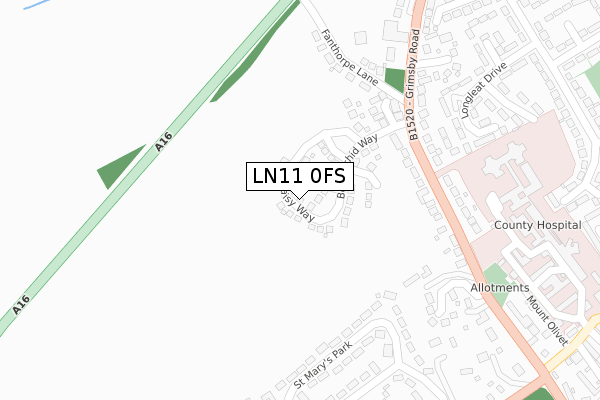
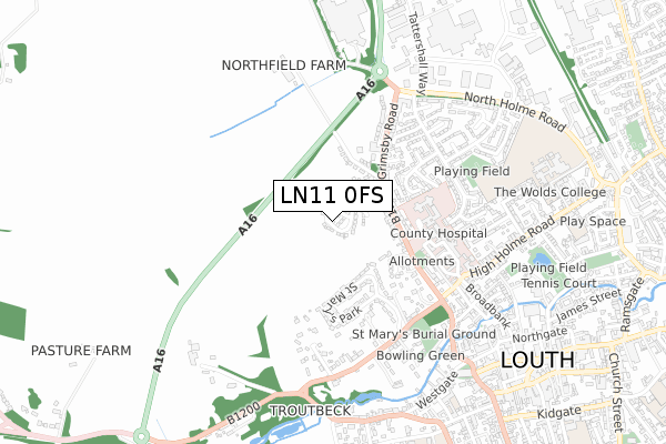
LN11 0FS is located in the North Holme electoral ward, within the local authority district of East Lindsey and the English Parliamentary constituency of Louth and Horncastle. The Sub Integrated Care Board (ICB) Location is NHS Lincolnshire ICB - 71E and the police force is Lincolnshire. This postcode has been in use since June 2019.
LN11 0FS maps


Licence: Open Government Licence (requires attribution)
Attribution: Contains OS data © Crown copyright and database right 2025
Source: Open Postcode Geo
Licence: Open Government Licence (requires attribution)
Attribution: Contains OS data © Crown copyright and database right 2025; Contains Royal Mail data © Royal Mail copyright and database right 2025; Source: Office for National Statistics licensed under the Open Government Licence v.3.0
LN11 0FS geodata
| Easting | 532111 |
| Northing | 387940 |
| Latitude | 53.371837 |
| Longitude | -0.015746 |
Where is LN11 0FS?
| Country | England |
| Postcode District | LN11 |
Politics
| Ward | North Holme |
|---|---|
| Constituency | Louth And Horncastle |
House Prices
Sales of detached houses in LN11 0FS
2025 13 JUN £370,000 |
2024 9 AUG £310,000 |
2023 30 MAR £390,000 |
2022 29 NOV £347,500 |
84, DAISY WAY, LOUTH, LN11 0FS 2022 4 NOV £260,000 |
74, DAISY WAY, LOUTH, LN11 0FS 2022 12 AUG £210,000 |
72, DAISY WAY, LOUTH, LN11 0FS 2022 29 JUL £210,000 |
2022 18 JUL £305,000 |
56, DAISY WAY, LOUTH, LN11 0FS 2022 14 JAN £330,000 |
21, DAISY WAY, LOUTH, LN11 0FS 2021 13 AUG £305,000 |
Licence: Contains HM Land Registry data © Crown copyright and database right 2025. This data is licensed under the Open Government Licence v3.0.
Transport
Nearest bus stops to LN11 0FS
| Blenheim Close (Arundel Drive) | Louth | 507m |
| Louth Hospital (Turning Circle) | Louth | 517m |
| Lady Of Shallot Ph (Grimsby Road) | Louth | 524m |
| Blenheim Close (Arundel Drive) | Louth | 527m |
| Louth Hospital (High Holme Road) | Louth | 588m |
Broadband
Broadband access in LN11 0FS (2020 data)
| Percentage of properties with Next Generation Access | 100.0% |
| Percentage of properties with Superfast Broadband | 100.0% |
| Percentage of properties with Ultrafast Broadband | 28.6% |
| Percentage of properties with Full Fibre Broadband | 28.6% |
Superfast Broadband is between 30Mbps and 300Mbps
Ultrafast Broadband is > 300Mbps
Broadband limitations in LN11 0FS (2020 data)
| Percentage of properties unable to receive 2Mbps | 0.0% |
| Percentage of properties unable to receive 5Mbps | 0.0% |
| Percentage of properties unable to receive 10Mbps | 0.0% |
| Percentage of properties unable to receive 30Mbps | 0.0% |
Deprivation
76.4% of English postcodes are less deprived than LN11 0FS:Food Standards Agency
Three nearest food hygiene ratings to LN11 0FS (metres)


➜ Get more ratings from the Food Standards Agency
Nearest post box to LN11 0FS
| Last Collection | |||
|---|---|---|---|
| Location | Mon-Fri | Sat | Distance |
| Westgate | 16:15 | 11:00 | 764m |
| Louth Post Office | 17:15 | 12:15 | 843m |
| Louth Delivery Office | 17:45 | 12:45 | 844m |
LN11 0FS ITL and LN11 0FS LAU
The below table lists the International Territorial Level (ITL) codes (formerly Nomenclature of Territorial Units for Statistics (NUTS) codes) and Local Administrative Units (LAU) codes for LN11 0FS:
| ITL 1 Code | Name |
|---|---|
| TLF | East Midlands (England) |
| ITL 2 Code | Name |
| TLF3 | Lincolnshire |
| ITL 3 Code | Name |
| TLF30 | Lincolnshire CC |
| LAU 1 Code | Name |
| E07000137 | East Lindsey |
LN11 0FS census areas
The below table lists the Census Output Area (OA), Lower Layer Super Output Area (LSOA), and Middle Layer Super Output Area (MSOA) for LN11 0FS:
| Code | Name | |
|---|---|---|
| OA | E00132360 | |
| LSOA | E01026077 | East Lindsey 003A |
| MSOA | E02005426 | East Lindsey 003 |
Nearest postcodes to LN11 0FS
| LN11 0FR | Howard Fields Way | 222m |
| LN11 0EB | Fanthorpe Lane | 247m |
| LN11 0ED | Grimsby Road | 263m |
| LN11 0DZ | Grimsby Road | 290m |
| LN11 0GB | Woodvale Rise | 303m |
| LN11 0EF | St Marys Park | 321m |
| LN11 0YW | Longleat Drive | 369m |
| LN11 0YY | Hill Rise | 371m |
| LN11 0YH | Badminton Way | 399m |
| LN11 0EA | Grimsby Road | 427m |